


Get to know Daofu County
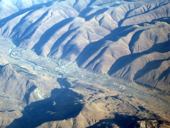
Photo adjustments
Full frame retained; proportionally resized and converted to WebP. No retouching or changes to the photographed subject. Card displays may crop the view.
- Administrative area
- County · 县
- Part of
- Garzê Tibetan Autonomous Prefecture
- Chinese name
- 道孚县
- Local areas
- County guide
Area & population
- Area in the source
- 7,546.00 km²
- Population · 2020
- 53,378
- Administrative seat
- Xêqu (Xianshui)
Source: cited geographic source, as of the dates shown.
Setting and landscape
The county sits on the northern part of the Daxue Mountains (大雪山), which split its rivers in two: the Shachong (沙冲河) and Yuqu (玉曲河) run north-east to the Dadu River (大渡河), while the Xianshui (鲜水河) and others flow south-east into the Yalong (雅砻江). The highest point is Haizi Shan (海子山), better known as the sacred mountain Yala (垭拉神山), at 5,820 metres; the lowest valley floor in the south is at 2,670 metres.
In the north, the Yuke grassland (玉科大草原) covers 1,846 square kilometres of flat and sloping pasture broken by forest. Herders take their animals to high pastures in summer; the valley meadows are for winter. The county government lists four hot springs in the area, with water between 29 and 80 °C.
History
The old name Daowu (道坞) means "foal" in Tibetan. A Daowu county was set up in 1912 and renamed Daofu in 1913. In 1936 the Red Army passed through on the Long March and set up a Bopa (博巴) government here. The county joined Sichuan's Garzê prefecture in 1955, and an earthquake of magnitude 6.8 struck on 24 January 1981.
After the Dzungars invaded Tibet in 1729, the Qing court paid 400,000 taels of silver to build Huiyuan Temple (惠远寺) as a safe residence for the Seventh Dalai Lama, Kelsang Gyatso (格桑嘉措), who moved in in 1730. Emperor Yongzheng named it and wrote its board, and the Dalai Lama returned to Tibet after the Dzungars sued for peace in 1734.
What to see
Huiyuan Temple stands at 3,600 metres in a small mountain basin 8 kilometres from Bamei (八美) on the road towards Danba (丹巴). Stone tablets of 1735 and 1865 beside the halls record its building, and the Dugang building (都纲楼), put up in 1733 as the Dalai Lama's quarters after repeated earthquakes, sits in a garden to the west of the main hall.
Moshi Park (墨石公园), a 4A scenic area near Bamei, covers 5 square kilometres at about 3,500 metres. Its dark rock formations run along the Xianshui River fault zone. Chinese Wikipedia describes the Bamei stone forest (八美石林) in the same town as a rare mylonite stone forest of dark, pointed outcrops, unlike the karst stone forests of southern China. The county also lists Yala mountain and Muya Gada (木雅噶达) among its 4A scenic areas.
Daofu houses are large timber buildings of the "bengke" (崩科) type. The county government notes that they are known as "the first Tibetan house of Kham" and credits their design with earthquake resistance.
Highlights
- Huiyuan Temple 惠远寺: Built with Qing court funds after 1729 as the residence of the Seventh Dalai Lama.
- Moshi Park 墨石公园: 4A scenic area of dark rock formations along the Xianshui River fault zone near Bamei.
- Yuke grassland 玉科大草原: A 1,846-square-kilometre grassland in the north of the county, with hot springs.
- Yala sacred mountain 垭拉神山: The county's highest peak at 5,820 metres; a 4A scenic area.
Sources for this guide
2024年道孚县情资料 - 道孚县人民政府 · Daofu County People's Government (county gazetteer office)
墨石公园 - 道孚县人民政府 · Daofu County People's Government
莲花古刹—惠远寺 - 道孚县人民政府 · Daofu County People's Government
康巴阿勒泰—玉科立体大草原 - 道孚县人民政府 · Daofu County People's Government
道孚民居 - 道孚县人民政府 · Daofu County People's Government
道孚县 - 维基百科,自由的百科全书 · Wikipedia (Chinese) · CC BY-SA 4.0
Original English written from the listed sources and checked sentence by sentence against quoted extracts by a separate reviewer. Updated 2026-09-25.
Explore Daofu County
Core places to explore, with English and Chinese names.
Places to explore around Daofu County
 Moshi Park · 墨石公园
Moshi Park墨石公园
Moshi Park is a stone forest of mylonite on the boundary between Zhonggu and Kama villages in Bamei town, Daofu County, Garze Tibetan Autonomous Prefecture, Sichuan, 6 km from the town government and beside National Highway 317.
Read the place guide →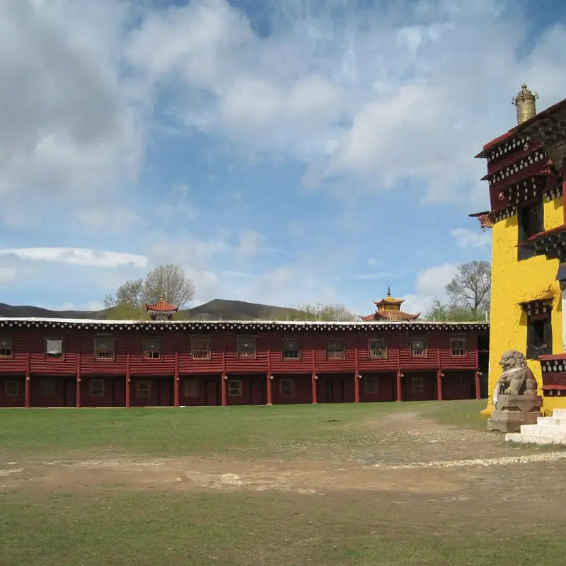 Bamei and Huiyuan Monastery · 八美与惠远寺
Bamei and Huiyuan Monastery八美与惠远寺
Bamei is a town in the east of Daofu County, in the Ganzi Tibetan Autonomous Prefecture of Sichuan, and the catalogue name pairs it with Huiyuan Temple, a Gelug monastery in Xiede Township about 8 km away that the Qing government built and paid for after the Dzungar invasion of Tibet in 1729.
Read the place guide →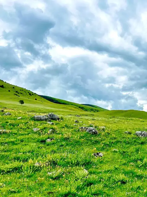 Yuke Grassland · 玉科草原
Yuke Grassland玉科草原
Yuke is a grassland of 1,846 square kilometres in the north of Daofu County, in the Ganzi Tibetan Autonomous Prefecture of Sichuan, part level and open and part tiered, with forest interspersed through it.
Read the place guide →Plan your visit
Getting there
Daofu County is about 130 km in a straight line from central Garzê Tibetan Autonomous Prefecture. Search for 道孚县 in a map app to find stations and your accommodation.
Where to stay →Build your route
Moshi Park and Bamei and Huiyuan Monastery are both listed here. The linked place guides have entrance and visit details.
Continue with Garzê Tibetan Autonomous Prefecture →More in Garzê Tibetan Autonomous Prefecture
Sources & geographic information
Administrative names and parent areas: Official geographic directory · Reference date 2026-09-06.
Some facts checked against 道孚县 — Wikipedia contributors, CC BY-SA 4.0.
Photo: Moshi Park · Source photographer · License not provided. EXIF orientation normalized; resized without changing aspect ratio; converted to WebP. No subject edits.
Photo: Bamei and Huiyuan Monastery · Source photographer · License not provided. EXIF orientation normalized; resized without changing aspect ratio; converted to WebP. No subject edits.
Photo: Yuke Grassland · Source photographer · License not provided. EXIF orientation normalized; resized without changing aspect ratio; converted to WebP. No subject edits.
Map data © OpenStreetMap contributors. Pins mark approximate centres, not entrances or boundaries.