


Get to know Daocheng County

Photo adjustments
Full frame retained; proportionally resized and converted to WebP. No retouching or changes to the photographed subject. Card displays may crop the view.
- Administrative area
- County · 县
- Part of
- Garzê Tibetan Autonomous Prefecture
- Chinese name
- 稻城县
- Local areas
- County guide
Area & population
- Area in the source
- 7,323.00 km²
- Population · 2020
- 32,916
- Administrative seat
- Jingzhoi (Jinzhu)
Source: cited geographic source, as of the dates shown.
Yading’s three sacred mountains
Yading lies in Shangri-La Town (香格里拉镇). Xiannairi (仙乃日), Yangmaiyong (央迈勇) and Xianuoduoji (夏诺多吉) rise above a landscape of glaciers, valleys, forests, meadows and lakes. The area is also a Tibetan Buddhist pilgrimage destination, so its mountains have religious as well as scenic significance.
Glacial country and prehistory
Haizi Mountain (海子山), in northern Daocheng, preserves traces of an ancient ice cap. Numerous small lakes lie among granite rocks left after the glaciers melted. The county seat stands at 3,750 metres. In central Daocheng, the Piluo Site (皮洛遗址), discovered in 2021, adds a Palaeolithic archaeological dimension to this highland landscape.
Sources for this guide
稻城概况 - 稻城县人民政府 · Daocheng County Government
聚焦县域高质量发展|四川稻城县:“天、地、人”新地标促进文旅高质量发展 · People’s Daily Online
文化和旅游部数据服务栏目 · Ministry of Culture and Tourism
Original English written from the listed sources and checked sentence by sentence against quoted extracts by a separate reviewer. Updated 2026-09-26.
Explore Daocheng County
Core places to explore, with English and Chinese names.
Places to explore around Daocheng County
Milk Lake in Yading · 亚丁牛奶海 Photograph date recorded by the source: 18 September 2025, 20:07:48.Yading稻城亚丁
Yading brings together three sacred mountain peaks, alpine meadows, lakes and the religious setting of Chonggu Temple. The shorter route toward Zhuoma La Lake and the longer approach through Luorong Pasture are different…
Read the place guide →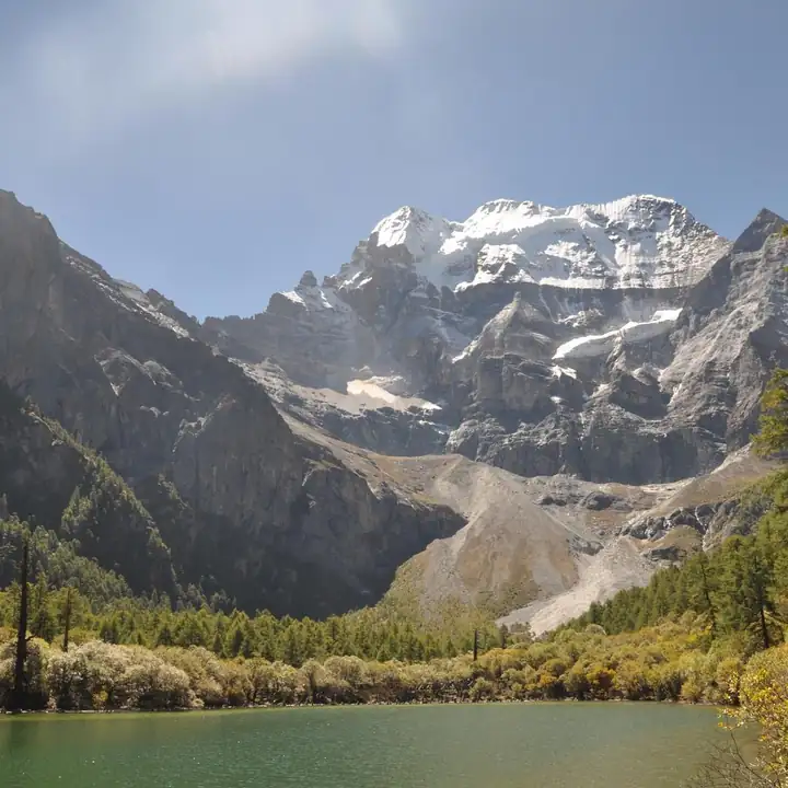 Haizishan Plateau Official Viewing Route · 海子山正规开放路段
Haizishan Plateau Official Viewing Route海子山正规开放路段
Haizishan is a hummocky plateau of the Shaluli range in the north of Daocheng County, Garze Tibetan Autonomous Prefecture, Sichuan, named for the 1,145 lakes scattered across it, and since 1995 a national nature reserve spanning Daocheng and Litang counties.
Read the place guide →Plan your visit
Getting there
Daocheng County is about 195 km in a straight line from central Garzê Tibetan Autonomous Prefecture. Search for 稻城县 in a map app to find stations and your accommodation.
Where to stay →Build your route
Yading and Haizishan Plateau Official Viewing Route are both listed here. The linked place guides have entrance and visit details.
Continue with Garzê Tibetan Autonomous Prefecture →More in Garzê Tibetan Autonomous Prefecture
Sources & geographic information
Administrative names and parent areas: Official geographic directory · Reference date 2026-09-06.
Photo: Yading · Izeberg007 · CC0. Full frame retained; proportionally resized and converted to WebP. No retouching or changes to the photographed subject. Card displays may crop the view.

Photo: Haizishan Plateau Official Viewing Route · Source photographer · License not provided. EXIF orientation normalized; resized without changing aspect ratio; converted to WebP. No subject edits.
Map data © OpenStreetMap contributors. Pins mark approximate centres, not entrances or boundaries.