


Get to know Derong County
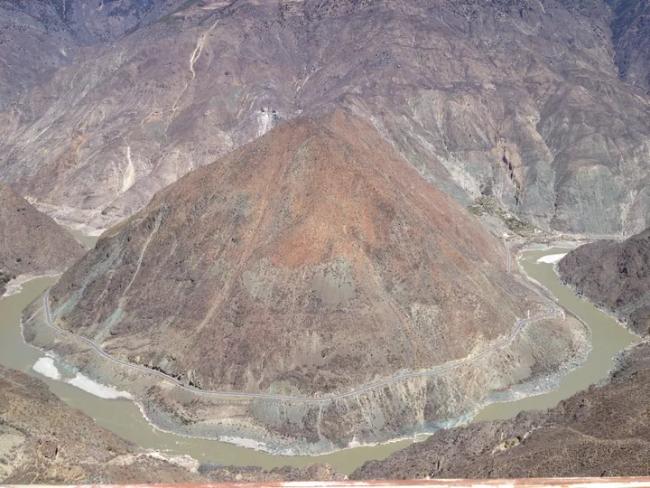
Photo adjustments
Full frame retained; proportionally resized and converted to WebP. No retouching or changes to the photographed subject. Card displays may crop the view.
- Administrative area
- County · 县
- Part of
- Garzê Tibetan Autonomous Prefecture
- Chinese name
- 得荣县
- Local areas
- County guide
Area & population
- Area in the source
- 2,916.00 km²
- Population · 2020
- 24,748
- Administrative seat
- Waka
Source: cited geographic source, as of the dates shown.
A river bend and a cave temple
The Jinsha makes a broad, omega-shaped turn around pyramid-like Rizhui Peak (日锥峰), forming the landscape known as the First Bend of the Jinsha River (金沙江第一湾). Wengjia Temple (翁甲寺) takes a different shape: it is built into a natural karst cave on a mountainside, with its main scripture hall inside the cave. Parts of the building project from the cliff.
Peach blossom in the valleys
March brings peach blossom to places including Waka Town (瓦卡镇), Baisong Town (白松镇) and Ciwu Township (茨巫乡). Blossoms line field banks and streams. Different elevations stagger the flowering period, which can extend over about a month, adding a seasonal contrast to Derong’s steep mountains and deep valleys.
Sources for this guide
得荣简介 - 得荣县人民政府 · Derong County Government
甘孜得荣太阳谷:十里桃花 灼灼其华_四川在线 · Sichuan Daily (Sichuan Online)
Original English written from the listed sources and checked sentence by sentence against quoted extracts by a separate reviewer. Updated 2026-09-26.
Explore Derong County
Core places to explore, with English and Chinese names.
Places to explore around Derong County
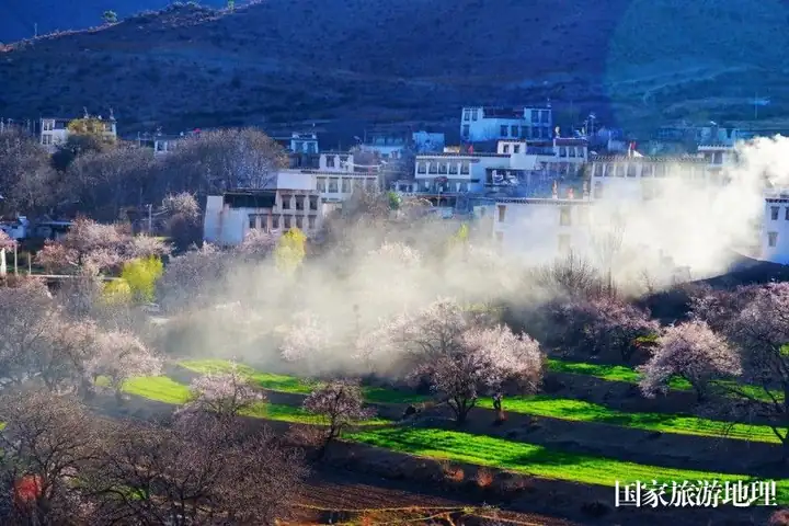 Sun Valley ·
 Plan your visit
Getting there
Derong County is about 300 km in a straight line from central Garzê Tibetan Autonomous Prefecture. Search for 得荣县 in a map app to find stations and your accommodation.
Where to stay →Build your route
Start with Sun Valley. The linked place guides have entrance and visit details.
Continue with Garzê Tibetan Autonomous Prefecture →More in Garzê Tibetan Autonomous Prefecture
Sources & geographic information
Administrative names and parent areas: Official geographic directory (dmfw.mca.gov.cn) · Reference date 2026-09-06.
Photo: Sun Valley · Source photographer · License not provided. EXIF orientation normalized; resized without changing aspect ratio; converted to WebP. No subject edits.
Map data © OpenStreetMap contributors. Pins mark approximate centres, not entrances or boundaries.