


Get to know Seda County
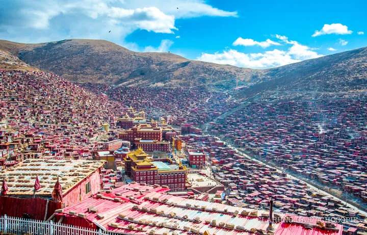
Photo adjustments
Full frame retained; proportionally resized and converted to WebP. No retouching or changes to the photographed subject. Card displays may crop the view.
- Administrative area
- County · 县
- Part of
- Garzê Tibetan Autonomous Prefecture
- Chinese name
- 色达县
- Local areas
- County guide
Area & population
- Area in the source
- 9,338.98 km²
- Population · 2020
- 64,681
- Administrative seat
- Sêrkog (Seke)
Source: cited geographic source, as of the dates shown.
Jinma Grassland
Jinma Grassland (金马草原) lies three kilometres from the county seat. Its pastures support horses, cattle and sheep, and the scenic area focuses on grassland landscapes and nomadic culture.
Gesar carved in stone
Artists use local natural stone slabs, usually keeping their original shapes. They draw outlines, carve the images, apply a white ground and then add colour, commonly red, yellow, blue, white, black and green. At Puwu Village (普吾村), the carvings occupy a five-level stone platform within the scripture walls around Puwu Temple’s (普吾寺) white tower. They portray Gesar and figures from his epic world. Seda’s painted-stone-carving tradition entered the first national intangible-cultural-heritage list in 2006.
Sources for this guide
●金马草原旅游区(3A) - 色达县人民政府 · Seda County Government
藏族格萨尔彩绘石刻 - 中国非物质文化遗产网·中国非物质文化遗产数字博物馆 - 中国非物质文化遗产网非遗 · China Intangible Cultural Heritage Network
Original English written from the listed sources and checked sentence by sentence against quoted extracts by a separate reviewer. Updated 2026-09-27.
Explore Seda County
Core places to explore, with English and Chinese names.
Seda County 色达县
Plan your visit
Getting there
Seda County is about 290 km in a straight line from central Garzê Tibetan Autonomous Prefecture. Search for 色达县 in a map app to find stations and your accommodation.
Where to stay →More in Garzê Tibetan Autonomous Prefecture
Sources & geographic information
Administrative names and parent areas: Official geographic directory · Reference date 2026-09-06.
Map data © OpenStreetMap contributors. Pins mark approximate centres, not entrances or boundaries.