


Get to know Shiqu County
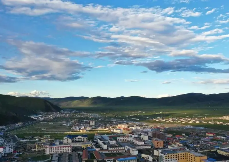
Photo adjustments
EXIF orientation normalized; resized without changing aspect ratio; converted to WebP. No subject edits.
- Administrative area
- County · 县
- Part of
- Garzê Tibetan Autonomous Prefecture
- Chinese name
- 石渠县
- Local areas
- County guide
Area & population
- Area in the source
- 24,944.00 km²
- Population · 2020
- 103,633
- Administrative seat
- Jugar (Niga)
Source: cited geographic source, as of the dates shown.
Stone monuments across the grassland
Songge Mani Stone City (松格玛尼石经城) lies on a route through Arizha Township (阿日扎乡), about 83 kilometres from the county seat according to Shiqu County Government. Bage Mani Wall (巴格嘛呢墙) is reached on another route that passes Sexu Monastery (色须寺). The county’s summer landscape includes the Zaxika Grassland (扎溪卡草原), with horses, cattle and sheep grazing beneath open skies.
Sexu Monastery
Sexu Monastery was founded in 1760, during the Qianlong reign. It follows the Gelug school of Tibetan Buddhism and contains a gilded copper image of Jampa Buddha (强巴佛). The county government explains the monastery’s name as referring to descendants of a tribe associated with yellow hats.
Sources for this guide
石渠各景点和周边交通指南 - 石渠县人民政府 · Shiqu County Government
最美的夏天,在太阳部落石渠! - 石渠县人民政府 · Shiqu County Government
石渠县色须寺由来 - 石渠县人民政府 · Shiqu County Government
Original English written from the listed sources and checked sentence by sentence against quoted extracts by a separate reviewer. Updated 2026-09-27.
Explore Shiqu County
Core places to explore, with English and Chinese names.
Places to explore around Shiqu County
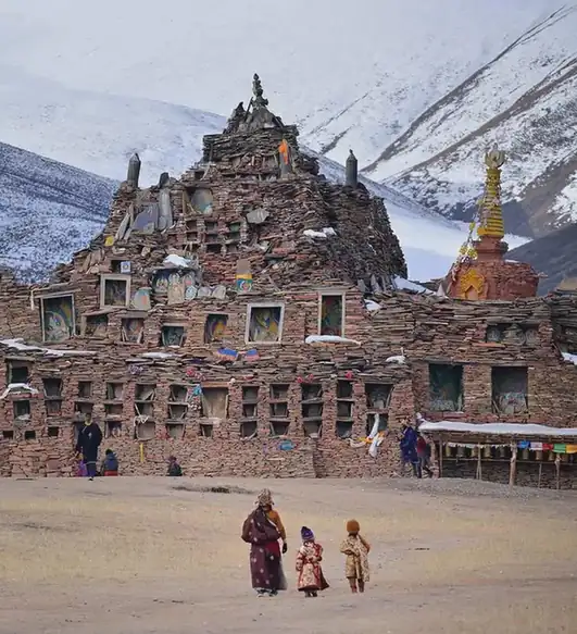 Songge Mani Stone Scripture City ·
 Plan your visit
Getting there
Shiqu County is about 490 km in a straight line from central Garzê Tibetan Autonomous Prefecture. Search for 石渠县 in a map app to find stations and your accommodation.
Where to stay →Build your route
Start with Songge Mani Stone Scripture City. The linked place guides have entrance and visit details.
Continue with Garzê Tibetan Autonomous Prefecture →More in Garzê Tibetan Autonomous Prefecture
Sources & geographic information
Administrative names and parent areas: Official geographic directory · Reference date 2026-09-06.
Photo: Songge Mani Stone Scripture City · Source photographer · License not provided. EXIF orientation normalized; resized without changing aspect ratio; converted to WebP. No subject edits.
Map data © OpenStreetMap contributors. Pins mark approximate centres, not entrances or boundaries.