


Get to know Mianning County
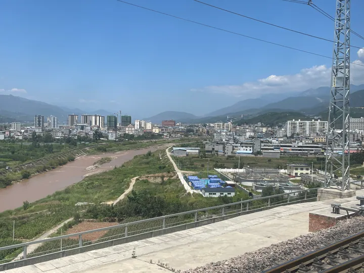
Photo adjustments
Full frame retained; proportionally resized and converted to WebP. No retouching or changes to the photographed subject. Card displays may crop the view.
- Administrative area
- County · 县
- Part of
- Liangshan Yi Autonomous Prefecture
- Chinese name
- 冕宁县
- Local areas
- County guide
Area & population
- Area in the source
- 4,432.00 km²
- Population · 2020
- 369,166
- Administrative seat
- Gaoyang Subdistrict
Source: cited geographic source, as of the dates shown.
The lakeside alliance
At Yihai Lake (彝海), Liu Bocheng (刘伯承) and Guoji Xiaoyedan (果基小叶丹) formed a sworn alliance on 22 May 1935. A monument and memorial hall commemorate the event among pine and cypress trees beside the lake. Yele Lake (冶勒湖) has a different setting, with forests, grasslands, sheep and Yi villages around the water.
Temple hills and olive groves
Lingshan Temple stands eight kilometres from the county seat, amid wooded peaks. Old trees, springs and mountain lakes occupy the hills behind it. Olive Town (橄榄小镇), in Yousheng Community (优胜社区), Hongmo Town (宏模镇), lies on the west bank of the Anning River (安宁河); its landscape centres on an olive-growing park.
Sources for this guide
【概况】_冕宁县_凉山州_市县地情_四川地情_四川省情网 · Sichuan Provincial Local Chronicles Office
冕宁县政务服务网 服务要闻 南烧北烤·焰遇冕宁 | 燃情七月,到冕宁解锁清凉之旅 · Mianning Government Services Portal
Original English written from the listed sources and checked sentence by sentence against quoted extracts by a separate reviewer. Updated 2026-09-26.
Explore Mianning County
Core places to explore, with English and Chinese names.
Places to explore around Mianning County
 AI illustration · AI 示意图(仅供参考,非该地点实拍)
Xichang Satellite Launch Centre Scenic Area西昌卫星发射中心旅游区
The Xichang Satellite Launch Centre is a launch base built mainly for geostationary satellites; its headquarters is in Xichang city, the China National Space Administration puts the launch area about 60 km north-west of that city, and Sichuan's provincial gazetteer office places the centre inside Mianning County, in a valley called Zeyuan, in the Liangshan Yi Autonomous Prefecture.
Read the place guide →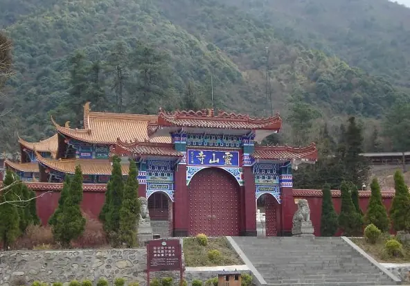 Lingshan Temple · 灵山寺
Lingshan Temple灵山寺
Lingshan Temple stands in deep forest on the western flank of the Xiaoxiangling range, east of the county town of Mianning in the Liangshan Yi Autonomous Prefecture of Sichuan, and takes its name from the mountain that rises immediately behind it.
Read the place guide →Plan your visit
Getting there
Mianning County is about 75 km in a straight line from central Liangshan Yi Autonomous Prefecture. Search for 冕宁县 in a map app to find stations and your accommodation.
Where to stay →Build your route
Xichang Satellite Launch Centre Scenic Area and Lingshan Temple are both listed here. The linked place guides have entrance and visit details.
Continue with Liangshan Yi Autonomous Prefecture →More in Liangshan Yi Autonomous Prefecture
Sources & geographic information
Administrative names and parent areas: Official geographic directory · Reference date 2026-09-06.
Photo: Lingshan Temple · Source photographer · License not provided. EXIF orientation normalized; resized without changing aspect ratio; converted to WebP. No subject edits.
Map data © OpenStreetMap contributors. Pins mark approximate centres, not entrances or boundaries.