


Get to know Hukou Township
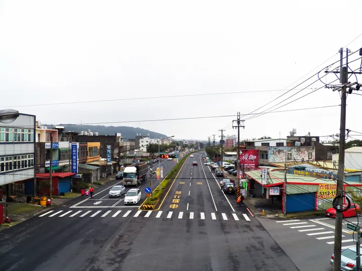
Photo adjustments
Full frame retained; proportionally resized and converted to WebP. No retouching or changes to the photographed subject. Card displays may crop the view.
- Administrative area
- Rural township · 鄉
- Part of
- Hsinchu County
- Chinese name
- 湖口鄉
- Local areas
- Rural township guide
Area & population
- Area in the source
- 58.43 km²
Source: cited geographic source, as of the dates shown.
An old street and religious buildings
Hukou Old Street (湖口老街) is associated with Sanyuan Temple (老湖口三元宮) and the old Catholic church. Other heritage places include the Xinhukou School assembly hall (新湖口學校講堂), the Laohukou Octagonal Building (老湖口八角樓) and the armoured-forces dependents’ village (湖口裝甲新村). Beihu (北湖) and Hukou (湖口) railway stations serve the township.
A meal shared by rotating villages
The Xingchun Banquet (行春宴), also called Shifu (食福), developed from meals prepared for a resting Mazu procession. Sanyuan Temple is its ritual centre, and local villages take turns hosting. Rice remains a local crop; hillside tea-growing has also given way in some places to camellia-oil production and countryside recreation.
Sources for this guide
湖口鄉 - 维基百科,自由的百科全书 · Wikipedia contributors · CC BY-SA 4.0
Hukou, Hsinchu · Wikipedia contributors · CC BY-SA 4.0
Original English written from the listed sources and checked sentence by sentence against quoted extracts by a separate reviewer. Updated 2026-09-30.
Explore Hukou Township
Core places to explore, with English and Chinese names.
Hukou Township 湖口鄉
Plan your visit
Getting there
Hukou Township is about 8 km in a straight line from central Hsinchu County. Search for 湖口鄉 in a map app to find stations and your accommodation.
Where to stay →More in Hsinchu County
Sources & geographic information
Administrative names and parent areas: Official geographic directory · Reference date 2026-09-06.
Some facts checked against 湖口鄉 — Wikipedia contributors, CC BY-SA 4.0.
Some facts checked against Hukou, Hsinchu — Wikipedia contributors, CC BY-SA 4.0.
Map data © OpenStreetMap contributors. Pins mark approximate centres, not entrances or boundaries.