


Get to know Wufeng Township
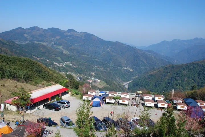
Photo adjustments
Full frame retained; proportionally resized and converted to WebP. No retouching or changes to the photographed subject. Card displays may crop the view.
- Administrative area
- Rural township · 鄉
- Part of
- Hsinchu County
- Chinese name
- 五峰鄉
- Local areas
- Rural township guide
Area & population
- Area in the source
- 228.00 km²
Source: cited geographic source, as of the dates shown.
A spring and a former residence
Qingquan Hot Spring (清泉溫泉) was formerly called Inoue Spring (井上溫泉). A bathing and recuperation facility was established there in 1914 under Japanese rule. Chang Hsueh-liang’s former residence (張學良故居) recalls a period of the general’s house arrest in Taiwan. Sanmao’s Dream House (三毛夢屋) and the Indigenous museum (原住民族館) add other local cultural stops.
Historic route and forest trails
The Syakaro route (霞喀羅古道), completed in 1922, historically linked Qingquan with Kongxi (控溪), now in Jianshi’s Xiuluan village. Guanwu’s forest landscape (觀霧森林遊樂區), the giant-tree trail at Kuaishan (檜山) and the Bailan Creek historic route (白蘭溪古道) extend the mountain itinerary.
Sources for this guide
五峰鄉 (台灣) - 维基百科,自由的百科全书 · Wikipedia contributors · CC BY-SA 4.0
Wufeng, Hsinchu · Wikipedia contributors · CC BY-SA 4.0
新竹縣旅遊網 五峰鄉 · Hsinchu County Government
Original English written from the listed sources and checked sentence by sentence against quoted extracts by a separate reviewer. Updated 2026-09-30.
Explore Wufeng Township
Core places to explore, with English and Chinese names.
Wufeng Township 五峰鄉
Plan your visit
Getting there
Wufeng Township is about 30 km in a straight line from central Hsinchu County. Search for 五峰鄉 in a map app to find stations and your accommodation.
Where to stay →More in Hsinchu County
Sources & geographic information
Administrative names and parent areas: Official geographic directory · Reference date 2026-09-06.
Some facts checked against 五峰鄉 (台灣) — Wikipedia contributors, CC BY-SA 4.0.
Some facts checked against Wufeng, Hsinchu — Wikipedia contributors, CC BY-SA 4.0.
Map data © OpenStreetMap contributors. Pins mark approximate centres, not entrances or boundaries.