


Get to know Shuangxi District
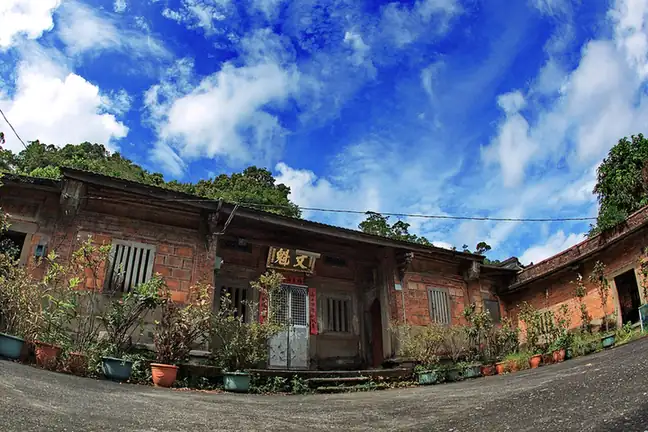
Photo adjustments
EXIF orientation normalized; resized without changing aspect ratio; converted to WebP. No subject edits.
- Administrative area
- District · 區
- Part of
- New Taipei City
- Chinese name
- 雙溪區
- Local areas
- District guide
Area & population
- Area in the source
- 146.25 km²
Source: cited geographic source, as of the dates shown.
Goods between river and sea
Shuangxi Ferry Landing (雙溪渡船頭) was a Qing-period transport point on the Danlan Historic Trail (淡蘭古道). Cargo and passengers travelled downstream to Jiushe (舊社), then transferred to sailing vessels; smaller boats brought daily necessities back upstream. Railway and road construction reduced the landing’s importance. Century-old stone houses remain beside the former trading area.
A timber route through woodland
Pingxi Historic Trail (坪溪古道) once carried timber and forms part of the Danlan middle route. Its 1.5 kilometres run beside a stream among Japanese cedars and ferns, with two water crossings. From the viewing platform at the end, clear weather permits views of Guishan Island (龜山島) and the Pacific Ocean (太平洋).
Sources for this guide
雙溪渡船頭 | 新北市觀光旅遊網 · Tourism and Travel Department, New Taipei City Government
坪溪古道 | 新北市觀光旅遊網 · Tourism and Travel Department, New Taipei City Government
Original English written from the listed sources and checked sentence by sentence against quoted extracts by a separate reviewer. Updated 2026-09-27.
Explore Shuangxi District
Core places to explore, with English and Chinese names.
Shuangxi District 雙溪區
Plan your visit
Getting there
Shuangxi District is about 35 km in a straight line from central New Taipei City. Search for 雙溪區 in a map app to find stations and your accommodation.
Where to stay →More in New Taipei City
Sources & geographic information
Administrative names and parent areas: Official geographic directory · Reference date 2026-09-06.
Map data © OpenStreetMap contributors. Pins mark approximate centres, not entrances or boundaries.