


Get to know Xindian District
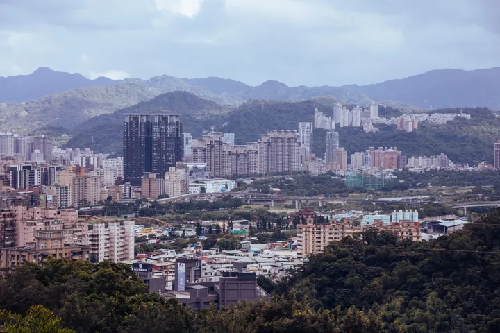
Photo adjustments
Full frame retained; proportionally resized and converted to WebP. No retouching or changes to the photographed subject. Card displays may crop the view.
- Administrative area
- District · 區
- Part of
- New Taipei City
- Chinese name
- 新店區
- Local areas
- District guide
Area & population
- Area in the source
- 120.23 km²
Source: cited geographic source, as of the dates shown.
Across the suspension bridge
Bitan’s eastern bank has installation art and painted steps. Crossing Bitan Suspension Bridge (碧潭吊橋) leads to the western bank and Biting Pavilion (碧亭), above the Bitan inscription. Nearby Hemei Mountain Trail (和美山步道) has a blue route overlooking woodland and water, while its green route reaches a summit with views towards Nangang Mountain (南港山) and Taipei 101 (臺北101).
A temple beside falling water
Yinhedong lies upstream on Meiziliao Stream (楣子寮溪). A small Guanyin (觀音) temple sits within the cliff recess, and its balcony overlooks the waterfall and ferns. Passing through the temple reaches a shrine to Lü Dongbin (呂洞賓), close to the falling water.
Sources for this guide
碧潭風景區 | 新北市觀光旅遊網 · Tourism and Travel Department, New Taipei City Government
銀河洞登山步道 | 新北市觀光旅遊網 · Tourism and Travel Department, New Taipei City Government
Original English written from the listed sources and checked sentence by sentence against quoted extracts by a separate reviewer. Updated 2026-09-27.
Explore Xindian District
Core places to explore, with English and Chinese names.
Xindian District 新店區
Plan your visit
Getting there
Xindian District is about 10 km in a straight line from central New Taipei City. Search for 新店區 in a map app to find stations and your accommodation.
Where to stay →More in New Taipei City
Sources & geographic information
Administrative names and parent areas: Official geographic directory · Reference date 2026-09-06.
Map data © OpenStreetMap contributors. Pins mark approximate centres, not entrances or boundaries.