


Get to know Xinzhuang District
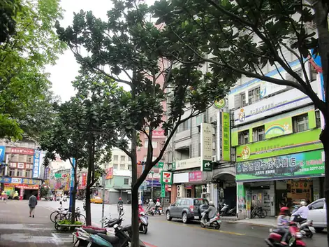
Photo adjustments
EXIF orientation normalized; resized without changing aspect ratio; converted to WebP. No subject edits.
- Administrative area
- District · 區
- Part of
- New Taipei City
- Chinese name
- 新莊區
- Local areas
- District guide
Area & population
- Area in the source
- 19.74 km²
Source: cited geographic source, as of the dates shown.
Beliefs carried by settlers
Migrants brought their home communities’ religious traditions to Xinzhuang, leaving a concentration of old temples. Guangfu Temple (廣福宮), Ciyou Temple (慈祐宮), Wusheng Temple (武聖廟) and Wenchang Shrine (文昌祠) remain important local places of worship. River-port silting later helped shift commercial prominence towards Mengjia (艋舺).
Old lanes and market flavours
The trading district retains lanes and shops associated with Rice Market Street (米市街), Theatre Lane (戲館巷) and blacksmithing. Temple Street foods include spring-roll wraps, rice with pickled-melon meat and red-yeast-seasoned rouyuan (紅糟肉圓). Lane 214 of Xinzhuang Road (新莊路214巷) adds savoury sticky rice, mung-bean soup and chilled tofu pudding to the food walk.
Sources for this guide
新莊廟街商圈 | 新北市觀光旅遊網 · Tourism and Travel Department, New Taipei City Government
新莊廟街夜市 | 新北市觀光旅遊網 · Tourism and Travel Department, New Taipei City Government
Original English written from the listed sources and checked sentence by sentence against quoted extracts by a separate reviewer. Updated 2026-09-27.
Explore Xinzhuang District
Core places to explore, with English and Chinese names.
Xinzhuang District 新莊區
Plan your visit
Getting there
Xinzhuang District covers the centre of New Taipei City. Search for 新莊區 in a map app to find stations and your accommodation.
Where to stay →More in New Taipei City
Sources & geographic information
Administrative names and parent areas: Official geographic directory · Reference date 2026-09-06.
Map data © OpenStreetMap contributors. Pins mark approximate centres, not entrances or boundaries.