


Get to know Wugu District
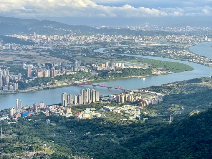
Photo adjustments
Full frame retained; proportionally resized and converted to WebP. No retouching or changes to the photographed subject. Card displays may crop the view.
- Administrative area
- District · 區
- Part of
- New Taipei City
- Chinese name
- 五股區
- Local areas
- District guide
Area & population
- Area in the source
- 34.86 km²
Source: cited geographic source, as of the dates shown.
A stairway with a military name
Yinghanling Trail (硬漢嶺登山步道), formerly called Guanyin Historic Trail (觀音古道), takes its name from military-police training here in the 1960s. The roughly 1,563-metre route is mostly stone steps. At the top, an archway bears exhortations to choose difficult paths and carry heavy burdens, recalling the trail’s emphasis on mental and physical endurance.
River, mountains and migrating birds
The summit viewing platform looks towards Taipei Port (臺北港), the meeting of river and sea, Guandu Bridge (關渡大橋) and Taipei 101 (臺北101). Guanyin Mountain is a cone-shaped volcano within the Datun volcanic group (大屯火山群) and a passage for migrating hawks and falcons.
Sources for this guide
硬漢嶺 | 新北市觀光旅遊網 · Tourism and Travel Department, New Taipei City Government
Original English written from the listed sources and checked sentence by sentence against quoted extracts by a separate reviewer. Updated 2026-09-27.
Explore Wugu District
Core places to explore, with English and Chinese names.
Wugu District 五股區
Plan your visit
Getting there
Wugu District is about 8 km in a straight line from central New Taipei City. Search for 五股區 in a map app to find stations and your accommodation.
Where to stay →More in New Taipei City
Sources & geographic information
Administrative names and parent areas: Official geographic directory · Reference date 2026-09-06.
Map data © OpenStreetMap contributors. Pins mark approximate centres, not entrances or boundaries.