


Get to know Changbin Township
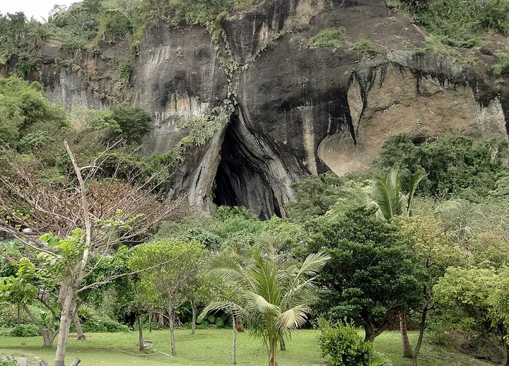
Photo adjustments
Full-frame source proportionally resized and converted to WebP for display. No subject alteration. Source-supplied marks and edits remain; cards may crop the view.
- Administrative area
- Rural township · 鄉
- Part of
- Taitung County
- Chinese name
- 長濱鄉
- Local areas
- Rural township guide
Area & population
- Area in the source
- 155.00 km²
Source: cited geographic source, as of the dates shown.
Caves above the shore
The caves formed in volcanic agglomerate as waves eroded the coast during periods of land uplift. Lower caves are younger than those above them, and their shapes include vertical openings and horizontal semicircles. Wooden steps beside the caves lead through woodland; from Yongan Cave (永安洞), the coastal terraces of Changbin can be seen below.
Stone tools and cave dwellings
Prehistoric people used the caves as dwellings. Archaeological excavations by National Taiwan University (臺灣大學) between 1968 and 1970 uncovered extensive cultural remains. The visitor centre has an interpretation gallery with chipped stone tools, other artefacts and reconstruction models. The nearby pebble beach contains igneous and metamorphic rocks of different colours.
Sources for this guide
八仙洞-東部海岸國家風景區觀光資訊網 · East Coast National Scenic Area Administration
歷史足跡-東部海岸國家風景區觀光資訊網 · East Coast National Scenic Area Administration
Original English written from the listed sources and checked sentence by sentence against quoted extracts by a separate reviewer. Updated 2026-09-27.
Explore Changbin Township
Core places to explore, with English and Chinese names.
Places to explore around Changbin Township
Plan your visit
Getting there
Changbin Township is about 70 km in a straight line from central Taitung County. Search for 長濱鄉 in a map app to find stations and your accommodation.
Where to stay →Build your route
Start with Baxian Caves Archaeological Site. The linked place guides have entrance and visit details.
Continue with Taitung County →More in Taitung County
Sources & geographic information
Administrative names and parent areas: Official geographic directory · Reference date 2026-09-06.
Photo: Baxian Caves Archaeological Site · Bernard Gagnon · CC BY-SA 3.0. Full-frame source proportionally resized and converted to WebP for display. No subject alteration. Source-supplied marks and edits remain; cards may crop the view.

Map data © OpenStreetMap contributors. Pins mark approximate centres, not entrances or boundaries.