


Get to know Taitung County
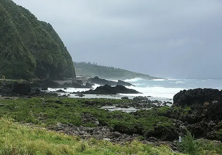
Photo adjustments
Full-frame source proportionally resized and converted to WebP for display. No subject alteration. Source-supplied marks and edits remain; cards may crop the view.
- Administrative area
- County / city · 縣市
- Part of
- Taiwan
- Chinese name
- 臺東縣
- Local areas
- 16 local areas
Area & population
- Area in the source
- 3,515.25 km²
- Administrative seat
- Taitung City
Source: cited geographic source, as of the dates shown.
Culture
Taitung County possesses a very diverse collection of aboriginal cultures. Because Taitung is probably one of the least affected counties by the settlement of the Han Chinese, most of the aboriginal cultures are still very much a part of everyday society.
Explore Taitung County
Core places to explore, with English and Chinese names.
Green Island, Taiwan 綠島
Orchid Island 蘭嶼
Sanxiantai 三仙台
Chishang Brown Boulevard 池上伯朗大道
Luye Highland 鹿野高台
Dulan Amis Village 都兰
Zhiben Hot Springs & Forest Recreation Area 知本温泉与森林游乐区
Taitung Seashore Park 台东海滨公园
Tiehua Cultural & Music Quarter 铁花村周边音乐街区
Chishang Countryside Cycling Routes 池上田园自行车线路
Baxian Caves Archaeological Site 八仙洞
Taitung City 臺東市
Chenggong Township 成功鎮
Guanshan Township 關山鎮
Beinan Township 卑南鄉
Luye Township 鹿野鄉
Chishang Township 池上鄉
Donghe Township 東河鄉
Changbin Township 長濱鄉
Taimali Township 太麻里鄉
Dawu Township 大武鄉
Lüdao Township 綠島鄉
Haiduan Township 海端鄉
Yanping Township 延平鄉
Jinfeng Township 金峰鄉
Daren Township 達仁鄉
Places to explore around Taitung County
Rocky coast of Green Island, Taiwan · 台湾绿岛岩岸 Source-recorded photograph date: Taken on 17 June 2003.Green Island, Taiwan綠島
Green Island combines coral-coast scenery with a compact island landscape off Taitung. The visitor centre introduces its geology, plants, wildlife and marine habitats, while the white lighthouse marks the northwestern coast. The…
Read the place guide →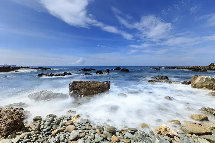 Rocky shoreline on Orchid Island · 兰屿岩石海岸 Source-recorded photograph date: 2013-08-13.
Orchid Island蘭嶼
Orchid Island, or Lanyu, is the homeland of Tao communities whose culture is closely connected with the sea. Traditional plank boats and partly sunken houses reflect this relationship with the coastal environment. These are…
Read the place guide →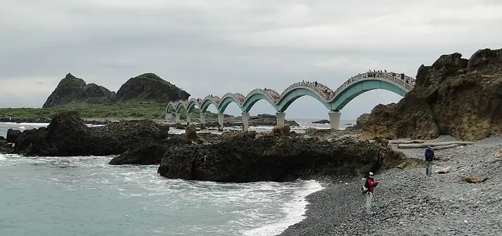 The eight-arch bridge at Sanxiantai · 三仙台八拱桥 Source-recorded photograph date: 2011-06-09.
Sanxiantai三仙台
Sanxiantai’s eight-arch bridge curves towards a small offshore island, creating one of the east coast’s most recognisable views. The island’s volcanic and sea-eroded formations explain the landscape, but access is currently…
Read the place guide →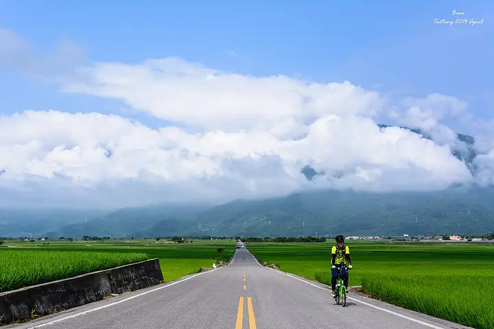 Brown Boulevard between rice fields in Chishang · 池上伯朗大道与两侧稻田 Source-recorded photograph date: 2014-05-05.
Chishang Brown Boulevard池上伯朗大道
Brown Boulevard runs through the rice-growing landscape of Chishang, with open views toward the surrounding mountains.
Read the place guide →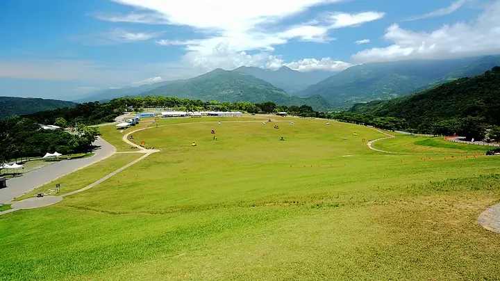 Looking south across Luye Highland · 向南眺望鹿野高台 Source-recorded photograph date: 2014-06-23 12:03:59.
Luye Highland鹿野高台
Luye Highland is an elevated viewpoint in the southern East Rift Valley, overlooking the area around the Luye and Beinan river confluence.
Read the place guide →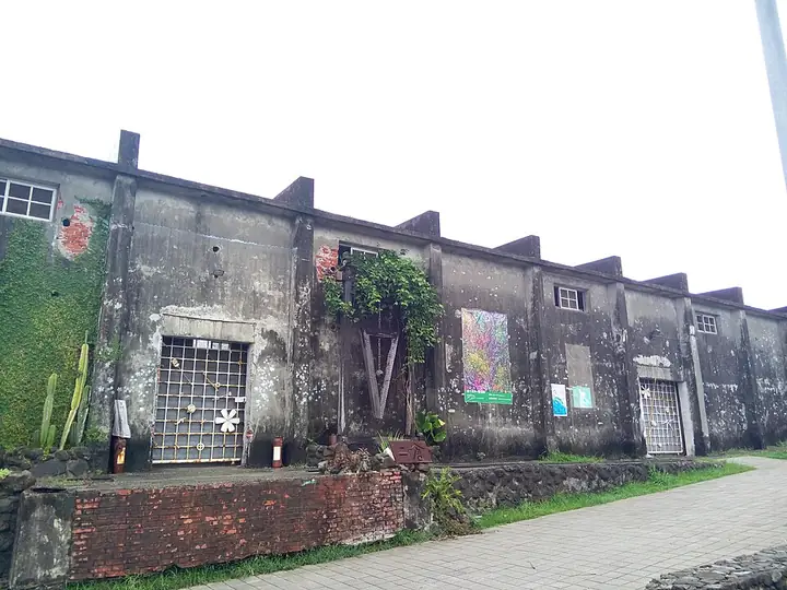 A former Xing-Tung Sugar Factory warehouse in Dulan village · 都兰村新东糖厂旧仓库 Source-recorded photograph date: 2015-08-26.
Dulan Amis Village都兰
Dulan (都兰) is an Amis community in Donghe Township, with Dulan Mountain behind it and the Pacific in front.
Read the place guide →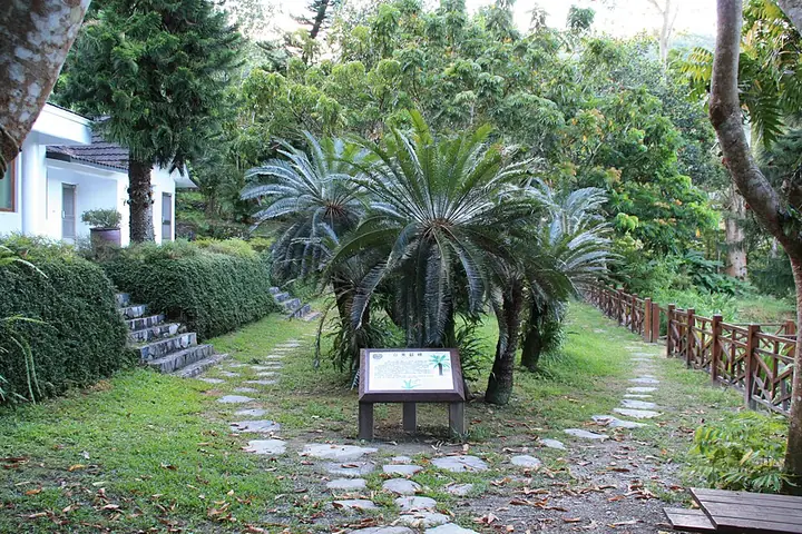 A landscaped walking path inside Zhiben National Forest Recreation Area · 知本国家森林游乐区内的园景步道 Source-recorded photograph date: 2010-07-12.
Zhiben Hot Springs & Forest Recreation Area知本温泉与森林游乐区
Zhiben (知本) combines a hot-spring settlement with a separate forest recreation area inland from Taitung.
Read the place guide →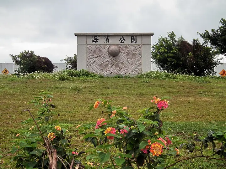 Landscaped grounds and the name marker at Taitung Seaside Park · 台东海滨公园的园景与名称标识 Source-recorded photograph date: Taken on 22 February 2012.
Taitung Seashore Park台东海滨公园
Taitung Seashore Park (台东海滨公园) follows the Pacific edge of Taitung City.
Read the place guide →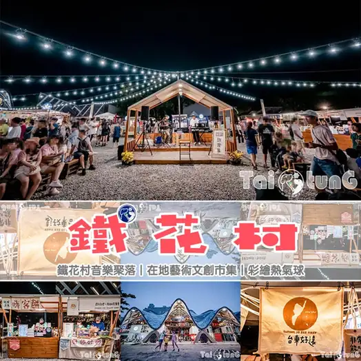 Tiehua Cultural & Music Quarter · 铁花村周边音乐街区
Tiehua Cultural & Music Quarter铁花村周边音乐街区
The Tiehua cultural quarter (铁花村周边音乐街区) grew around Taitung's former railway spaces and the music village established in 2010.
Read the place guide →Brown Boulevard through Chishang's rice fields, with a cyclist · 池上伯朗大道与稻田,可见自行车骑行者 Source-recorded photograph date: 2014-05-05.Chishang Countryside Cycling Routes池上田园自行车线路
Chishang's countryside cycling routes (池上田园自行车线路) form a network through the agricultural landscape around Chishang station.
Read the place guide →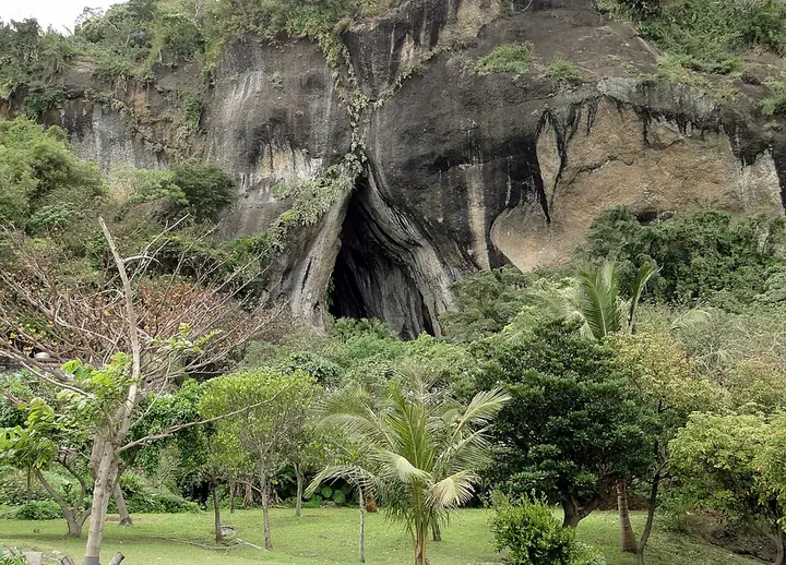 A sea-cave opening at Bashian Caves in Changbin, Taitung · 台东长滨八仙洞的一处海蚀洞口 Source-recorded photograph date: 2011-06-09.
Baxian Caves Archaeological Site八仙洞
Baxian Caves (八仙洞) are a group of former sea caves on the coastal cliffs of Changbin Township.
Read the place guide →Local life & food
Taitung County local specialties
臺東縣特色美食 · 11 specialties to discover
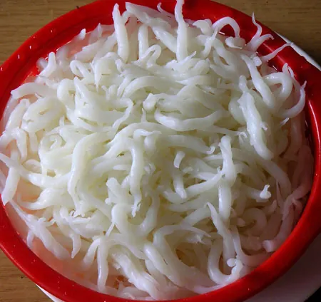 Rice Pin Noodles 米苔目
Rice Pin Noodles (米苔目) is a rice-noodle dish served in Taitung (台东), where the local version is predominantly savoury.
Source ↗Read the dish guide →
Photo adjustments
Resized and WebP compressed; subject not altered.
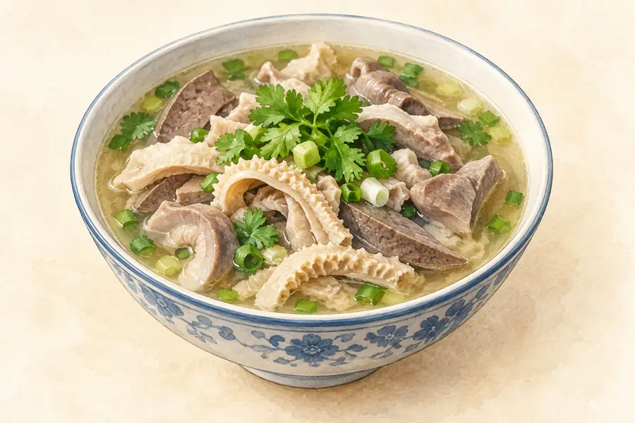 Beinan Pork Blood Soup 卑南猪血汤AI illustration · AI 示意图(仅供参考,非实拍)
Beinan Pork Blood Soup (卑南猪血汤) is a Taitung (臺東) speciality with large pieces of pork blood curd, sliced large intestine, chives and pickled mustard. Its broth combines pork bones, cabbage and mustard greens.
Read the dish guide →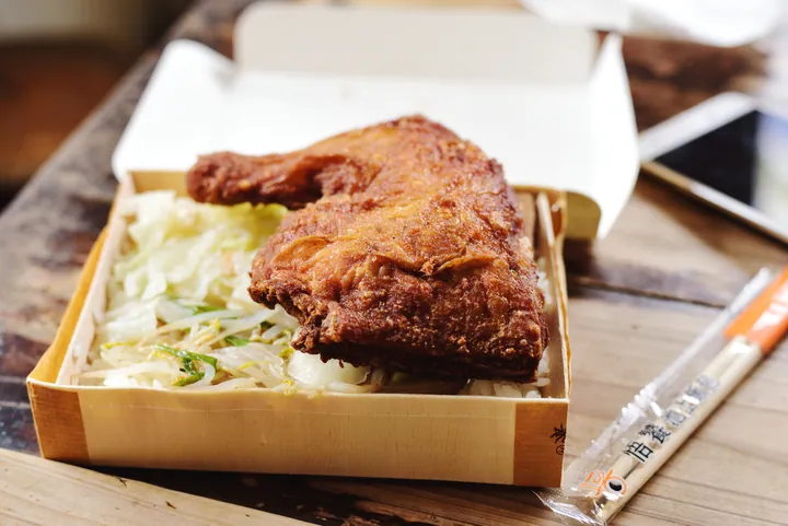 Chishang Lunch Box 池上便当
Chishang Lunch Box (池上便当) is a railway meal from Chishang Township (池上鄉) in Taitung County (臺東縣), also called Chishang Fanbao (池上飯包). Its traditional hallmarks are Chishang rice, a wooden box and a dry style of meal.
Read the dish guide →.jpg)
Photo adjustments
Full frame retained; proportionally resized and converted to WebP. No retouching or changes to the photographed subject. Card displays may crop the view.
 Donghe Steamed Pork Buns 东河包子Reference photo of a similar dish · 同类菜品参考照片
Donghe Steamed Pork Buns (东河包子) is listed among the local specialties of Taitung County, Taiwan. The term 包子 points to steamed buns.
Read the dish guide →
Photo adjustments
Full frame retained; EXIF orientation normalized, proportionally resized to at most 800 pixels and converted to WebP. No generated pixels or subject changes. Cards may crop the display.
 Taitung Sugar Apple Ice Pop 释迦冰
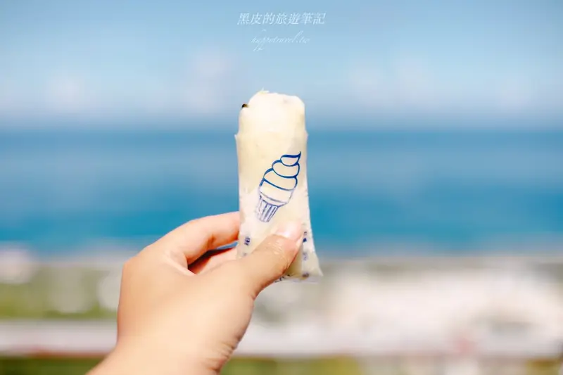
Taitung Sugar Apple Ice Pop (释迦冰) is a frozen treat made from the sugar apple (释迦) of Taitung County (台东县) in eastern Taiwan.
Read the dish guide →Photo adjustments
EXIF orientation normalized; resized without changing aspect ratio; converted to WebP. No subject edits.
 Swordfish Floss 旗鱼松AI illustration · AI 示意图(仅供参考,非实拍)
Swordfish Floss (旗鱼松) is listed among the local specialties of Taitung County, Taiwan. The name includes 鱼 (fish).
Read the dish guide →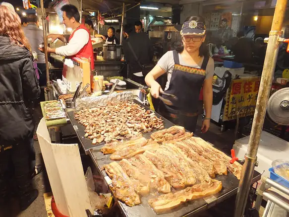 Indigenous Grilled Meat 原住民烤肉
Indigenous Grilled Meat (原住民烤肉) is listed among the local specialties of Taitung County, Taiwan. 烤 describes roasting or grilling.
Read the dish guide →
Photo adjustments
EXIF orientation normalized; resized without changing aspect ratio; converted to WebP. No subject edits.
 Abai Leaf-Wrapped Grain Cakes 阿拜
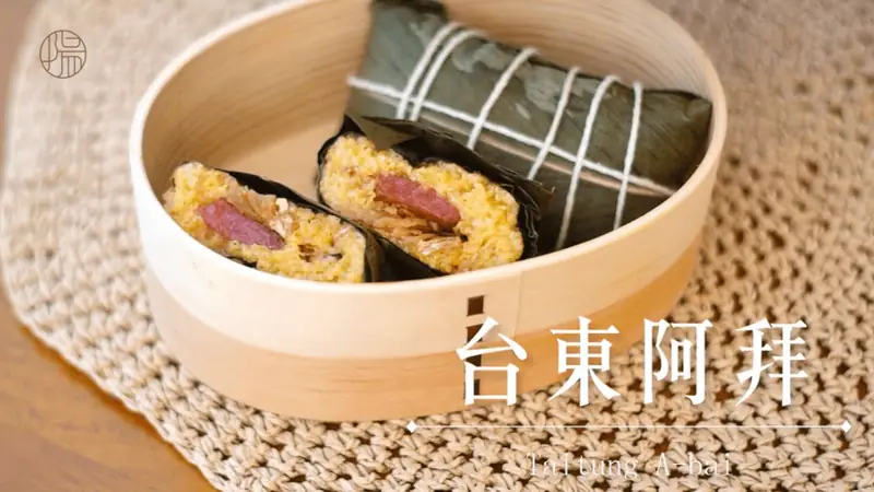
Abai Leaf-Wrapped Grain Cakes (阿拜) are an Indigenous food of Taitung (臺東), made by steaming grain and pork filling inside two layers of leaves. Traditional rice-paste cakes and modified versions containing millet coexist.
Read the dish guide →Photo adjustments
EXIF orientation normalized; resized without changing aspect ratio; converted to WebP. No subject edits.
All dish names · 全部菜名 (11)
- Rice Pin Noodles · 米苔目
- Beinan Pork Blood Soup · 卑南猪血汤
- Chishang Lunch Box · 池上便当
- Donghe Steamed Pork Buns · 东河包子
- Taitung Sugar Apple Ice Pop · 释迦冰
- Swordfish Floss · 旗鱼松
- Indigenous Grilled Meat · 原住民烤肉
- Abai Leaf-Wrapped Grain Cakes · 阿拜
- Flying Fish Dishes · 飞鱼料理
- Bonito Flake Soup · 柴鱼汤
- Taitung Stinky Tofu · 台东臭豆腐
More dishes from across Taiwan are in the Taiwan food guide.
Townships, districts & local cities in Taitung County
16 areas belong directly to Taitung County.
16 areas
Taitung City 臺東市
Taitung City is a county-administered city and the county seat of Taitung County, Taiwan. It lies on the southeast coast of Taiwan facing the Pacific Ocean, southwest of the Beinan River estuary.
Explore the area →TownshipChenggong Township 成功鎮
Chenggong Township or Chengkung Township is an urban township in Taitung County, Taiwan. It is a coastal town facing the Pacific Ocean. Chenggong Fish Harbor is just west of downtown.
Explore the area →TownshipGuanshan Township 關山鎮
Guanshan Township is an urban township in northern Taitung County, Taiwan.
Explore the area →Rural townshipBeinan Township 卑南鄉
Beinan Township or Peinan Township is a rural township in Taitung County, Taiwan. It has a population of 16,798 as of February 2023. It is home to the Puyuma and Rukai peoples.
Explore the area →Show fewer areas
Luye Township 鹿野鄉
Luye Township is a rural township in Taitung County, Taiwan. It is located in the Huadong Valley.
Explore the area →Rural townshipChishang Township 池上鄉
Chihshang Township is a rural township in Taitung County, Taiwan.
Explore the area →Rural townshipDonghe Township 東河鄉
Donghe Township is a rural township located in northeastern Taitung County, Taiwan. The population is mainly the indigenous Amis people. The main industry is agriculture.
Explore the area →Rural townshipChangbin Township 長濱鄉
Changbin Township is a rural township in Taitung County, Taiwan. It is the northernmost township in Taitung County. The population of the township consists mainly of the Amis people with a Kavalan minority.
Explore the area →Rural townshipTaimali Township 太麻里鄉
Taimali Township is a rural township in Taitung County, Taiwan. It has a population of 10,763 in 96.6523 km² area. Taimali Township is located on the Pacific coast.
Explore the area →Rural townshipDawu Township 大武鄉
Dawu Township is a rural township in Taitung County, Taiwan.
Explore the area →Rural townshipLüdao Township 綠島鄉
Green Island, also known by other names, is a small volcanic island in the Pacific Ocean about 33 km (21 mi) off the eastern coast of the main island of Taiwan.
Explore the area →Rural townshipHaiduan Township 海端鄉
Haiduan Township is a mountain indigenous township in Taitung County, Taiwan. It has an area of 880.0382 km², with a population of 4,224 as of February 2023.
Explore the area →Rural townshipYanping Township 延平鄉
Yanping Township is a mountain indigenous township in Taitung County, Taiwan. The main population is the Bunun people of the Taiwanese aborigines.
Explore the area →Rural townshipJinfeng Township 金峰鄉
Jinfeng Township is a mountain indigenous township in Taitung County, Taiwan. The main population is the Paiwan people of the Taiwanese aborigines.
Explore the area →Rural townshipDaren Township 達仁鄉
Daren Township is a mountain indigenous township in Taitung County, Taiwan. The main population is the Paiwan people of the Taiwanese aborigines.
Explore the area →Rural townshipLanyu Township 蘭嶼鄉
Orchid Island, known as Pongso no Tao by the indigenous Tao people, is a 45 km² (17 sq mi) volcanic island located off the southeastern coast of Taiwan.
Explore the area →No areas match this name.
Plan your visit
Getting there
Search for 臺東縣 in a map app to find stations and your accommodation.
Where to stay →Build your route
Green Island, Taiwan and Orchid Island are about 70 km apart in a straight line. The linked place guides have entrance and visit details.
Continue with Taiwan →More in Taiwan
Sources & geographic information
Administrative names and parent areas: Official geographic directory · Reference date 2026-09-06.
Background text adapted from Taitung County — Wikipedia contributors, under CC BY-SA 4.0. Text has been shortened and reorganized; source revision 1360744898.
Photo: Green Island, Taiwan · lienyuan lee · CC BY 3.0. Full-frame source proportionally resized and converted to WebP for display. No subject alteration. Source-supplied marks and edits remain; cards may crop the view.

Photo: Orchid Island · Shang Ming Wang · CC BY-SA 2.0. Full-frame source proportionally resized and converted to WebP for display. No subject alteration. Source-supplied marks and edits remain; cards may crop the view.

Photo: Sanxiantai · Bernard Gagnon · CC BY-SA 3.0. Full-frame source proportionally resized and converted to WebP for display. No subject alteration. Source-supplied marks and edits remain; cards may crop the view.

Photo: Chishang Brown Boulevard · 大雄 汪 · CC BY-SA 2.0. Full-frame source proportionally resized and converted to WebP for display. No subject alteration. Source-supplied marks and edits remain; cards may crop the view.

Photo: Luye Highland · JianEn Yu · CC BY 2.0. Full-frame source proportionally resized and converted to WebP for display. No subject alteration. Source-supplied marks and edits remain; cards may crop the view.

Photo: Dulan Amis Village · Eric Deng · CC BY-SA 4.0. Full-frame source proportionally resized and converted to WebP for display. No subject alteration. Source-supplied marks and edits remain; cards may crop the view.

Photo: Zhiben Hot Springs & Forest Recreation Area · Lord Koxinga · CC BY-SA 3.0. Full-frame source proportionally resized and converted to WebP for display. No subject alteration. Source-supplied marks and edits remain; cards may crop the view.

Photo: Taitung Seashore Park · lienyuan lee · CC BY 3.0. Full-frame source proportionally resized and converted to WebP for display. No subject alteration. Source-supplied marks and edits remain; cards may crop the view.

Photo: Tiehua Cultural & Music Quarter · Source photographer · License not provided. EXIF orientation normalized; resized without changing aspect ratio; converted to WebP. No subject edits.
Photo: Chishang Countryside Cycling Routes · 大雄 汪 · CC BY-SA 2.0. Full-frame source proportionally resized and converted to WebP for display. No subject alteration. Source-supplied marks and edits remain; cards may crop the view.
Photo: Baxian Caves Archaeological Site · Bernard Gagnon · CC BY-SA 3.0. Full-frame source proportionally resized and converted to WebP for display. No subject alteration. Source-supplied marks and edits remain; cards may crop the view.

Map data © OpenStreetMap contributors. Pins mark approximate centres, not entrances or boundaries.