


Get to know Luye Township
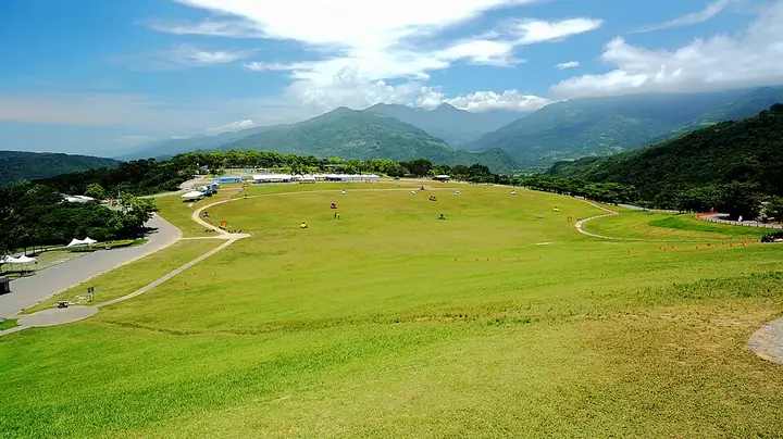
Photo adjustments
Full-frame source proportionally resized and converted to WebP for display. No subject alteration. Source-supplied marks and edits remain; cards may crop the view.
- Administrative area
- Rural township · 鄉
- Part of
- Taitung County
- Chinese name
- 鹿野鄉
- Local areas
- Rural township guide
Area & population
- Area in the source
- 90.00 km²
Source: cited geographic source, as of the dates shown.
Above the fields
The viewpoint on the upper grass slope overlooks the highland and fields in the Beinan River (卑南溪) valley. Hot-air balloon events also take place at the highland. Luye produces Fulu tea (福鹿茶), an oolong tea, while sugar apples and pineapples are other prominent local crops.
Cycling through Longtian
The 7.2-kilometre Longtian (龍田) cycle route follows mainly agricultural roads. Longtian retains a grid of streets from its Japanese settlement history, with old houses, trees, a shrine and an elementary school among its sights. Residents helped restore the old houses. At the end of the cycleway is a grassy paragliding landing ground. The route also includes a kilometre-long avenue shaded by small-leaved almond trees.
Sources for this guide
城鄉遊蹤-花東縱谷國家風景區 · East Rift Valley National Scenic Area Administration
鹿野龍田自行車道 | 交通部觀光署花東縱谷國家風景區管理處-自行車主題網 · East Rift Valley National Scenic Area Administration
Original English written from the listed sources and checked sentence by sentence against quoted extracts by a separate reviewer. Updated 2026-09-27.
Explore Luye Township
Core places to explore, with English and Chinese names.
Places to explore around Luye Township
Plan your visit
Getting there
Luye Township is about 25 km in a straight line from central Taitung County. Search for 鹿野鄉 in a map app to find stations and your accommodation.
Where to stay →Build your route
Start with Luye Highland. The linked place guides have entrance and visit details.
Continue with Taitung County →More in Taitung County
Sources & geographic information
Administrative names and parent areas: Official geographic directory · Reference date 2026-09-06.
Photo: Luye Highland · JianEn Yu · CC BY 2.0. Full-frame source proportionally resized and converted to WebP for display. No subject alteration. Source-supplied marks and edits remain; cards may crop the view.

Map data © OpenStreetMap contributors. Pins mark approximate centres, not entrances or boundaries.