


Get to know Daren Township
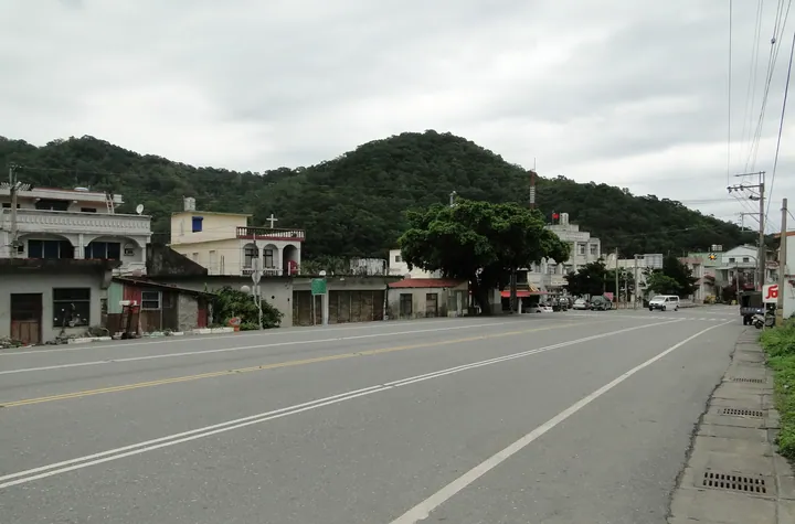
Photo adjustments
Full frame retained; proportionally resized and converted to WebP. No retouching or changes to the photographed subject. Card displays may crop the view.
- Administrative area
- Rural township · 鄉
- Part of
- Taitung County
- Chinese name
- 達仁鄉
- Local areas
- Rural township guide
Area & population
- Area in the source
- 306.00 km²
Source: cited geographic source, as of the dates shown.
Villages and river valleys
Tusaka (土坂) lies in the Dazhugao Creek (大竹高溪) basin, Xinhua (新化) in the Balangwei Creek (巴塱衛溪) basin, and Nantian (南田) in the Fenggang Creek (楓港溪) basin. Tusaka and Kuzilun (姑子崙) suspension bridges appear among the township’s landmarks, along with the Nantian coast.
A coast crossing township boundaries
The Alangyi Trail (阿朗壹古道), officially named the Langjiao–Beinan Trail (瑯嶠卑南古道), connects Nantian with Xuhai (旭海) in Pingtung’s Mudan Township. It follows the Pacific beside coastal native forest. Its name derives from Aljungic, the Paiwan name of Anshuo (安朔); the trail lies within that community’s traditional territory but does not pass through the settlement itself. Long wave action rounds fallen coastal rocks into Nantian stones.
Sources for this guide
達仁鄉 - 维基百科,自由的百科全书 (https://zh.wikipedia.org/wiki/%E9%81%94%E4%BB%81%E9%84%89) · Wikipedia contributors · CC BY-SA 4.0
阿朗壹古道 - 维基百科,自由的百科全书 (https://zh.wikipedia.org/wiki/%E9%98%BF%E6%9C%97%E5%A3%B9%E5%8F%A4%E9%81%93) · Wikipedia contributors · CC BY-SA 4.0
Original English written from the listed sources and checked sentence by sentence against quoted extracts by a separate reviewer. Updated 2026-09-30.
Explore Daren Township
Core places to explore, with English and Chinese names.
Daren Township 達仁鄉
Plan your visit
Getting there
Daren Township is about 70 km in a straight line from central Taitung County. Search for 達仁鄉 in a map app to find stations and your accommodation.
Where to stay →More in Taitung County
Sources & geographic information
Administrative names and parent areas: Official geographic directory · Reference date 2026-09-06.
Some facts checked against 達仁鄉 — Wikipedia contributors, CC BY-SA 4.0.
Some facts checked against 阿朗壹古道 — Wikipedia contributors, CC BY-SA 4.0.
Map data © OpenStreetMap contributors. Pins mark approximate centres, not entrances or boundaries.