


Get to know Haiduan Township
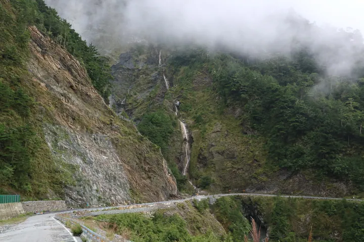
Photo adjustments
Full frame retained; proportionally resized and converted to WebP. No retouching or changes to the photographed subject. Card displays may crop the view.
- Administrative area
- Rural township · 鄉
- Part of
- Taitung County
- Chinese name
- 海端鄉
- Local areas
- Rural township guide
Setting and landscape
Xiangyang National Forest Recreation Area (向陽國家森林遊樂區) stands at about 2,320 metres above sea level. Its planted woodland includes two-needle pines and red cypress, with forest tracks winding between the trees. The Taitung Branch of the Forestry and Nature Conservation Agency describes Mikado pheasants, Taiwan firecrests and muntjacs among the wildlife here. The area combines high-elevation conditions with gently graded trails through the plantations.
Food and local products
Haiduan grows high-altitude vegetables, millet and peaches. The East Longitudinal Valley National Scenic Area Administration also identifies Wulu Gorge (霧鹿峽谷), Lidao Village (利稻部落) and Lisong Hot Spring (栗松溫泉) among the township's landscapes and settlements.
Sources for this guide
城鄉遊蹤-花東縱谷國家風景區 · East Longitudinal Valley National Scenic Area Administration
向陽國家森林遊樂區 · Forestry and Nature Conservation Agency, Taitung Branch
Original English written from the listed sources and checked sentence by sentence against quoted extracts by a separate reviewer. Updated 2026-09-27.
Explore Haiduan Township
Core places to explore, with English and Chinese names.
Haiduan Township 海端鄉
Plan your visit
Getting there
Haiduan Township is about 30 km in a straight line from central Taitung County. Search for 海端鄉 in a map app to find stations and your accommodation.
Where to stay →More in Taitung County
Sources & geographic information
Administrative names and parent areas: Official geographic directory · Reference date 2026-09-06.
Map data © OpenStreetMap contributors. Pins mark approximate centres, not entrances or boundaries.