


Get to know Gaochang District
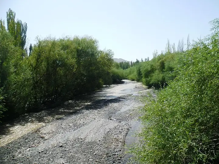
Photo adjustments
Full frame retained; resized proportionally to a maximum dimension of 960 pixels and converted to WebP quality 88. No crop, retouch, generated elements, or subject alteration. Final website rendition: full frame retained, proportionally resized to at most 720 pixels and converted to WebP. No additional retouching or subject alteration. Card displays may crop the view.
- Administrative area
- District · 市辖区
- Part of
- Turpan
- Chinese name
- 高昌区
- Local areas
- District guide
Area & population
- Area in the source
- 13,650.00 km²
- Population · 2020
- 317,443
Source: cited geographic source, as of the dates shown.
Setting and landscape
The Flaming Mountains (火焰山) run across the middle of the district and split it into a northern and a southern half. The snowfields of Bogda Peak, 5,445 metres high, feed the basin's water, while Ayding Lake (艾丁湖) in the south lies 154 metres below sea level, described as the lowest point on land in China. The district government gives a mean annual temperature of 13.9°C, more than 100 days a year above 35°C and only 16.4 millimetres of rain a year. Turpan is known as the "Land of Fire" (火洲), and for its wind resources also as the "Wind Store" (风库).
History
The district government calls Gaochang a Silk Road town where Eastern and Western cultures met. In 1779 the Qing moved the area's senior official to Guang'an City (广安城), today's old town of Turpan, making it the administrative centre. Francis Younghusband passed through in 1887 and recorded two separate walled towns. Turpan County became the county-level city of Turpan in December 1984, and on 12 April 2015, when Turpan became a prefecture-level city, the old county-level city was renamed Gaochang District.
What to see
The district counts two World Heritage sites and eight national key cultural relics protection units. Those listed on Chinese Wikipedia include the Gaochang ruins (高昌故城), the Jiaohe ruins (交河故城), the Bezeklik Thousand Buddha Caves (柏孜克里克千佛洞), the Emin Minaret (苏公塔) and the karez underground irrigation channels (坎儿井).
Grape Valley (葡萄沟), on the western side of the Flaming Mountains, is about 8 kilometres long and 2 kilometres wide and takes its name from the hundred-plus grape varieties grown there, including manaizi (马奶子) and Kashgar grapes. Xinhua lists it as a national 5A scenic area; inside are the Wang Luobin (王洛宾) music and art museum and Qingwa Lane (青蛙巷), a folk-culture street.
Food and local products
Turpan is known as the "home of melons and fruit" and the "holy city of grapes". The district government also names Turpan black sheep, donkeys, fighting cocks, watermelons, mulberries and desert cistanche (大芸) among its farm products.
Getting oriented
Gaochang is 180 kilometres from Ürümqi (乌鲁木齐). The Lanzhou-Xinjiang Railway (兰新铁路) and the Southern Xinjiang Railway (南疆铁路) meet here, and the G30 Lianyungang-Khorgas Expressway, G312 and G314 pass through.
Highlights
- Grape Valley 葡萄沟: An 8 km valley on the western side of the Flaming Mountains with over a hundred grape varieties; a national 5A scenic area.
- Flaming Mountains 火焰山: Run across the middle of the district and divide it into northern and southern halves.
- Ayding Lake 艾丁湖: 154 m below sea level, described as the lowest point on land in China.
- Gaochang ruins 高昌故城: A national key cultural relics protection unit.
- Jiaohe ruins 交河故城: A national key cultural relics protection unit, also called the Yarkhoto ruins.
- Bezeklik Thousand Buddha Caves 柏孜克里克千佛洞: Listed alongside the Emin Minaret among the national key cultural relics protection units in the district.
Sources for this guide
高昌区基本情况 -欢迎你来到高昌区人民政府网 · Gaochang District People's Government
石榴花开 籽籽同心丨甜润葡萄沟 同心促振兴-新华网 · Xinhua News Agency
高昌区 - 维基百科,自由的百科全书 · Wikipedia · CC BY-SA 4.0
Original English written from the listed sources and checked sentence by sentence against quoted extracts by a separate reviewer. Updated 2026-09-25.
Explore Gaochang District
Core places to explore, with English and Chinese names.
Places to explore around Gaochang District
 Ancient City of Jiaohe (Yarkhoto) · 交河故城
Jiaohe ruins交河故城
Jiaohe occupies a narrow plateau between two river valleys west of Turpan. The steep natural edges helped protect a city whose streets, residential quarters and Buddhist remains can still be read in the eroded earth. Much of the…
Read the place guide →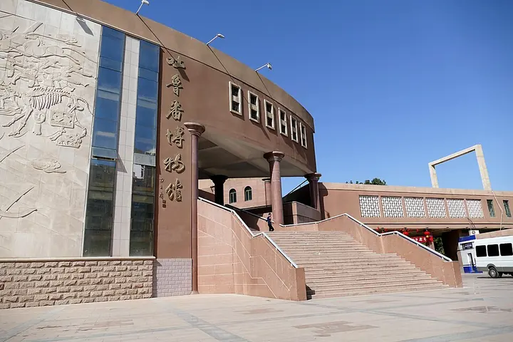 Entrance facade of Turpan Museum · 吐鲁番博物馆入口 Photograph date recorded by the source: 18 September 2015, 13:14:33.
Turpan Museum吐鲁番博物馆
Turpan Museum connects the basin’s ancient cities with the objects recovered from them. Written documents and coins reveal administration and trade, while burial displays preserve clothing and other evidence of everyday life. A…
Read the place guide →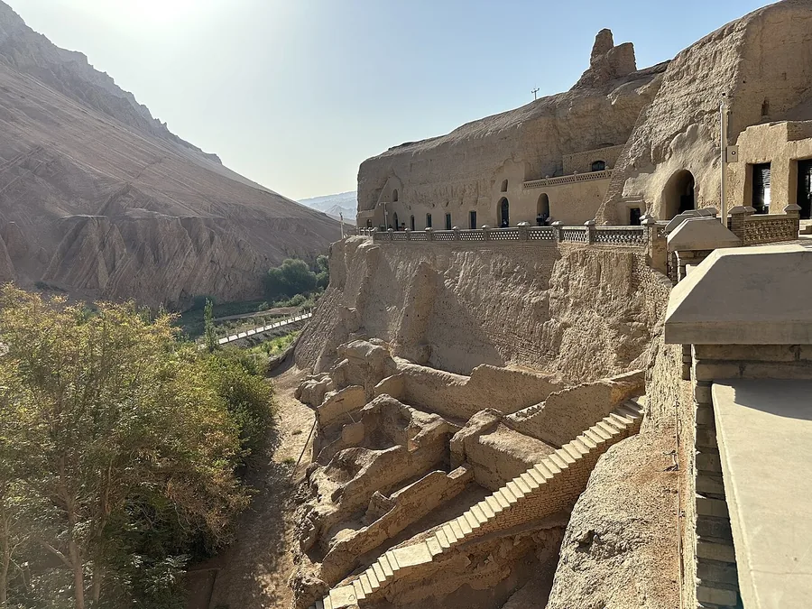 Bezeklik Thousand Buddha Caves above the Mutou valley, viewed from north to south; 20 September 2023.
Bezeklik Thousand Buddha Caves柏孜克里克千佛洞
Bezeklik’s Buddhist caves sit above the Mutou valley in the Flaming Mountains. Surviving painted surfaces and repeated Buddha imagery recall the patronage of the Uyghur kingdom of Qocho, while damaged and missing sections are an…
Read the place guide → Emin Minaret (Su Gong Ta), Turpan, Xinjiang, photographed in September 2023.
Emin Minaret苏公塔
Emin Minaret, also called Sugong Tower, is an eighteenth-century brick tower beside a mosque near Turpan. Its tapering circular form is covered with repeating geometric patterns created in the brickwork. The adjoining mosque’s…
Read the place guide → Ruined earthen structures at Gaochang near Turpan, October 2005.
Gaochang ruins高昌故城
Gaochang was an important oasis city and trading centre east of Turpan. Its surviving earthen walls, inner enclosures and religious ruins reveal a much broader urban footprint than a single monument. The city’s history includes…
Read the place guide →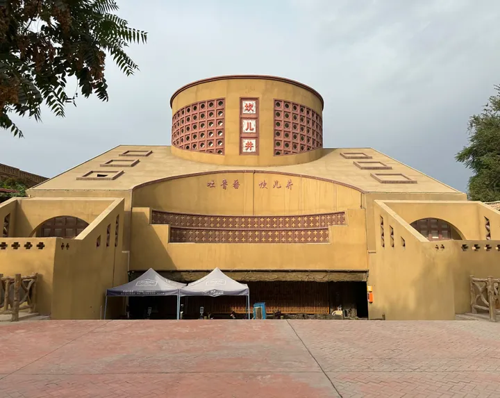 Exterior of the Karez Folk-custom Garden museum building, Gaochang District, Turpan · 吐鲁番市高昌区坎儿井民俗园 Source-recorded photograph date: 2023-09-21 09:59:52.
Karez Folk Culture Park坎儿井民俗园
Karez Folk Culture Park (坎儿井民俗园) is a tourism area built around an old karez at Xincheng Ximen village, Ya'er township, Turpan (吐鲁番市), Xinjiang. A municipal description records that it was built in July 2000 and covers 14,680 sq m.
Read the place guide → Eroded red slopes of the Flaming Mountains near Turpan, Xinjiang; 17 May 2014.
Flaming Mountains火焰山
The Flaming Mountains are a band of eroded red sandstone hills east of Turpan. Deep gullies and strong sunlight create the flame-like appearance behind their name. The landscape also became famous through Journey to the West…
Read the place guide → A vine-covered walkway in Grape Valley near Turpan, August 2017.
Grape Valley葡萄沟
Grape Valley is an irrigated corridor beneath the Flaming Mountains northeast of Turpan. Water flowing through the valley supports vineyards that contrast sharply with the dry hills around them. The visitor area combines…
Read the place guide →Plan your visit
Getting there
Search for 高昌区 in a map app to find stations and your accommodation.
Where to stay →Build your route
Jiaohe ruins and Turpan Museum are about 10 km apart in a straight line. The linked place guides have entrance and visit details.
Continue with Turpan →More in Turpan
Sources & geographic information
Administrative names and parent areas: Official geographic directory · Reference date 2026-09-06.
Some facts checked against 高昌区 — Wikipedia contributors, CC BY-SA 4.0.
Photo: Jiaohe ruins · Colegota · CC BY-SA 2.5 es. Wikimedia thumbnail; fitted to the ranking-card frame.

Photo: Turpan Museum · Zossolino · Zossolino — 2015-09-18-131512_-_Turpan-Museum.jpg — CC BY-SA 4.0 · CC BY-SA 4.0. Full frame retained; proportionally resized and converted to WebP. No retouching or changes to the photographed subject. Card displays may crop the view.

Photo: Bezeklik Thousand Buddha Caves · HaziiDozen · CC BY-SA 4.0. Proportionally resized and converted to WebP without cropping, retouching or changing the photographed subject.

Photo: Emin Minaret · HaziiDozen · CC BY-SA 4.0. Proportionally resized and converted to WebP without cropping, retouching or changing the photographed subject.

Photo: Gaochang ruins · Colegota · CC BY-SA 2.5 es. Proportionally resized and converted to WebP without cropping, retouching or changing the photographed subject.

Photo: Karez Folk Culture Park · HaziiDozen · CC BY-SA 4.0. Full frame retained; proportionally resized and converted to WebP. No retouching or changes to the photographed subject. Card displays may crop the view.

Photo: Flaming Mountains · liuzusai刘祖赛 · CC BY 3.0. Proportionally resized and converted to WebP without cropping, retouching or changing the photographed subject.

Photo: Grape Valley · Radosław Botev · CC BY 3.0 pl. Proportionally resized and converted to WebP without cropping, retouching or changing the photographed subject.
.jpg)
Map data © OpenStreetMap contributors. Pins mark approximate centres, not entrances or boundaries.