


Get to know Künes County
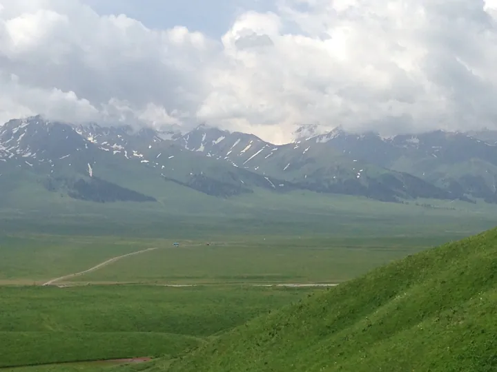
Photo adjustments
Full frame retained; proportionally resized and converted to WebP. No retouching or changes to the photographed subject. Card displays may crop the view.
- Administrative area
- County · 县
- Part of
- Ili Kazakh Autonomous Prefecture
- Chinese name
- 新源县
- Local areas
- County guide
Area & population
- Population · 2020
- 306,525
- Administrative seat
- Künes Town
Source: cited geographic source, as of the dates shown.
Spruce forest and grassland
Panlong Valley Road (盘龙谷道) runs for twenty-six kilometres within the scenic area. It passes through spruce woods and river valleys, with elevated grassland and valley forest along the way. Nalati’s autumn meadows change from summer green to a mixture of yellow and green; cattle and sheep are scattered across the grassland among the mountain and river-valley scenery.
Apricot blossom in spring
Nalati Apricot Blossom Valley (那拉提杏花谷) flowers in April. The county government describes thirty thousand mu of apricot blossom across the hills, with old trees on the rolling slopes. Grassland and snow-covered mountains form the surrounding landscape, while cattle and sheep rest nearby. Morning mist gathers in the valley.
Sources for this guide
那拉提景区打造四季旅游项目 丰富游客旅游体验_游在伊犁_伊犁哈萨克自治州人民政府 · Xinyuan Integrated Media Centre, via Ili Prefecture Government
解码新疆“网红公路”的流量秘诀 · Xinjiang Daily, via Xinjiang Department of Transport
秋入草原山有色 那拉提的限定秋色美到“出圈”_风光名胜_新源县人民政府网 · Xinyuan Integrated Media Centre
你准备好了吗?相约四月的那拉提杏花谷最浪漫的春之约会_风光名胜_新源县人民政府网 · Künes County Government Office
Original English written from the listed sources and checked sentence by sentence against quoted extracts by a separate reviewer. Updated 2026-09-27.
Explore Künes County
Core places to explore, with English and Chinese names.
Places to explore around Künes County
 Grazing livestock on the grassland of Nalati, Xinyuan County, Xinjiang, with the snow-capped Tian Shan in the background. ·
 Plan your visit
Getting there
Künes County is about 165 km in a straight line from central Ili Kazakh Autonomous Prefecture. Search for 新源县 in a map app to find stations and your accommodation.
Where to stay →Build your route
Start with Nalati Grassland. The linked place guides have entrance and visit details.
Continue with Ili Kazakh Autonomous Prefecture →More in Ili Kazakh Autonomous Prefecture
Sources & geographic information
Administrative names and parent areas: Official geographic directory · Reference date 2026-09-06.
Photo: Nalati Grassland · Voidvector · CC BY-SA 4.0. Full frame retained; proportionally resized and converted to WebP. No retouching or changes to the photographed subject. Card displays may crop the view.
.jpg)
Map data © OpenStreetMap contributors. Pins mark approximate centres, not entrances or boundaries.