


Get to know Yining
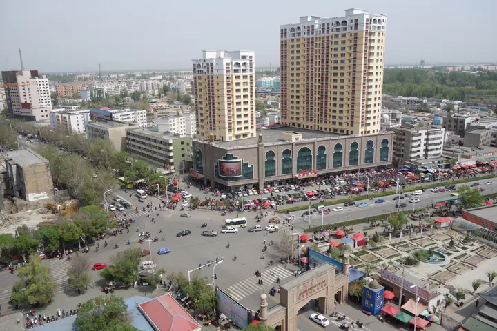
Photo adjustments
Full frame retained; proportionally resized and converted to WebP. No retouching or changes to the photographed subject. Card displays may crop the view.
- Administrative area
- County-level city · 县级市
- Part of
- Ili Kazakh Autonomous Prefecture
- Chinese name
- 伊宁市
- Local areas
- County-level city guide
Area & population
- Area in the source
- 616.70 km²
- Population · 2020
- 778,047
- Administrative seat
- Döngmehelle Subdistrict
Source: cited geographic source, as of the dates shown.
Setting and landscape
The Kegurqin Mountains (科古尔琴山), a branch of the Tianshan, rise to the north. The Ili River winds west along the city's southern edge for 35.3 kilometres, with Qapqal Xibe Autonomous County (察布查尔锡伯自治县) on the far bank; Yining County (伊宁县) lies to the east and Huocheng County (霍城县) to the west. People's Daily describes reed-lined wetlands along the riverbank where egrets take flight, and the city's tree cover has earned it the name "Jiangnan beyond the frontier" (塞外江南).
History
The New Book of Tang (新唐书) records a town called Zheshimi (蛰失密城), an old name for Yining. After the Qing conquered the Ili basin in 1755, they built nine towns in the valley: Huiyuan (惠远城, now in Huocheng) held the General of Ili, while Ningyuan (宁远城), today's Yining, was the town of traders and residents. Ningyuan County was renamed Yining County in 1914, and Yining city was carved out of the county seat in May 1952. When Ili Kazakh Autonomous Prefecture was founded in November 1954, Yining became its seat. The Xibe (锡伯族) people living in the city descend from families moved from north-east China under the Qianlong emperor.
What to see
Kazanqi (喀赞其), whose name comes from the Uyghur for "people who cast pots", is a blue-walled quarter with more than 300 buildings from the Qing to the Republican era. Craftsmen work in the street at saddle-making, ironwork and woodcarving, and visitors can tour the lanes by horse cart. Liuxing Street (六星街) was laid out in the 1930s as a hexagon, with six main streets running out from a central square, and is home to many ethnic groups. The old General of Ili's Mansion (伊犁将军府) is a nationally protected site; the Shaanxi Grand Mosque (陕西大寺) and Baytulla Mosque (拜都拉大寺) are among the city's religious buildings.
Food and local products
The Yining city tourism bureau describes youtazi (油塔子), a steamed Uyghur bun shaped like a pagoda: thin sheets of dough are spread with rendered sheep-tail fat, salt and Sichuan pepper, rolled, twisted into a tower and steamed over a fierce fire for half an hour. It is eaten for breakfast, and the bureau recommends it with hezhi soup (合汁汤), a mutton broth with beef, meatballs, mushrooms, wood-ear fungus, glass noodles, tofu, tomato and chilli. People's Daily recommends the city's ice cream, made by hand from fresh milk, eggs and honey without added water, and the baked samsa (烤包子), pilaf and yoghurt found around Kazanqi and Liuxing Street.
Highlights
- Kazanqi 喀赞其: Blue-walled quarter named for pot-casters, with 300-plus Qing and Republican buildings and street craftsmen.
- Liuxing Street 六星街: Hexagonal quarter planned in the 1930s, six streets radiating from a central square.
- General of Ili's Mansion 伊犁将军府: Listed as a Major Historical and Cultural Site Protected at the National Level.
- Ili River 伊犁河: Runs along the city's southern edge, with wetlands and reeds on its banks.
- Youtazi 油塔子: Pagoda-shaped steamed bun layered with sheep-tail fat, eaten for breakfast with hezhi soup.
Sources for this guide
伊宁市 - 维基百科,自由的百科全书 · Chinese Wikipedia · CC BY-SA 4.0
在伊宁过一天彩色日子_人民日报 · People's Daily
油而不腻软而不沾---油塔子_特色美食 · Yining City People's Government (source: tourism bureau)
Original English written from the listed sources and checked sentence by sentence against quoted extracts by a separate reviewer. Updated 2026-09-25.
Explore Yining
Core places to explore, with English and Chinese names.
Places to explore around Yining
 The mosque on Liuxing Street (Six Star Street), Yining · 伊犁哈萨克自治州伊宁市六星街清真寺 Source-recorded photograph date: 2025-10-10 12:26:32.
Liuxing Street六星街
Liuxing Street (六星街, "Six-Star Street") is a historic residential quarter in Yining (伊宁市), the seat of Ili Kazakh Autonomous Prefecture in Xinjiang. The prefecture government says the name comes from its six-armed street pattern, laid out across six fan-shaped sectors.
Read the place guide → Kazanqi Folk Culture Scenic Area · 喀赞其民俗旅游区
Kazanqi Folk Culture Scenic Area喀赞其民俗旅游区
Kazanqi Folk Customs Tourist Area (喀赞其民俗旅游区) is a historic residential quarter in the old town of Yining (伊宁市) in Ili Kazakh Autonomous Prefecture, Xinjiang. The city's tourism bureau describes it as an area for showing Ili's Uyghur folk customs while keeping the original houses, ways and residents in place.
Read the place guide →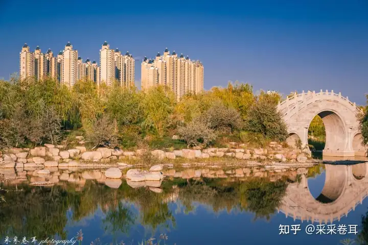 Ili River Scenic Area · 伊犁河风景区
Ili River Scenic Area伊犁河风景区
The Ili River Scenic Area (伊犁河风景区) is the riverside park and wetland corridor along the Ili River at Yining (伊宁市) in Ili Kazakh Autonomous Prefecture, Xinjiang. The city's tourism bureau describes it as a fully open scenic area and the city's ecological greenway.
Read the place guide →Plan your visit
Getting there
Yining is about 4 km in a straight line from central Ili Kazakh Autonomous Prefecture. Search for 伊宁市 in a map app to find stations and your accommodation.
Where to stay →Build your route
Liuxing Street and Kazanqi Folk Culture Scenic Area are both listed here. The linked place guides have entrance and visit details.
Continue with Ili Kazakh Autonomous Prefecture →More in Ili Kazakh Autonomous Prefecture
Sources & geographic information
Administrative names and parent areas: Official geographic directory · Reference date 2026-09-06.
Some facts checked against 伊宁市 — Wikipedia contributors, CC BY-SA 4.0.
Photo: Liuxing Street · HaziiDozen · CC BY-SA 4.0. Full frame retained; proportionally resized and converted to WebP. No retouching or changes to the photographed subject. Card displays may crop the view.

Photo: Kazanqi Folk Culture Scenic Area · Source photographer · License not provided. EXIF orientation normalized; resized without changing aspect ratio; converted to WebP. No subject edits.
Photo: Ili River Scenic Area · Source photographer · License not provided. EXIF orientation normalized; resized without changing aspect ratio; converted to WebP. No subject edits.
Map data © OpenStreetMap contributors. Pins mark approximate centres, not entrances or boundaries.