


Get to know Dali
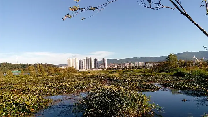
Photo adjustments
Full frame retained; resized proportionally to a maximum dimension of 960 pixels and converted to WebP quality 88. No crop, retouch, generated elements, or subject alteration. Final website rendition: full frame retained, proportionally resized to at most 720 pixels and converted to WebP. No additional retouching or subject alteration. Card displays may crop the view.
- Administrative area
- County-level city · 县级市
- Part of
- Dali Bai Autonomous Prefecture
- Chinese name
- 大理市
- Local areas
- County-level city guide
Area & population
- Area in the source
- 1,738.63 km²
- Population · 2021
- 771,128
- Administrative seat
- Haidong
Source: cited geographic source, as of the dates shown.
Setting and landscape
The Cangshan is made up of 19 peaks running north to south, with the city's highest point, Yuju Peak (玉局峰), at 4,097 metres. Erhai, shaped like an ear, is Yunnan's second-largest lake, 40.5 kilometres long and 3 to 9 kilometres wide; its only natural outlet, the Xi'er River (西洱河), leaves from the southern end. The old town and the Cangshan and Erhai scenery on either side lie within the Cangshan–Erhai national nature reserve. Dali is known as the "city of wind", windier around Xiaguan (下关) than around the old town, and Dali's four traditional scenes are the wind of Xiaguan, the flowers of Shangguan (上关), the snow of Cangshan and the moon over Erhai.
History
In 738 the ruler Piluoge (皮罗阁) absorbed the other chiefdoms (诏) around Erhai to found Nanzhao and moved his capital to Taihe (太和城); in 779 it moved again to Yangjumie (羊苴咩城), on the site of today's old town. Duan Siping (段思平) founded the Dali kingdom there in 937, and it lasted until Kublai Khan conquered it in 1253. After the Yuan set up Yunnan province in 1274, the centre of the region shifted to Kunming. The present old town was first built in the Ming Hongwu reign, and during the uprising led by Du Wenxiu (杜文秀) from 1856 to 1872 his regime controlled most of Yunnan.
What to see
The Three Pagodas of Chongsheng Temple (崇圣寺三塔) are the city's only 5A scenic area. The old town (大理古城) keeps a chessboard plan of five north–south streets and eight east–west lanes. Other national protected sites include the Taihe city ruins with the Nanzhao Dehua Stele (南诏德化碑), the Bai buildings of Xizhou (喜洲白族古建筑群), the stele recording Kublai's conquest of Yunnan (元世祖平云南碑), Du Wenxiu's headquarters in the old Yunnan provincial military office (云南提督府旧址) and Dali Catholic Church (大理天主教堂). Butterfly Spring (蝴蝶泉) is among the sights of Cangshan. The Shuanglang (双廊) art quarter was named a national night-time culture and tourism cluster in 2024.
Food and local products
Xizhou baba (喜洲粑粑), also called poxu (破酥), is a baked wheat flatbread sold around Sifang Street (四方街) in Xizhou; it comes in sweet and savoury versions, with rose sugar and minced pork named as keys to its taste, and the Dali prefecture government notes that visitors call it "Dali pizza". Other local products include Dali marble (大理石), Bai tie-dye (扎染), Xiaguan tuocha tea (下关沱茶), the Bai three-course tea (白族三道茶) and rushan (乳扇), a dairy product.
Highlights
- Three Pagodas of Chongsheng Temple 崇圣寺三塔: Dali's only 5A scenic area and a national protected site.
- Dali Old Town 大理古城: Ming-era town with five north–south streets and eight east–west lanes.
- Xizhou Bai buildings 喜洲白族古建筑群: National protected group of Bai houses in Xizhou.
- Nanzhao Dehua Stele 南诏德化碑: Protected with the Taihe city ruins, the first Nanzhao capital.
- Shuanglang 双廊: Art quarter named a national night-time culture and tourism cluster in 2024.
- Xizhou baba 喜洲粑粑: Baked sweet or savoury wheat flatbread, nicknamed Dali pizza.
Sources for this guide
大理市 - 维基百科,自由的百科全书 · Chinese Wikipedia · CC BY-SA 4.0
走进大理 - 大理市人民政府 · Dali City People's Government
大理这些“舌尖上的非遗”,你吃过多少? - 大理白族自治州人民政府 · Dali Bai Autonomous Prefecture People's Government
Original English written from the listed sources and checked sentence by sentence against quoted extracts by a separate reviewer. Updated 2026-09-25.
Explore Dali
Core places to explore, with English and Chinese names.
Places to explore around Dali
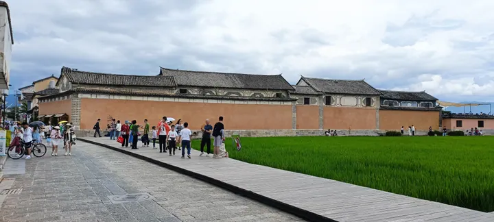 The perimeter wall of the Linden Centre beside rice paddies in Xizhou old town, Dali · 大理市喜洲古镇喜林苑外墙及稻田 Source-recorded photograph date: 2022-08-01 16:27:33.
Xizhou Ancient Town喜洲古镇
Xizhou (喜洲古镇) is a historic Bai settlement in Dali city, Yunnan, below the Wutai peak of Cangshan on the west shore of Erhai, known for a large complex of Bai courtyard residences built mainly by early-20th-century merchant families.
Read the place guide →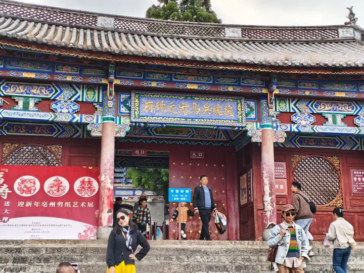 The former Du Wenxiu commander-in-chief's residence hall inside Dali Old Town, Dali City · 大理古城内的杜文秀总统兵马大元帅府,大理市 Source-recorded photograph date: 2026-02-23 17:18:49.
Dali Old Town大理古城
Dali Old Town sits between Cangshan and Erhai, with a street grid that makes its layout easy to read. Fuxing Road links the north and south gate areas, while side streets lead past shops, courtyards and local museum spaces…
Read the place guide →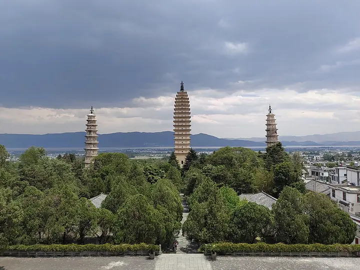 The Three Pagodas of Chongsheng Temple in Dali · 大理崇圣寺三塔 Photograph date recorded by the source: 2 May 2024, 13:12:32.
Three Pagodas崇圣寺三塔
The Three Pagodas stand below Cangshan in a triangular arrangement. The tall central Qianxun Pagoda has a square plan and closely spaced eaves, while the two smaller companions are octagonal. Their different forms are easiest to…
Read the place guide →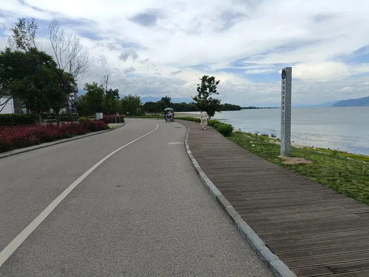 Lakeside boardwalk marked with a stone sign for the Erhai Lake Ecological Corridor, Dali City · 大理市洱海生态廊道湖滨栈道 Source-recorded photograph date: 2023-07-25 14:54:19.
Erhai Ecological Corridor洱海生态廊道
The Erhai Ecological Corridor (洱海生态廊道) is a lake-encircling conservation and public-access project along the shore of Erhai in Dali city, Yunnan, combining a cycling path, lakeside boardwalks and restored wetland with the lake-shore Bai villages it passes.
Read the place guide →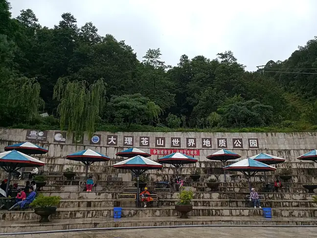 Cangshan Mountains · 苍山
Cangshan Mountains苍山
Cangshan (苍山) is a mountain range of nineteen peaks above Dali city, Yunnan, forming the Dali Cangshan World Geopark together with the lake-shore and plateau-lake landscapes around neighbouring Erhai.
Read the place guide →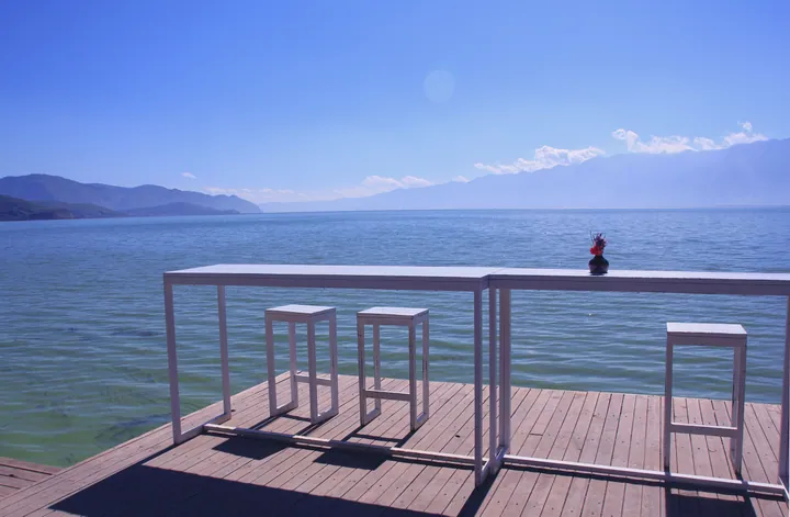 A lakeside deck overlooking Erhai Lake at Shuanglang, Dali · 大理双廊镇一处临洱海的观景平台 Source-recorded photograph date: 2013-11-02 14:33:46.
Shuanglang Village双廊
Shuanglang (双廊) is a Bai lakeside village on the northeast shore of Erhai in Dali city, Yunnan, whose name comes from the two curving bays and two islands that frame it, and which became known from the 2000s for artist-designed buildings alongside its older fishing and temple life.
Read the place guide →Local life & food
Dali local specialties
大理市特色美食 · 1 specialties to discover
 Xizhou baked filled bread 喜洲粑粑AI dish illustration / AI 菜品示意图
A crisp surface contrasts with soft layers. The savoury version can be rich with fat, while sweet versions give a very different snack.
Source ↗Read the dish guide →All dish names · 全部菜名 (1)
More dishes from across Yunnan are in the Yunnan food guide.
Plan your visit
Getting there
Dali is about 9 km in a straight line from central Dali Bai Autonomous Prefecture. Search for 大理市 in a map app to find stations and your accommodation.
Where to stay →Build your route
Xizhou Ancient Town and Dali Old Town are both listed here. The linked place guides have entrance and visit details.
Continue with Dali Bai Autonomous Prefecture →More in Dali Bai Autonomous Prefecture
Sources & geographic information
Administrative names and parent areas: Official geographic directory · Reference date 2026-09-06.
Some facts checked against 大理市 — Wikipedia contributors, CC BY-SA 4.0.
Photo: Xizhou Ancient Town · Kcx36 · CC BY-SA 4.0. Full frame retained; proportionally resized and converted to WebP. No retouching or changes to the photographed subject. Card displays may crop the view.

Photo: Dali Old Town · Ngguls · CC BY-SA 4.0. Full frame retained; proportionally resized and converted to WebP. No retouching or changes to the photographed subject. Card displays may crop the view.

Photo: Three Pagodas · Yumeto · CC BY-SA 4.0. Full frame retained; proportionally resized and converted to WebP. No retouching or changes to the photographed subject. Card displays may crop the view.
.jpg)
Photo: Erhai Ecological Corridor · Kcx36 · CC BY-SA 4.0. Full frame retained; proportionally resized and converted to WebP. No retouching or changes to the photographed subject. Card displays may crop the view.

Photo: Cangshan Mountains · Source photographer · License not provided. EXIF orientation normalized; resized without changing aspect ratio; converted to WebP. No subject edits.

Photo: Shuanglang Village · Zhangmoon618 · CC BY-SA 3.0. Full frame retained; proportionally resized and converted to WebP. No retouching or changes to the photographed subject. Card displays may crop the view.

Map data © OpenStreetMap contributors. Pins mark approximate centres, not entrances or boundaries.