


Get to know Nanjian Yi Autonomous County

Photo adjustments
Full frame retained; proportionally resized and converted to WebP. No retouching or changes to the photographed subject. Card displays may crop the view.
- Administrative area
- Autonomous county · 自治县
- Part of
- Dali Bai Autonomous Prefecture
- Chinese name
- 南涧彝族自治县
- Local areas
- Autonomous county guide
Area & population
- Area in the source
- 1,731.63 km²
- Population · 2020 census
- 192,942
- Administrative seat
- Nanjian
Source: cited geographic source, as of the dates shown.
Cherry trees over the tea rows
Taiwanese tea growers planted winter-flowering cherry trees to shade their tea plants. The mature trees bloom against the orderly green tea fields in the cold season. Plantings extend from hilltops and slopes into the valley and Shanhua Village (山花村). From the viewing platform in Area One, visitors can look across to Area Three and down into Area Two.
Stone temples and serving dances
Nearby Lingbaoshan (灵宝山) has forest paths passing stone-built temples. Nanjian’s tiaocai (南涧跳菜) combines dance, music and serving food into one performance. Local dishes include guoba youfen (锅巴油粉), black-boned chicken and ham.
Sources for this guide
无量山樱花谷(3A) - 大理白族自治州人民政府 · Dali Bai Autonomous Prefecture Government
Original English written from the listed sources and checked sentence by sentence against quoted extracts by a separate reviewer. Updated 2026-09-27.
Explore Nanjian Yi Autonomous County
Core places to explore, with English and Chinese names.
Places to explore around Nanjian Yi Autonomous County
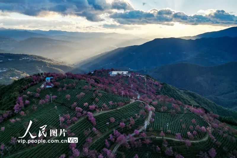 Wuliangshan Cherry Blossom Valley ·
 Plan your visit
Getting there
Nanjian Yi Autonomous County is about 65 km in a straight line from central Dali Bai Autonomous Prefecture. Search for 南涧彝族自治县 in a map app to find stations and your accommodation.
Where to stay →Build your route
Start with Wuliangshan Cherry Blossom Valley. The linked place guides have entrance and visit details.
Continue with Dali Bai Autonomous Prefecture →More in Dali Bai Autonomous Prefecture
Sources & geographic information
Administrative names and parent areas: Official geographic directory · Reference date 2026-09-06.
Photo: Wuliangshan Cherry Blossom Valley · Source photographer · License not provided. EXIF orientation normalized; resized without changing aspect ratio; converted to WebP. No subject edits.
Map data © OpenStreetMap contributors. Pins mark approximate centres, not entrances or boundaries.