


Get to know Qilin District

Photo adjustments
Full frame retained; resized proportionally to a maximum dimension of 960 pixels and converted to WebP quality 88. No crop, retouch, generated elements, or subject alteration. Final website rendition: full frame retained, proportionally resized to at most 720 pixels and converted to WebP. No additional retouching or subject alteration. Card displays may crop the view.
- Administrative area
- District · 市辖区
- Part of
- Qujing
- Chinese name
- 麒麟区
- Local areas
- District guide
Area & population
- Area in the source
- 4,093.00 km²
- Population · 2020 census
- 996,279
Source: cited geographic source, as of the dates shown.
The city centre
Qujing’s municipal offices are in Liaokuo Subdistrict (寥廓街道), while Qilin’s district government is in Nanning Subdistrict (南宁街道). The district lies on the central eastern Yunnan plateau and meets Fuyuan (富源), Luoping (罗平), Luliang (陆良), Malong (马龙) and Zhanyi (沾益). National roads 320 and 326 and the Guiyang–Kunming Railway (贵昆铁路) cross it.
Keyihei’s rural water landscape
Keyihei Scenic Area (克依黑景区) lies in Keyihei Village (克依黑村), Dongshan Town (东山镇), 58 kilometres from Qujing. Hills, trees and water form its setting. Lakeside walking paths and a glass walkway accompany a 7.2-kilometre route through rural water scenery and farmland. The scenic area is nationally rated 4A.
Sources for this guide
麒麟概况-曲靖市麒麟区人民政府-曲靖市麒麟区人民政府 · Qilin District Government
克依黑风景区/AAAA级旅游景区-曲靖市麒麟区人民政府-曲靖市麒麟区人民政府 · Qilin District Government
Original English written from the listed sources and checked sentence by sentence against quoted extracts by a separate reviewer. Updated 2026-09-30.
Explore Qilin District
Core places to explore, with English and Chinese names.
Places to explore around Qilin District
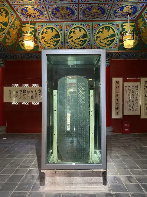 Cuan Baozi Stele ·
 Plan your visit
Getting there
Qilin District covers the centre of Qujing. Search for 麒麟区 in a map app to find stations and your accommodation.
Where to stay →Build your route
Start with Cuan Baozi Stele. The linked place guides have entrance and visit details.
Continue with Qujing →More in Qujing
Sources & geographic information
Administrative names and parent areas: Official geographic directory · Reference date 2026-09-06.
Photo: Cuan Baozi Stele · 瑞丽江的河水 · CC BY-SA 4.0. EXIF orientation normalized; resized without changing aspect ratio; converted to WebP. No subject edits.

Map data © OpenStreetMap contributors. Pins mark approximate centres, not entrances or boundaries.