


Get to know Xuanwei
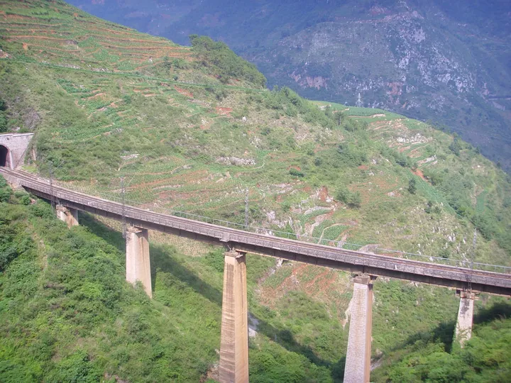
Photo adjustments
Full frame retained; proportionally resized and converted to WebP. No retouching or changes to the photographed subject. Card displays may crop the view.
- Administrative area
- County-level city · 县级市
- Part of
- Qujing
- Chinese name
- 宣威市
- Local areas
- County-level city guide
Area & population
- Area in the source
- 6,705.00 km²
- Population · 2020
- 1,189,813
Source: cited geographic source, as of the dates shown.
From prefecture to city
Xuanwei changed from prefecture to county status in 1913. The county briefly took the name Rongfeng (榕峰) in 1954 before reverting to Xuanwei in 1959; county-level city status followed in 1994. The Guiyang–Kunming Railway (贵昆铁路) runs through it.
Canyon and mountain destinations
Nizhu River Grand Canyon is a nationally rated 4A scenic area. Beipan River Bridge (北盘江大桥) crosses between Yunnan (云南) and Guizhou (贵州), while Dongshan (东山) and Wansongju (万松居) are other named nationally rated scenic areas. Old postal roads associated with the Silk Road (丝绸之路) form part of Xuanwei’s historical landscape. Xuanwei’s tourism promotion pairs these mountain and canyon destinations with its local ham.
Sources for this guide
宣威概况-宣威市人民政府-宣威市人民政府网,宣威市人民政府,宣威市政府,云南省宣威市人民政府网 · Xuanwei Municipal Government
宣威市推动文旅产业提质增效 - 县区动态 - 曲靖市人民政府门户网 · Qujing Daily via Qujing Municipal Government; Xuanwei Government Information Service Centre
Original English written from the listed sources and checked sentence by sentence against quoted extracts by a separate reviewer. Updated 2026-09-30.
Explore Xuanwei
Core places to explore, with English and Chinese names.
Plan your visit
Getting there
Xuanwei is about 85 km in a straight line from central Qujing. Search for 宣威市 in a map app to find stations and your accommodation.
Where to stay →More in Qujing
Sources & geographic information
Administrative names and parent areas: Official geographic directory (dmfw.mca.gov.cn) · Reference date 2026-09-06.
Map data © OpenStreetMap contributors. Pins mark approximate centres, not entrances or boundaries.