


Get to know Hongta District
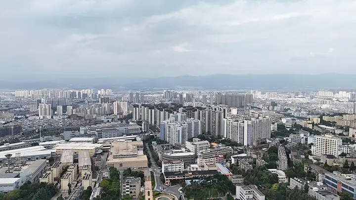
Photo adjustments
Full frame retained; resized proportionally to a maximum dimension of 960 pixels and converted to WebP quality 88. No crop, retouch, generated elements, or subject alteration. Final website rendition: full frame retained, proportionally resized to at most 720 pixels and converted to WebP. No additional retouching or subject alteration. Card displays may crop the view.
- Administrative area
- District · 市辖区
- Part of
- Yuxi
- Chinese name
- 红塔区
- Local areas
- District guide
Area & population
- Area in the source
- 1,004.00 km²
- Population · 2020 census
- 588,738
Source: cited geographic source, as of the dates shown.
A valley and transport junction
The district’s urban centre stands at about 1,630 metres above sea level. The Yuxi River crosses the area, and the Kunming–Mohan Expressway (昆磨高速公路), National Road 213 and the Kunming–Yuxi (昆玉铁路) and Yuxi–Mengzi (玉蒙铁路) railways connect it with surrounding regions. The district is 88 kilometres from Kunming (昆明).
Music heritage and urban waters
Nie Er Cultural Square (聂耳文化广场) incorporates Yu Lake (玉湖), two stretches of the Yuxi River landscape and Yuxi Waterfall Ecological Park (玉溪瀑布生态公园). Nie Er Park (聂耳公园) is another maintained urban green space. The district also records the composer’s former home (聂耳故居) and the former Wenxingxiang trading-house site (文兴祥商号旧址) among its cultural destinations.
Explore Hongta District
Core places to explore, with English and Chinese names.
Hongta District 红塔区
Plan your visit
Getting there
Hongta District covers the centre of Yuxi. Search for 红塔区 in a map app to find stations and your accommodation.
Where to stay →More in Yuxi
Sources & geographic information
Administrative names and parent areas: Official geographic directory (dmfw.mca.gov.cn) · Reference date 2026-09-06.
Map data © OpenStreetMap contributors. Pins mark approximate centres, not entrances or boundaries.