


Get to know Yuanjiang Hani, Yi and Dai Autonomous County
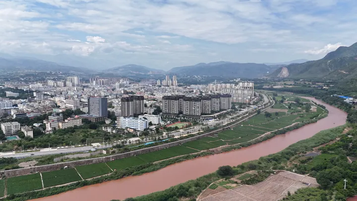
Photo adjustments
Full frame retained; proportionally resized and converted to WebP. No retouching or changes to the photographed subject. Card displays may crop the view.
- Administrative area
- Autonomous county · 自治县
- Part of
- Yuxi
- Chinese name
- 元江哈尼族彝族傣族自治县
- Local areas
- Autonomous county guide
Area & population
- Area in the source
- 2,858.00 km²
- Population · 2020 census
- 195,647
Source: cited geographic source, as of the dates shown.
Rice fields and earthen houses
Nanuo Terraces (那诺梯田) express Hani (哈尼族) farming traditions through a changing seasonal landscape. Their outlines are clear before spring planting; summer brings green rice fields, autumn ripening grain, and winter cloud and mist. In Podi Village (坡垤村), Yi (彝族) earthen houses climb the hillside beside water, with the village reflected in a pool.
Forest springs and tropical fruit
Honghegu Rehai Hot Springs (红河谷热海温泉) lie within forest. Naturally hot spring water is used for cooking without a fire. Yijiangfeng Tropical Botanical Garden (依江风热带植物园), on the Yuanjiang basin floor, combines fruit picking and farming experiences with displays of unusual flowers and fruits. Local foods include sweet, slightly sour duoduo cakes (朵朵糕) and crisp, sour-spicy pickled wangen (弯根腌菜).
Sources for this guide
元江县人民政府 · Yuanjiang County Government
旅游度假到玉溪丨元江:看美景、品美食,感受红河谷中太阳城的热情_文旅头条 · Wenlü Toutiao / Yunnan Daily Press Group
Original English written from the listed sources and checked sentence by sentence against quoted extracts by a separate reviewer. Updated 2026-09-27.
Explore Yuanjiang Hani, Yi and Dai Autonomous County
Core places to explore, with English and Chinese names.
Places to explore around Yuanjiang Hani, Yi and Dai Autonomous County
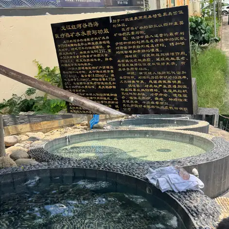 Honghegu Rehai Hot Spring ·
 Plan your visit
Getting there
Yuanjiang Hani, Yi and Dai Autonomous County is about 100 km in a straight line from central Yuxi. Search for 元江哈尼族彝族傣族自治县 in a map app to find stations and your accommodation.
Where to stay →Build your route
Start with Honghegu Rehai Hot Spring. The linked place guides have entrance and visit details.
Continue with Yuxi →More in Yuxi
Sources & geographic information
Administrative names and parent areas: Official geographic directory · Reference date 2026-09-06.
Photo: Honghegu Rehai Hot Spring · Source photographer · License not provided. EXIF orientation normalized; resized without changing aspect ratio; converted to WebP. No subject edits.
Map data © OpenStreetMap contributors. Pins mark approximate centres, not entrances or boundaries.