


Get to know Xinping Yi and Dai Autonomous County
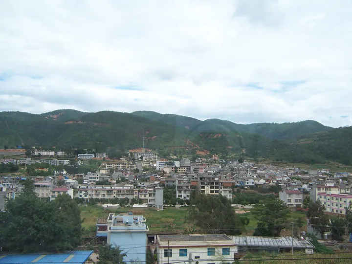
Photo adjustments
Full frame retained; proportionally resized and converted to WebP. No retouching or changes to the photographed subject. Card displays may crop the view.
- Administrative area
- Autonomous county · 自治县
- Part of
- Yuxi
- Chinese name
- 新平彝族傣族自治县
- Local areas
- Autonomous county guide
Area & population
- Area in the source
- 1,114.00 km²
- Population · 2020 census
- 262,771
- Administrative seat
- Guishan
Source: cited geographic source, as of the dates shown.
Water above and below the road
Nan’en Waterfall stands beside the Enshui Road (恩水公路). Water drops from the cliff above the road onto a rocky slope, gathers among boulders and passes beneath a bridge before falling again. From July to October, its stronger flow sends spray into the valley; sunlight can produce rainbows above the falls.
Five natural stone gateways
Shimen Gorge stretches for six kilometres on the mountain’s middle slopes, at elevations above two thousand metres. Five natural formations resembling gates give the gorge its name. Streams weave among rocks, forming cascades, pools and shallow reaches. Old trees, vines and wet moss cover parts of the ravine. Named sights along the upstream route include Mingyue Pool (明月潭), Meteor Spring (流星泉) and Pearl Waterfall (珍珠瀑).
Sources for this guide
玉溪市人民政府 · Yuxi Network, via Yuxi City Government
Original English written from the listed sources and checked sentence by sentence against quoted extracts by a separate reviewer. Updated 2026-09-27.
Explore Xinping Yi and Dai Autonomous County
Core places to explore, with English and Chinese names.
Places to explore around Xinping Yi and Dai Autonomous County
 Ailao Mountains Nan'en Waterfall and Shimen Gorge · 哀牢山南恩瀑布与石门峡开放区
Ailao Mountains Nan'en Waterfall and Shimen Gorge哀牢山南恩瀑布与石门峡开放区
Nan'en Waterfall and Shimen Gorge are two stops on a developed, open stretch of the Ailao Mountains in Xinping County, Yuxi, strung along National Highway 323 outside the closed core of the Ailao Mountain national nature reserve.
Read the place guide → AI illustration · AI 示意图(仅供参考,非该地点实拍)
Gasa Town戛洒小镇
Gasa is a town in Xinping Yi and Dai Autonomous County, in Yunnan's Yuxi municipality, lying west of the county seat on the eastern flank of the middle Ailao range beside the Gasa River in the upper Red River basin. It is the county's principal Huayao Dai centre, a branch of the Dai named for the hand-woven patterned sash worn at the waist of its women's skirts.
Read the place guide →Plan your visit
Getting there
Xinping Yi and Dai Autonomous County is about 65 km in a straight line from central Yuxi. Search for 新平彝族傣族自治县 in a map app to find stations and your accommodation.
Where to stay →Build your route
Ailao Mountains Nan'en Waterfall and Shimen Gorge and Gasa Town are both listed here. The linked place guides have entrance and visit details.
Continue with Yuxi →More in Yuxi
Sources & geographic information
Administrative names and parent areas: Official geographic directory (dmfw.mca.gov.cn) · Reference date 2026-09-06.
Photo: Ailao Mountains Nan'en Waterfall and Shimen Gorge · Source photographer · License not provided. EXIF orientation normalized; resized without changing aspect ratio; converted to WebP. No subject edits.
Map data © OpenStreetMap contributors. Pins mark approximate centres, not entrances or boundaries.