


Get to know Qiantang District
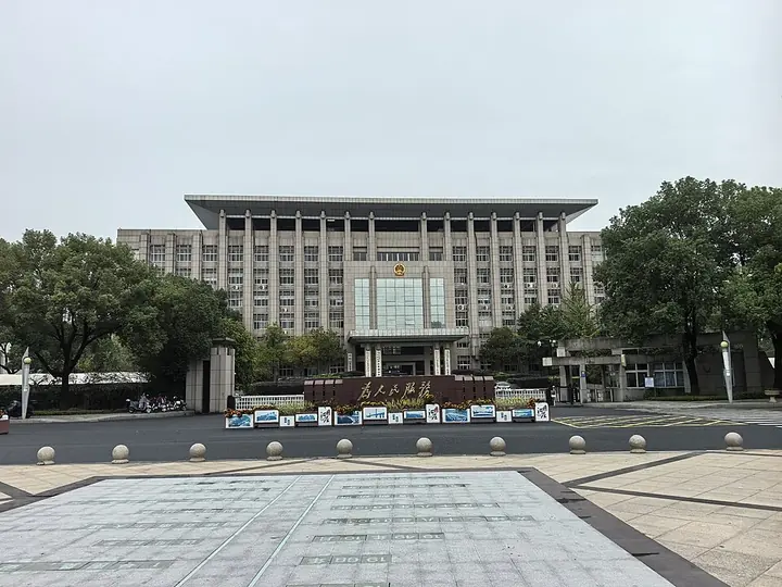
Photo adjustments
Full frame retained; proportionally resized and converted to WebP. No retouching or changes to the photographed subject. Card displays may crop the view.
- Administrative area
- District · 市辖区
- Part of
- Hangzhou
- Chinese name
- 钱塘区
- Local areas
- District guide
Area & population
- Area in the source
- 531.70 km²
Source: cited geographic source, as of the dates shown.
Setting and landscape
Most of the district's land was won from the river. Xiasha (下沙) in the west and Dajiangdong (大江东) in the east, known in the past as Nansha (南沙), were both sandy ground: tidal flats built up from Qiantang River sediment and enclosed over generations by local people against the Qiantang tide. The big Xiasha reclamation ran from the early 1950s to 1980 and produced about 80 percent of Xiasha's present land. The Dajiangdong reclamation began in 1949 and had enclosed 518,200 mu by the 1990s.
Hangzhou News counts 180 square kilometres of wetland in the district, including coastal flats, rivers, lakes and fish ponds, and reports that the Jianghai wetland (江海湿地) has recorded more than 140 bird species, among them the tundra swan, black-faced spoonbill and reed parrotbill. The same report places Hangzhou's largest wetland, the Linjiang Jianghai Wetland (临江江海湿地), and the longest riverside stretch of the Zhijiang Greenway (之江绿道) in Qiantang, and reported in 2023 that Hangzhou plans to build a Greater Bay wetland park (大湾区湿地公园) in the district, in the estuary of the Qiantang River.
What to see
The Xiasha Higher Education Park (下沙高教园区), set up by the provincial government in 2000, holds 14 universities, among them Hangzhou Dianzi University (杭州电子科技大学), Zhejiang Sci-Tech University (浙江理工大学) and the Communication University of Zhejiang (浙江传媒学院). The reclamation story is told at the reclamation culture exhibition hall in Xinwei Village (新围村), which the Zhejiang Provincial Cultural Heritage Administration recognised as a rural museum in 2023.
Highlights
- Linjiang Jianghai Wetland 临江江海湿地: Named by Hangzhou News as Hangzhou's largest wetland, on the Qiantang estuary; more than 140 bird species recorded in the Jianghai wetland.
- Xiasha Higher Education Park 下沙高教园区: Set up in 2000; 14 universities.
- Xinwei Village reclamation culture exhibition hall 新围村围垦文化展陈馆: Rural museum on the district's land reclamation, recognised in 2023.
Sources for this guide
钱塘区 - 维基百科,自由的百科全书 · Wikipedia (Chinese) · CC BY-SA 4.0
杭州要建大湾区湿地公园,4.7个西溪湿地那么大,建在哪里?杭州第一缕阳光升起的地方-杭州新闻中心-杭州网 · Hangzhou News (hangzhou.com.cn)
浙江新增85家乡村博物馆,全省乡村博物馆地图小程序今日上线 | 极目新闻 · Jimu News (ctdsb.net)
Original English written from the listed sources and checked sentence by sentence against quoted extracts by a separate reviewer. Updated 2026-09-25.
Explore Qiantang District
Core places to explore, with English and Chinese names.
Places to explore around Qiantang District
 Qiantang River and Qiantang River Bridge ·
 Local life & food
Qiantang District local specialties
钱塘区特色美食 · 1 specialties to discover
 Qiantang bamboo shoots with fermented greens 倒笃春笋AI illustration · AI 示意图
The shoots offer a fresh, tender-crisp bite against the greens' concentrated savory aroma. It is a small-ingredient pairing with a pronounced flavor contrast.
Source ↗Read the dish guide →All dish names · 全部菜名 (1)
More dishes from across Zhejiang are in the Zhejiang food guide.
Plan your visit
Getting there
Qiantang District is about 30 km in a straight line from central Hangzhou. Search for 钱塘区 in a map app to find stations and your accommodation.
Where to stay →Build your route
Start with Qiantang River. The linked place guides have entrance and visit details.
Continue with Hangzhou →More in Hangzhou
Sources & geographic information
Administrative names and parent areas: Official geographic directory · Reference date 2026-09-06.
Some facts checked against 钱塘区 — Wikipedia contributors, CC BY-SA 4.0.
Photo: Qiantang River · David290 · CC BY-SA 4.0. Full frame retained; proportionally resized and converted to WebP. No retouching or changes to the photographed subject. Card displays may crop the view.
.jpg)
Map data © OpenStreetMap contributors. Pins mark approximate centres, not entrances or boundaries.