

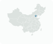
Get to know Changping District
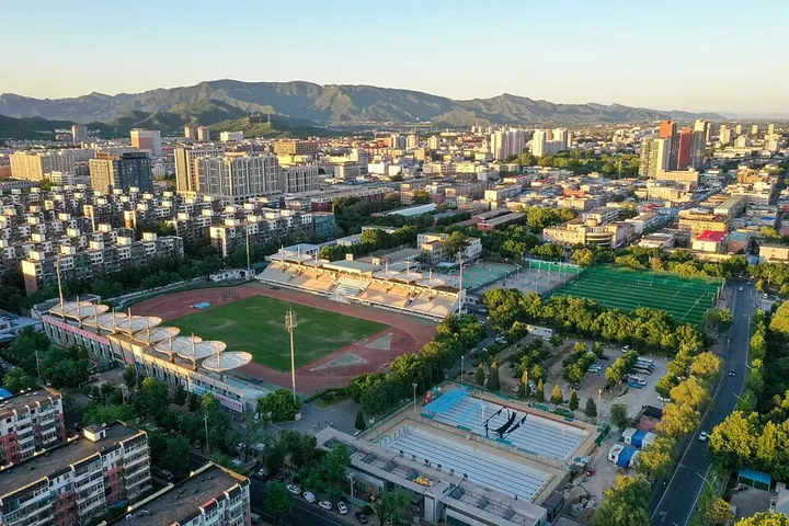
Photo adjustments
Full frame retained; proportionally resized and converted to WebP. No retouching or changes to the photographed subject. Card displays may crop the view.
- Administrative area
- District · 市辖区
- Part of
- Beijing
- Chinese name
- 昌平区
- Local areas
- District guide
Area & population
- Area in the source
- 1,352.00 km²
- Population · 2020
- 2,269,487
- Administrative seat
- Chengbei Subdistrict (城北街道)
Source: cited geographic source, as of the dates shown.
Setting and landscape
The land rises to the north-west and falls to the south-east. Changping borders Yanqing (延庆) and Huairou (怀柔) to the north, Shunyi (顺义) to the east, Haidian (海淀), Chaoyang (朝阳) and Mentougou (门头沟) to the south, and Huailai County (怀来县) in Hebei to the west. The district government calls it an ecological barrier for the north-west of the capital, and also a new town and a base for science and higher education.
History
The district government speaks of 6,000 years of civilisation and more than 2,000 years as a county; its Xueshan culture (雪山文化) sites are described as among the earliest Neolithic finds in the Beijing area. The Qin set up Jundu County (军都县) here, and a Changping County existed from the Western Han. The name, meaning 'prosperous and peaceful', comes from a Han marquisate. In the Ming the county was raised to Changping Zhou (昌平州), and it was known as the 'pillow of the capital' (京师之枕). Changping County became a district in 1999.
What to see
The Ming tombs lie on the southern slope of Tianshou Mountain (天寿山), about 42 kilometres north-north-west of central Beijing; thirteen Ming emperors from the Yongle Emperor onwards are buried here. A seven-kilometre Spirit Way lined with statues of guardian animals and officials leads into the complex, and the underground palace of Dingling (定陵) has been excavated. The tombs are part of the World Heritage listing for the Imperial Tombs of the Ming and Qing Dynasties.
Juyong Pass sits in the 18-kilometre Guangou Valley (关沟) and was one of the Ming 'Three Inner Passes' on the Great Wall; its white-marble Cloud Platform (云台) dates from 1342, under the Yuan. 'Juyong in green layers' (居庸叠翠) was one of the Eight Views of Yanjing (燕京八景). The district also has six national protected sites, among them the Yinshan Pagoda Forest (银山塔林) and the Baifu Spring site (白浮泉遗址), where a park is being built at the source of the Grand Canal.
Food and local products
Strawberries, grown especially around Xingshou (兴寿镇), are a Changping speciality protected as a Chinese geographical-indication product, and apples are another speciality, especially around Cuicun (崔村镇).
Highlights
- Ming tombs 明十三陵: Burial ground of thirteen Ming emperors on Tianshou Mountain; part of a World Heritage site.
- Juyong Pass 居庸关: Great Wall pass in the Guangou Valley with a Cloud Platform built in 1342.
- Yinshan Pagoda Forest 银山塔林: One of Changping's six national protected sites.
- Changping strawberries 昌平草莓: Geographical-indication product grown especially around Xingshou.
Sources for this guide
昌平概况 · Changping District People's Government, Beijing
昌平区 - 维基百科 · Wikipedia (Chinese) · CC BY-SA 4.0
Ming tombs - Wikipedia · Wikipedia (English) · CC BY-SA 4.0
Juyong Pass - Wikipedia · Wikipedia (English) · CC BY-SA 4.0
Original English written from the listed sources and checked sentence by sentence against quoted extracts by a separate reviewer. Updated 2026-09-25.
Explore Changping District
Core places to explore, with English and Chinese names.
Places to explore around Changping District
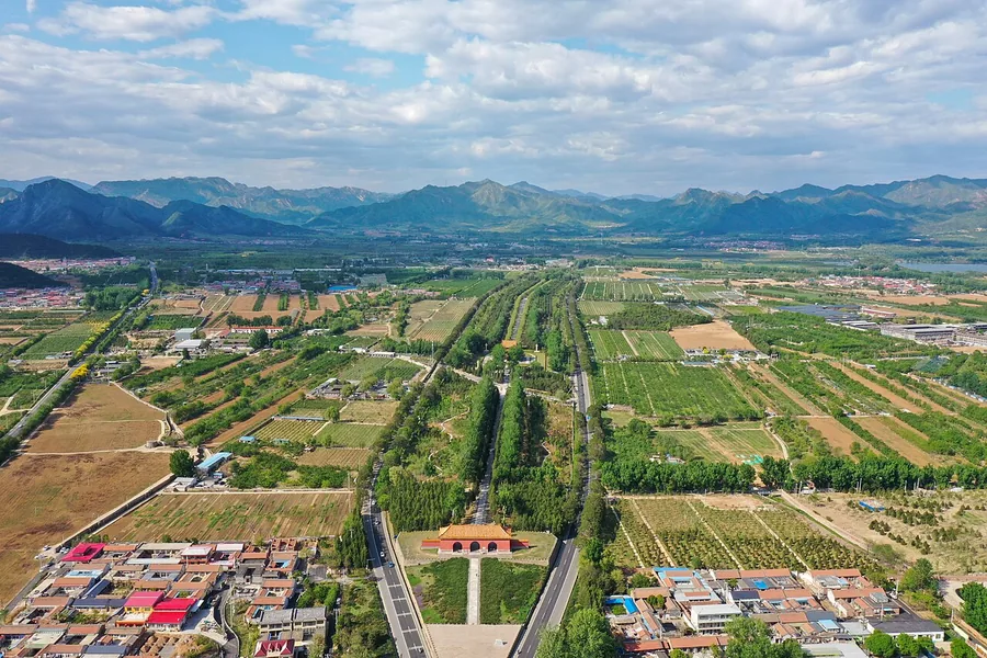 The Sacred Way and Dagong Gate at the Ming Tombs, seen from above in July 2019.
Ming tombs明十三陵
The Ming Tombs occupy a broad valley in Changping, where thirteen emperors were buried in separate compounds set against the surrounding mountains. The Sacred Way introduces the ceremonial landscape through stone animals and…
Read the place guide → Juyong Pass and its Great Wall route through the mountains, viewed from the north, Beijing; 27 June 2020.
Juyong Pass居庸关
Juyong Pass occupies the Guangou Valley in Changping, where the Great Wall guarded a strategic approach toward Beijing. The landscape makes the defensive purpose clear: walls rise on the surrounding slopes while the route passes…
Read the place guide →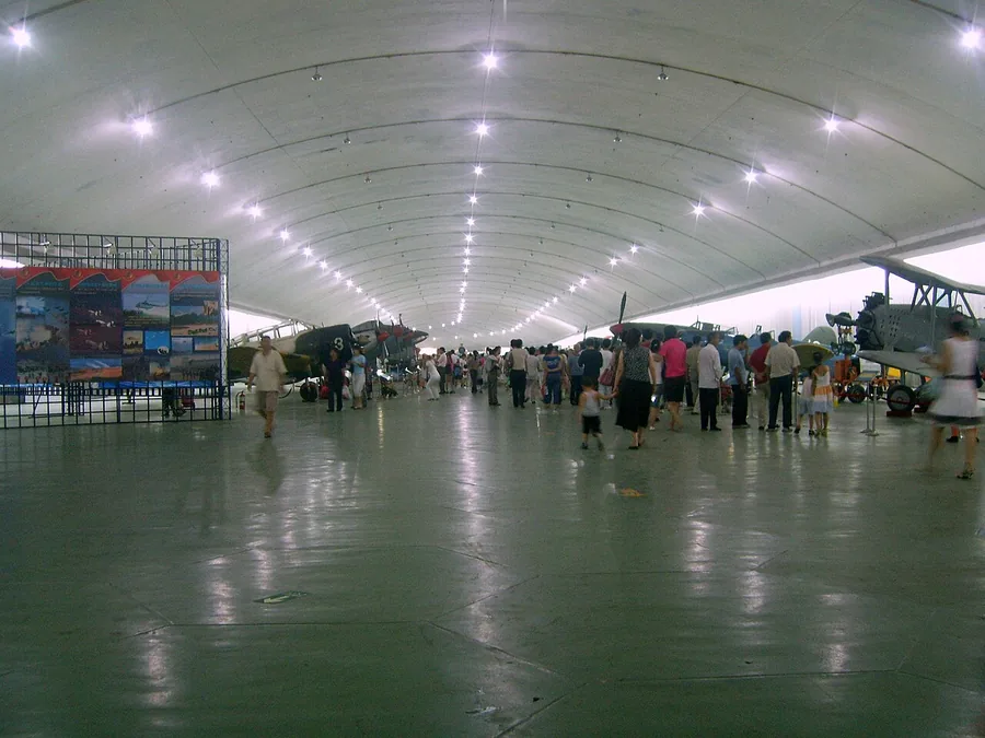 Aircraft displays in the cavern exhibition area of the Chinese Aviation Museum at Datangshan, July 2007.
Chinese Aviation Museum中国航空博物馆
The Chinese Aviation Museum at Datangshan brings a large aircraft collection into the setting of a former airbase. Part of the museum uses a cavern cut into the mountain, while the collection includes aircraft from the propeller…
Read the place guide →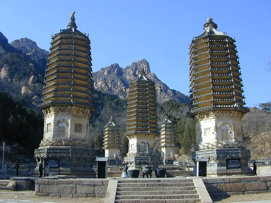 Historic pagodas against the mountains at Beijing's Yinshan Pagoda Forest.
Yinshan Pagoda Forest银山塔林
Yinshan Pagoda Forest combines historic Buddhist pagodas with a mountain landscape in Changping. The dark rock faces at the mountain’s foot explain the associated name Iron Wall, while winter snow inspired the Silver Mountain…
Read the place guide →Plan your visit
Getting there
Changping District is about 40 km in a straight line from central Beijing. Search for 昌平区 in a map app to find stations and your accommodation.
Where to stay →Build your route
Ming tombs and Juyong Pass are about 15 km apart in a straight line. The linked place guides have entrance and visit details.
Continue with Beijing →More in Beijing
Sources & geographic information
Administrative names and parent areas: Official geographic directory · Reference date 2026-09-06.
Some facts checked against 昌平区 — Wikipedia contributors, CC BY-SA 4.0.
Some facts checked against Ming tombs — Wikipedia contributors, CC BY-SA 4.0.
Some facts checked against Juyong Pass — Wikipedia contributors, CC BY-SA 4.0.
Photo: Ming tombs · Charlie fong · CC BY-SA 4.0. Proportionally resized and converted to WebP without cropping, retouching or changing the photographed subject.

Photo: Juyong Pass · Charlie fong · CC BY-SA 4.0. Proportionally resized and converted to WebP without cropping, retouching or changing the photographed subject.

Photo: Chinese Aviation Museum · Shizhao · CC BY-SA 3.0. Proportionally resized and converted to WebP without cropping, retouching or changing the photographed subject.

Photo: Yinshan Pagoda Forest · gongfu_king · CC BY-SA 2.0. Proportionally resized and converted to WebP without cropping, retouching or changing the photographed subject.

Map data © OpenStreetMap contributors. Pins mark approximate centres, not entrances or boundaries.