

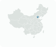
Get to know Miyun District

Photo adjustments
Full frame retained; proportionally resized and converted to WebP. No retouching or changes to the photographed subject. Card displays may crop the view.
- Administrative area
- District · 市辖区
- Part of
- Beijing
- Chinese name
- 密云区
- Local areas
- District guide
Area & population
- Area in the source
- 2,227.00 km²
- Population · 2020
- 527,683
- Administrative seat
- Gulou Subdistrict
Source: cited geographic source, as of the dates shown.
Setting and landscape
Mountains close the district on the east, north and west, with old Great Wall running along the ridges; the middle is low ground and an alluvial plain opens to the south-west. Miyun borders Xinglong (兴隆县), Chengde (承德县) and Luanping (滦平县) counties of Hebei (河北) to the east and north, and Huairou (怀柔区), Shunyi (顺义区) and Pinggu (平谷区) districts to the west and south. Because it sits on the route from North China towards the north-east and Inner Mongolia, it was called the "lock and key of the capital" (京师锁钥).
The reservoir straddles the Chao River (潮河) and the Bai River (白河). Work began on 1 September 1958 and was completed in September 1960; Tsinghua University (清华大学) designed it. The district government gives its largest water surface as 188 square kilometres, and Beijing's city master plan names Miyun the capital's most important water-source protection area.
What to see
The Simatai Great Wall (司马台长城) is described by the district government as the only stretch of the ancient wall that keeps the original appearance of the Ming wall; the architectural historian Luo Zhewen (罗哲文) called it the best of China's Great Wall. Beneath it, Gubei Water Town (古北水镇) is a resort town beside the Yuanyang Lake reservoir (鸳鸯湖水库), with 430,000 square metres of hillside courtyard buildings in Ming, Qing and Republican styles and dense canals rebuilt from the Tang River (汤河) system. Wooden boats run from the visitor centre to the foot of the wall.
Food and local products
Since the Ming and Qing, local people have summed up Miyun's farm produce as the "Eight Treasures of Miyun" (密云八珍), an informal grouping never officially rated. The usual list is Yanshan chestnuts (燕山板栗), Xitiangezhuang golden-thread jujubes (西田各庄金丝小枣), Fenzhuang walnuts (坟庄核桃), Huangtukan pears (黄土坎鸭梨), Jinpoluo millet (金叵罗小米), Dachengzi red Xiao pears (大城子红肖梨), Dongshaoqu yellow plums (东邵渠御皇李子) and Dongzhi toon shoots (东智香椿).
The chestnuts grow mainly north of the reservoir around Gaoling (高岭), Bulaotun (不老屯), Fengjiayu (冯家峪) and Shicheng (石城), and Miyun was allowed to use the Yanshan chestnut geographical indication in 2008. The jujubes nearly died out after disease struck in the 1970s; in 2010 Miyun brought more than 20,000 seedlings back from Cangzhou (沧州), which had taken jujube seedlings from Miyun in 1965.
Getting oriented
The district government puts Miyun 45 kilometres from urban Beijing and 35 kilometres from Beijing Capital International Airport. The Beijing–Chengde Expressway (京承高速), the Beijing–Shenyang high-speed railway (京沈高铁) and suburban railway line S5 all serve the district.
Highlights
- Simatai Great Wall 司马台长城: Described by the district government as the only section that keeps the original appearance of the Ming wall.
- Gubei Water Town 古北水镇: Resort town of Ming, Qing and Republican-style courtyard buildings and canals at the foot of the Simatai wall.
- Miyun Reservoir 密云水库: Built from 1958 to 1960 on the Chao and Bai rivers; the district's centre.
- Yanshan chestnuts 燕山板栗: First of the traditional Eight Treasures of Miyun; geographical indication granted for Miyun in 2008.
Sources for this guide
密云概况_北京市密云区人民政府 · Miyun District People's Government, Beijing
传统“密云八珍”_密云史志_北京市密云区人民政府 · Party History Research Office of the Miyun District Committee, on the Miyun District People's Government portal
古北水镇_旅游景区_北京市密云区人民政府 · Miyun District People's Government, Beijing
Miyun Reservoir - Wikipedia · Wikipedia · CC BY-SA 4.0
Original English written from the listed sources and checked sentence by sentence against quoted extracts by a separate reviewer. Updated 2026-09-25.
Explore Miyun District
Core places to explore, with English and Chinese names.
Places to explore around Miyun District
 The Simatai section of the Great Wall climbing a mountain ridge, September 2018.
Simatai司马台长城
Simatai follows a rugged ridge above the Gubei Water Town area in Miyun. Its steep changes of level and closely spaced watchtowers make the wall's relationship with the mountain particularly visible: the defenses adapt to the…
Read the place guide →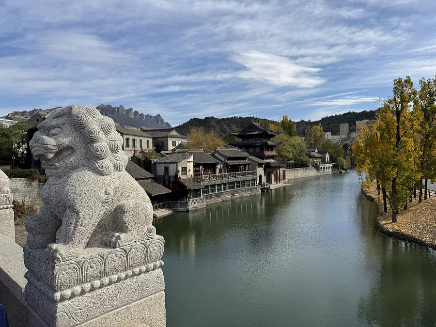 Gubei Water Town seen from its entrance bridge, with waterfront buildings and a stone lion.
Gubei Water Town古北水镇
Gubei Water Town is a modern tourism resort beside Yuanyang Lake Reservoir at the foot of Simatai Great Wall. Its courtyards and waterside lanes use architectural styles associated with the Ming, Qing and Republican periods; the…
Read the place guide → A rocky gorge entrance: a steep cliff carrying large red characters 黑龙潭 with a stone gate building below it, a wooded hillside behind, and a road bridge with metal railings crossing the foreground; a white date stamp 2010.11.14 sits at the lower right under a clear blue sky.
Heilongtan Gorge in Miyun黑龙潭
Heilongtan is a mountain gorge in Shicheng, Miyun District, known for a sequence of pools, streams and waterfalls.
Read the place guide →Plan your visit
Getting there
Miyun District is about 65 km in a straight line from central Beijing. Search for 密云区 in a map app to find stations and your accommodation.
Where to stay →Build your route
Simatai and Gubei Water Town are about 10 km apart in a straight line. The linked place guides have entrance and visit details.
Continue with Beijing →More in Beijing
Sources & geographic information
Administrative names and parent areas: Official geographic directory · Reference date 2026-09-06.
Some facts checked against Miyun Reservoir — Wikipedia contributors, CC BY-SA 4.0.
Photo: Simatai · Ludger Heide · CC BY-SA 2.0. Proportionally resized and converted to WebP without cropping, retouching or changing the photographed subject.
.jpg)
Photo: Gubei Water Town · Codas · CC BY-SA 4.0. Proportionally resized and converted to WebP without cropping, retouching or changing the photographed subject.

Photo: Heilongtan Gorge in Miyun · Tiger@西北 · CC BY-SA 3.0. Full frame retained; proportionally resized and converted to WebP. No retouching or changes to the photographed subject. Card displays may crop the view.

Map data © OpenStreetMap contributors. Pins mark approximate centres, not entrances or boundaries.