


Get to know Ngari Prefecture
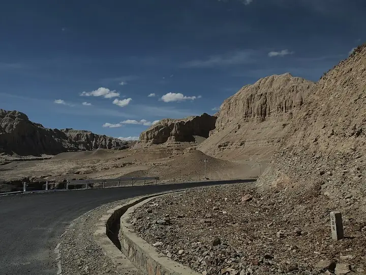
Photo adjustments
Full frame retained; resized proportionally to a maximum dimension of 960 pixels and converted to WebP quality 88. No crop, retouch, generated elements, or subject alteration. Final website rendition: full frame retained, proportionally resized to at most 720 pixels and converted to WebP. No additional retouching or subject alteration. Card displays may crop the view.
- Administrative area
- Prefecture · 地区
- Part of
- Tibet (Xizang)
- Chinese name
- 阿里地区
- Local areas
- 7 local areas
Area & population
- Area in the source
- 304,683.00 km²
- Population · 2020
- 123,281
- Administrative seat
- Shiquanhe, Gar County
Source: cited geographic source, as of the dates shown.
Transportation
The paved Xinjiang-Tibet Highway (新藏公路, G219) is the main transportation line through Ngari. The 2143 km long highway runs from Kargilik, Xinjiang to Lhatse County in central Tibet, where it meets the China–Nepal Highway. The section between Kargilik and Gartok was completed in 1957. At the time, it was the only gravel road into Ngari and the highest road in the world. The highway was subsequently extended eastward to Purang and Lhatse. Most of the road's Ngari section is located in uninhabited land at an average altitude of more than 4500 m. More than 1,000 soldiers of the People's Liberation Army died during the highway's construction due to altitude sickness and avalanches. The Xinjiang-Tibet Highway was completely paved from 2010 to 2012. In the present day, the majority of passengers and goods from Ngari are transported through the Xinjiang-Tibet Highway to China's railway network in southern Xinjiang.
Ngari Gunsa Airport began operations on 1 July 2010, becoming the fourth civil airport in Tibet (shortening the trip to Lhasa to one-and-a-half hours from three or four days by car) after Lhasa Gonggar Airport, Qamdo Bamda Airport and Nyingchi Mainling Airport.
Entry & permits for Tibet (Xizang)
Foreign tourists need Tibet entry approval, commonly called a Tibet Travel Permit, and an organised visit arranged through a specialist travel agency in China. Confirm your approved route before booking transport. Requirements differ for Taiwan residents and for travellers using mainland or Hong Kong/Macao Chinese resident documents; check the document guide before you book.
Check the travel-document requirements →Policy scope verified: 2026-09-06. UK FCDO: China regional travel advice ↗ State Council Taiwan Affairs Office: Tibet entry approval ↗ Xizang Department of Culture and Tourism: Medog border permit notice ↗
Explore Ngari Prefecture
Core places to explore, with English and Chinese names.
Pangong Lake Visitor Area 班公湖开放游览区
Rutog Rock Art Site 日土岩画开放展示点
Mount Kailash Kora Route 冈仁波齐正规开放转山线路
Rakshastal Lake Official Viewpoint 拉昂错正规观景点
Lake Manasarovar 玛旁雍错
Guge Kingdom Ruins 古格王国遗址
Tholing Monastery 托林寺
Zanda Earth Forest Viewing Route 札达土林正规观景路线
Piyang and Dongga Cave Temple Site 皮央东嘎遗址
Burang County 普兰县
Zanda County 札达县
Gar County 噶尔县
Rutog County 日土县
Gê'gyai County 革吉县
Gêrzê County 改则县
Coqên County 措勤县
Places to explore around Ngari Prefecture
 Pangong Lake Visitor Area · 班公湖开放游览区
Pangong Lake Visitor Area班公湖开放游览区
Pangong Lake (班公湖) is a long, narrow lake in the north-west of Rutog County, in the Ngari Prefecture of the Tibet Autonomous Region, about 15 kilometres from the county town. The Ngari Culture and Tourism Bureau lists it as a 3A scenic area, describes it as a nationally famous wetland, fresh in the east and salty in the west, and places it within Wujiang village in Duoma Township.
Read the place guide → AI illustration · AI 示意图(仅供参考,非该地点实拍)
Rutog Rock Art Site日土岩画开放展示点
The Rutog rock art (日土岩画) is a body of carvings on rock in Rutog County, in the Ngari Prefecture of the Tibet Autonomous Region. The Tibet Department of Natural Resources says rock art on the Qinghai-Tibet Plateau is mainly found in northern Tibet, most of it in Ngari, and that Rutog County's is the best known of it.
Read the place guide → AI illustration · AI 示意图(仅供参考,非该地点实拍)
Mount Kailash Kora Route冈仁波齐正规开放转山线路
Mount Kailash (冈仁波齐) stands in Baga Township, Purang County, in the Ngari Prefecture of the Tibet Autonomous Region, and is 6,656 metres high. The Purang County guide commentary translates its Tibetan name as king of snow mountains and records it as revered by the indigenous Tibetan Bon religion, by Tibetan Buddhism, by Hinduism and by Jainism, and called the centre of the world.
Read the place guide → AI illustration · AI 示意图(仅供参考,非该地点实拍)
Rakshastal Lake Official Viewpoint拉昂错正规观景点
La'nga Co (拉昂错), the lake the sources call the ghost lake, lies in Purang County in the Ngari Prefecture of the Tibet Autonomous Region at 4,573 metres, a slightly brackish lake. The Purang County government's commentary on the county's scenic sites describes it as standing beside the sacred lake Manasarovar with only a channel between them.
Read the place guide → Lake Manasarovar · 玛旁雍措
Lake Manasarovar玛旁雍错
Manasarovar is a large freshwater lake in Burang, lying near Kailash and beside the contrasting saline waters of Rakshastal. Its religious significance extends across several Himalayan traditions, but the physical landscape is…
Read the place guide → Earthen remains at the Guge Kingdom ruins · 古格王国遗址 Photograph date recorded by the source: 10 June 2012.
Guge Kingdom Ruins古格王国遗址
Guge's former capital climbs a dry earthen hill beside the Sutlej valley at Tsaparang, or Zhaburang. Cave dwellings and the remains of houses occupy the lower slopes, while temples and palace remains rise above them. The White…
Read the place guide → Tholing Monastery in evening light, photographed in August 2007 · 托林寺
Tholing Monastery托林寺
Tholing stands beside the Sutlej in Zanda and was a major centre for the Buddhist revival associated with Guge. Founded in 996 under Yeshe O, it became a base for translators and teachers including Rinchen Zangpo and Atisha. Its…
Read the place guide → Zanda Earth Forest Viewing Route · 札达土林正规观景路线
Zanda Earth Forest Viewing Route札达土林正规观景路线
The Zanda earth forest (札达土林) is a landform of eroded earth columns along the Xiangquan river valley in Zanda County, in the Ngari Prefecture of the Tibet Autonomous Region, spread between 3,750 and 4,500 metres over about 2,464 square kilometres. It was listed as a national-level geological park in 2005, and the park is centred on Toling town and spreads along both banks of the Xiangquan river.
Read the place guide → Piyang and Dongga Cave Temple Site · 皮央东嘎遗址
Piyang and Dongga Cave Temple Site皮央东嘎遗址
The Piyang and Dongga site (皮央东嘎遗址) is a Buddhist cave-temple site in Dongga village, Zanda County, in the Ngari Prefecture of the Tibet Autonomous Region, where the Piyang cave group and the Dongga Zhaxi Qulin monastery site two kilometres away together form what the Xinhua report calls Tibet's largest Buddhist cave-temple site. The State Council listed it as a nationally protected cultural relics unit in 2013.
Read the place guide →Local life & food
Ngari Prefecture local specialties
阿里地区特色美食 · 10 specialties to discover
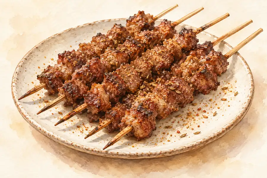 Ngari Roast Mutton 阿里烤羊肉AI illustration · AI 示意图(仅供参考,非实拍)
Ngari Roast Mutton (阿里烤羊肉) is listed among the local specialties of Ngari Prefecture, Tibet (Xizang). The name includes 羊肉 (lamb or mutton). 烤 describes roasting or grilling.
Read the dish guide → Yak Meat 牦牛肉AI illustration · AI 示意图(仅供参考,非实拍)
Yak Meat (牦牛肉) in Nyingchi (林芝) belongs to the food of the Kongpo (工布) area, Tibet.
Read the dish guide → Wind-Dried Meat 风干肉AI illustration · AI 示意图(仅供参考,非实拍)
Wind-Dried Meat (风干肉) in Lhasa (拉萨) is yak meat cut into strips and hung in a cold room for about a month in winter until it is fully dry.
Read the dish guide →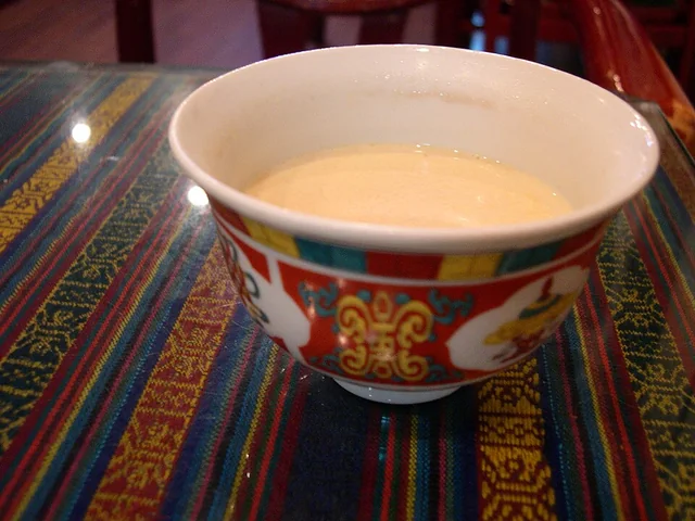 Butter tea 酥油茶
The flavor is savory, tea-bitter and rich, with a smooth fatty mouthfeel rather than the sweetness of commercial milk tea.
Source ↗Read the dish guide →
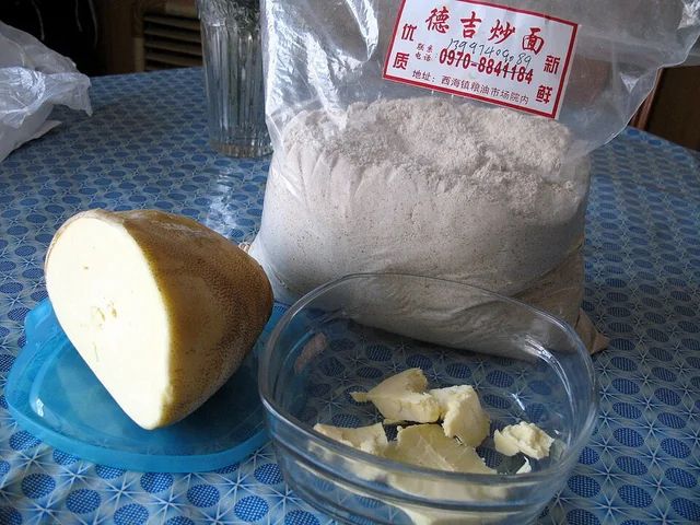 Tsampa 糌粑
The flavor is distinctly toasted and grainy, with richness from butter and a texture that changes with added liquid. It is substantial rather than a light powder garnish.
Source ↗Read the dish guide →
Photo adjustments
EXIF orientation applied where present; resized proportionally to at most 640 px on the long edge and encoded as WebP. No crop, retouching, recoloring or subject changes.
 Highland-barley flatbread 青稞饼AI illustration · AI 示意图
The bread has a rustic grain aroma, dense crumb and firmer crust. Added fat or sweetening can make individual versions quite different.
Source ↗Read the dish guide → Tibetan Yogurt 藏式酸奶
Tibetan Yogurt (藏式酸奶) is listed among the local specialties of Nyingchi, Tibet (Xizang). The name includes 酸奶 (cultured milk).
Read the dish guide →Photo adjustments
EXIF orientation normalized; resized without changing aspect ratio; converted to WebP. No subject edits.
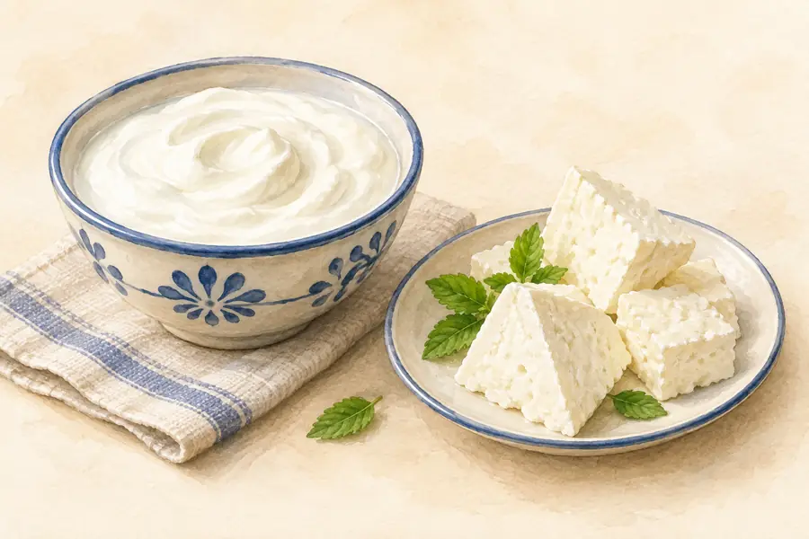 Dried Cheese Curds 奶渣AI illustration · AI 示意图(仅供参考,非实拍)
Dried Cheese Curds (奶渣) are the curds left from yak milk after butter has been churned out, dried into hard white pieces and eaten in Tibet as a snack and a seasoning.
Read the dish guide →More dishes from across Tibet (Xizang) are in the Tibet (Xizang) food guide.
Counties & districts in Ngari Prefecture
7 areas belong directly to Ngari Prefecture.
7 areas
Burang County 普兰县
(Tibetan: སྤུ་ཧྲེང་རྫོང; Chinese: 普兰县) is an administrative division of Ngari Prefecture in the Tibet Autonomous Region (TAR) of China. The county seat is Purang Town, known as Taklakot in Nepali.
Explore the area →CountyZanda County 札达县
Zanda County or Tsamda County (Tibetan: རྩ་མདའ་རྫོང, Chinese: 札达县) is a county in the Ngari Prefecture to the extreme west of the Tibet Autonomous Region of China.
Explore the area →CountyGar County 噶尔县
Gar County (Tibetan: སྒར་རྫོང་།; Chinese: 噶尔县), formerly Senge Tsangpo County, is a district (county) in the Ngari Prefecture of the western Tibet Autonomous Region of China.
Explore the area →CountyRutog County 日土县
Rutog County (Tibetan: རུ་ཐོག་རྫོང་།, Chinese: 日土县) is a county in Ngari Prefecture, Tibet Autonomous Region, China.
Explore the area →Show fewer areas
Gê'gyai County 革吉县
Gê'gyai County (Tibetan: དགེ་རྒྱས་རྫོང་།, Chinese: 革吉县) is a county in Ngari Prefecture of the Tibet Autonomous Region, China. 'Gê'gyai' is Tibetan for "full beauty".
Explore the area →CountyGêrzê County 改则县
Gertse County (Tibetan: སྒེར་རྩེ་རྫོང་།), Gêrzê County
Explore the area →CountyCoqên County 措勤县
Coqên County (Tibetan: མཚོ་ཆེན་རྫོང་།; Chinese: 措勤县) is a county in the Ngari Prefecture, in the west of the Tibet Autonomous Region of China. It is the located in the southeast of Ngari Prefecture.
Explore the area →No areas match this name.
Plan your visit
Getting there
Search for 阿里地区 in a map app to find stations and your accommodation.
Where to stay →Build your route
Pangong Lake Visitor Area and Rutog Rock Art Site are both listed here. The linked place guides have entrance and visit details.
Continue with Tibet (Xizang) →More in Tibet (Xizang)
Sources & geographic information
Administrative names and parent areas: Official geographic directory · Reference date 2026-09-06.
Background text adapted from Ngari Prefecture — Wikipedia contributors, under CC BY-SA 4.0. Text has been shortened and reorganized; source revision 1323639992.
Photo: Pangong Lake Visitor Area · Source photographer · License not provided. EXIF orientation normalized; resized without changing aspect ratio; converted to WebP. No subject edits.
Photo: Lake Manasarovar · Jean-Marie Hullot · CC BY-SA 4.0. Wikimedia thumbnail; fitted to the ranking-card frame.

Photo: Guge Kingdom Ruins · 李麓扬,上传Zhangmoon618 · CC BY-SA 3.0. Full frame retained; proportionally resized and converted to WebP. No retouching or changes to the photographed subject. Card displays may crop the view.

Photo: Tholing Monastery · Dieter Schuh · CC BY-SA 3.0. Full frame retained; proportionally resized and converted to WebP. No retouching or changes to the photographed subject. Card displays may crop the view.
_Dieter_Schuh.JPG)
Photo: Zanda Earth Forest Viewing Route · Source photographer · License not provided. EXIF orientation normalized; resized without changing aspect ratio; converted to WebP. No subject edits.
Photo: Piyang and Dongga Cave Temple Site · Source photographer · License not provided. EXIF orientation normalized; resized without changing aspect ratio; converted to WebP. No subject edits.
Map data © OpenStreetMap contributors. Pins mark approximate centres, not entrances or boundaries.