


Get to know Kuancheng Manchu Autonomous County
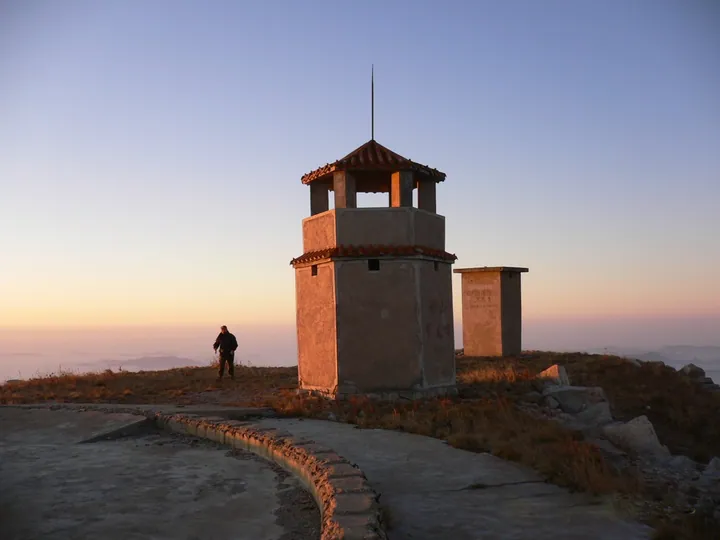
Photo adjustments
Full frame retained; proportionally resized and converted to WebP. No retouching or changes to the photographed subject. Card displays may crop the view.
- Administrative area
- Autonomous county · 自治县
- Part of
- Chengde
- Chinese name
- 宽城满族自治县
- Local areas
- Autonomous county guide
Area & population
- Area in the source
- 1,933.00 km²
- Population · 2020 census
- 240,579
- Administrative seat
- Kuancheng Town
Source: cited geographic source, as of the dates shown.
Setting and landscape
The whole county lies in the eastern Yan Mountains (燕山): the hills are packed close, the valleys narrow and the slopes steep. Winters and summers differ sharply, from a January mean of −9 °C to 23.9 °C in July, and summer brings hail and wind storms. The main stream of the Luan River crosses the west of the county, which is also home to Panjiakou Reservoir, a key reservoir of the scheme that carries Luan water to Tianjin. Farmers grow maize and sorghum, rice in the valley bottoms, and gather apricot kernels and tussah silk in the hills.
History
Under the Qing this was land beyond the passes where Han settlement was banned; farmers began moving in after 1911, but the stony soil could not feed many. The county was carved out of Chengde and Qinglong (青龙) counties in 1962 and became a Manchu autonomous county in 1989. On a CCTV programme, the county's Party secretary traced gold mining at Yuerya (峪耳崖) back to 1895, noting that Empress Dowager Cixi set up a state gold mine there in 1898.
What to see
When Panjiakou Reservoir filled, the Ming wall at Xifengkou (喜峰口) and Panjiakou near Panlong Lake (蟠龙湖) went under the surface. Seen from the hills, the wall runs down to the shore, continues underwater for one to two kilometres and climbs out on the far side. Xifengkou was a strategic pass of the Ming wall: Cao Cao (曹操) led an army out through it against the Wuhuan (乌桓), and in 1933 the 29th Army under Song Zheyuan (宋哲元) fought the Japanese here, a battle that inspired the composer Mai Xin (麦新) to write the "Big Sword March" (大刀进行曲).
Kuancheng beigan (宽城背杆), from North village in Kuancheng town, went on the national intangible heritage list in 2008. An adult carries an iron frame of about 27 kilograms on which costumed children perform scenes from opera; a strong carrier can hold three or four children, over 100 kilograms in all.
Food and local products
CCTV presents Kuancheng as a home of quality chestnuts, a geographical-indication product. The county's Party secretary put the number of chestnut trees over a century old at more than 100,000, including a pair of "husband and wife" trees that forestry experts date to 1303.
Highlights
- Underwater Great Wall 水下长城: Ming wall at Xifengkou and Panjiakou submerged by Panjiakou Reservoir, running one to two kilometres under water.
- Xifengkou 喜峰口: Ming pass where the 29th Army fought in 1933, the origin of the Big Sword March.
- Kuancheng beigan 宽城背杆: Children perform on iron frames carried by adults; national intangible heritage since 2008.
- Kuancheng chestnuts 宽城板栗: Geographical-indication chestnuts; a pair of trees is dated to 1303.
Sources for this guide
宽城满族自治县 - 维基百科,自由的百科全书 · Chinese Wikipedia · CC BY-SA 4.0
抬阁(芯子、铁枝、飘色)(宽城背杆) - 中国非物质文化遗产网·中国非物质文化遗产数字博物馆 · China Intangible Cultural Heritage Network (ihchina.cn)
《乡约河北宽城》节目文稿_三农_央视网 · CCTV (cntv.cn), Xiangyue programme transcript
Original English written from the listed sources and checked sentence by sentence against quoted extracts by a separate reviewer. Updated 2026-09-24.
Explore Kuancheng Manchu Autonomous County
Core places to explore, with English and Chinese names.
Places to explore around Kuancheng Manchu Autonomous County
 Panjiakou Reservoir Underwater Great Wall ·
 Plan your visit
Getting there
Kuancheng Manchu Autonomous County is about 60 km in a straight line from central Chengde. Search for 宽城满族自治县 in a map app to find stations and your accommodation.
Where to stay →Build your route
Start with Panjiakou Reservoir Underwater Great Wall. The linked place guides have entrance and visit details.
Continue with Chengde →More in Chengde
Sources & geographic information
Administrative names and parent areas: Official geographic directory · Reference date 2026-09-06.
Some facts checked against 宽城满族自治县 — Wikipedia contributors, CC BY-SA 4.0.
Photo: Panjiakou Reservoir Underwater Great Wall · Source photographer · License not provided. EXIF orientation normalized; resized without changing aspect ratio; converted to WebP. No subject edits.
Map data © OpenStreetMap contributors. Pins mark approximate centres, not entrances or boundaries.