


Get to know Ergun
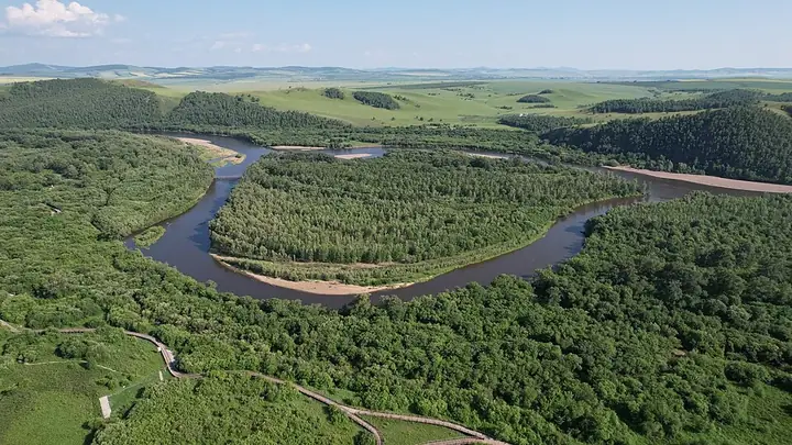
Photo adjustments
Full frame retained; resized proportionally to a maximum dimension of 960 pixels and converted to WebP quality 88. No crop, retouch, generated elements, or subject alteration. Final website rendition: full frame retained, proportionally resized to at most 720 pixels and converted to WebP. No additional retouching or subject alteration. Card displays may crop the view.
- Administrative area
- County-level city · 县级市
- Part of
- Hulunbuir
- Chinese name
- 额尔古纳市
- Local areas
- County-level city guide
Area & population
- Area in the source
- 28,400.00 km²
- Population · 2020
- 68,482
- Administrative seat
- Labdalin Subdistrict
Source: cited geographic source, as of the dates shown.
Setting and landscape
The Ergun River forms a border of 674.89 km with Russia, with national first-class ports at Heishantou (黑山头) and Shiwei (室韦). The Genhe Wetland (根河湿地), a national 4A scenic area near Labudalin (拉布大林), spreads over the floodplain and delta where the Gen (根河), Ergun, Derbugan (得尔布干河) and Hawur (哈乌尔河) rivers meet; the city government calls it "Asia's first wetland", and its known viewpoints include Horseshoe Island (马蹄岛) and the S-bend.
What to see
Mordaoga National Forest Park (莫尔道嘎国家森林公园), a national 4A area in the cold-temperate forest of the north, runs a 9.87 km sightseeing forest train past larch, Mongolian pine and birch woods, and 24 km into the park a site run by an Evenki (鄂温克) reindeer-herding group lets visitors meet its reindeer. Just upstream of the point where the Jiliu River (激流河) enters the Ergun inside the park, the water loops in an S between two long islets known as Canglang Bailu Island (苍狼白鹿岛). At Shiwei, boats run along the border river towards the China-Russia Friendship Bridge, with the Russian town of Olochi on the far bank.
The Mongol Origins Mengwu Shiwei scenic area (蒙兀室韦文化旅游景区) presents the history, archaeology and customs of the Mongols in forest and grassland. The city government describes Enhe (恩和) as China's only Russian ethnic township, says about 80% of its residents are ethnic Russians, and credits it with China's first Russian folk museum. Ten kilometres north-west of Heishantou town lie the earthen walls of the Heishantou ancient city (黑山头古城), a Liao-period site with inner and outer walls, gate enclosures and scattered glazed tiles; in the Mongol Empire the Ergun basin was the fief of Genghis Khan's brother Qasar (哈撒尔).
Food and local products
Ethnic Russian home cooking in Ergun includes borscht, blini, lieba bread (列巴), pickled cucumbers, smoked fish and kvass. The Sanhe horse (三河马), bred from Transbaikal horses brought from Russia crossed with Mongolian horses, is taller than the Mongolian horse and mostly bay or chestnut.
Highlights
- Genhe Wetland 根河湿地: 4A floodplain wetland where four rivers meet, with Horseshoe Island and the S-bend.
- Mordaoga National Forest Park 莫尔道嘎国家森林公园: Cold-temperate forest with a 9.87 km sightseeing train and an Evenki reindeer-herding site 24 km into the park.
- Enhe 恩和: Described by the city government as China's only Russian ethnic township, with the country's first Russian folk museum.
- Heishantou ancient city 黑山头古城: Liao-period earthen walled city 10 km north-west of Heishantou town.
- Sanhe horse 三河马: Breed from Transbaikal and Mongolian horses, mostly bay or chestnut.
Sources for this guide
市情概况 · Ergun City People's Government
根河湿地保护区 · Ergun City People's Government
俄罗斯族家庭传统经典菜式 · Ergun City People's Government
三河马 · Ergun City People's Government
莫尔道嘎国家森林公园 · Ergun City People's Government
蒙古之源·蒙兀室韦文化旅游景区 · Ergun City People's Government
恩和俄罗斯民族乡 · Ergun City People's Government
黑山头古城 · Ergun City People's Government
Original English written from the listed sources and checked sentence by sentence against quoted extracts by a separate reviewer. Updated 2026-09-25.
Explore Ergun
Core places to explore, with English and Chinese names.
Places to explore around Ergun
 Mordaoga National Forest Park entrance · 莫尔道嘎国家森林公园大门 Photograph date recorded by the source: 14 July 2025, 14:20:17.
Mordaoga National Forest Park莫尔道嘎国家森林公园
Mordaoga Forest Park introduces the larch and birch landscapes of the Greater Khingan Range. Hongdoupo, named for its northern lingonberries, shows the layered vegetation beneath the trees, while the Yimu Jiuling viewpoint opens…
Read the place guide →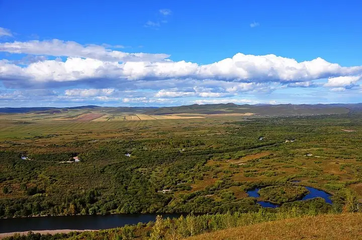 Matidao river bend in Ergun wetlands · 额尔古纳湿地马蹄岛河曲 Capture date not established by the retained file page.
Ergun wetlands额尔古纳湿地
Ergun's urban centre at Labudalin stands beside the broad Gen River wetland landscape. From the visitor overlook, winding channels divide grass, willow growth and wooded patches into a changing pattern. This close-to-town…
Read the place guide →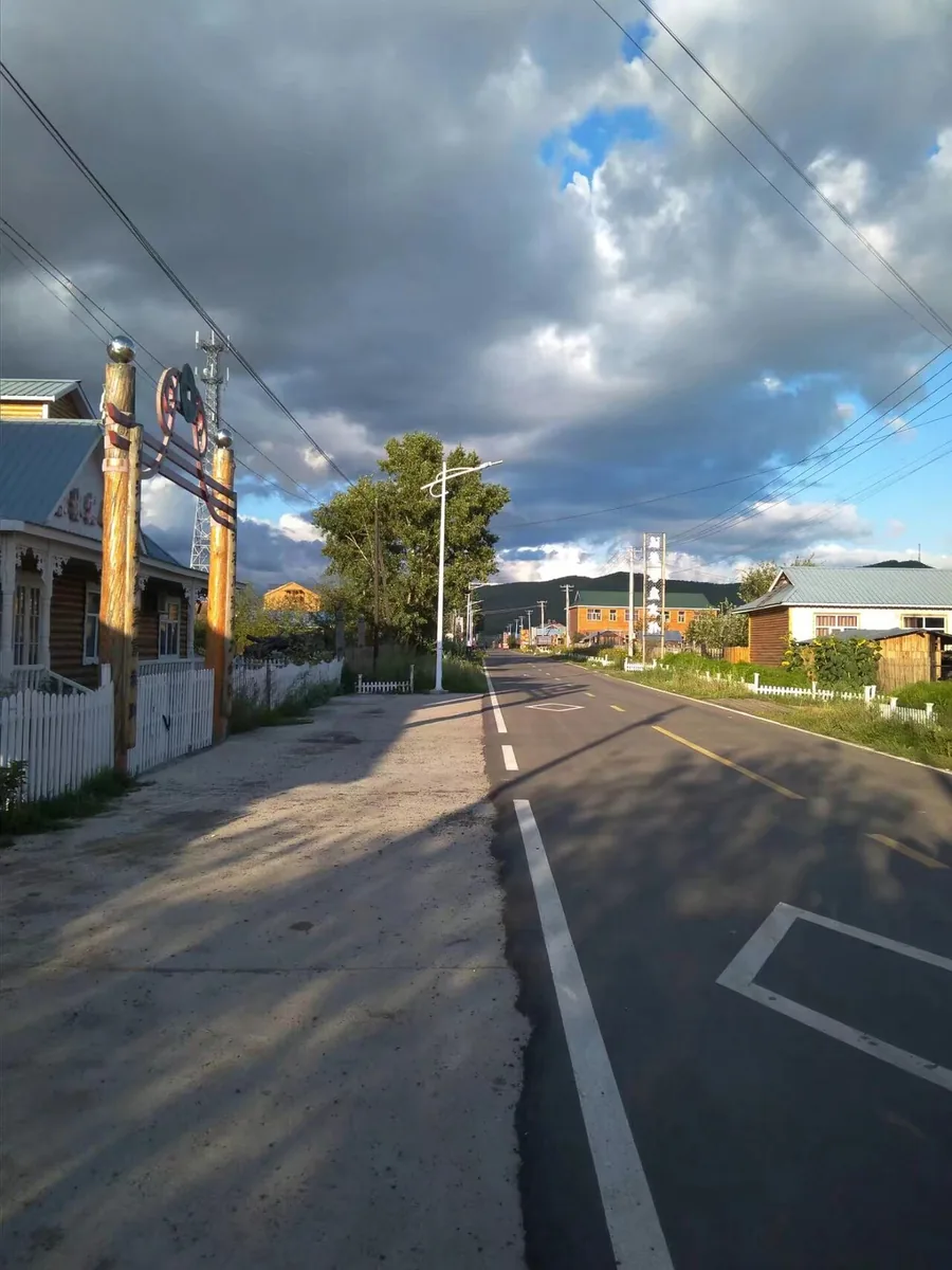 A street in Shiwei township, Inner Mongolia. Photographed on 27 August 2017.
Shiwei室韦
Shiwei faces the Russian village of Olochi across the Argun River. Russian-influenced buildings and the lively central square give the settlement a distinctive border-town appearance, but the most revealing view is along the…
Read the place guide →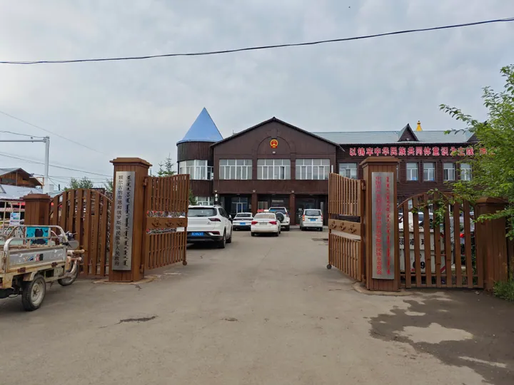 The government office building of Enhe Russian Ethnic Township, Ergun, with its log-cabin-style architecture · 额尔古纳市恩和俄罗斯族民族乡政府,木刻楞风格建筑 Source-recorded photograph date: 2025-07-15 15:17:20.
Enhe Russian Ethnic Township恩和俄罗斯族民族乡
China's only Russian ethnic township, on the Argun River border in Ergun, with log-house streets and families of mixed Chinese-Russian descent.
Read the place guide →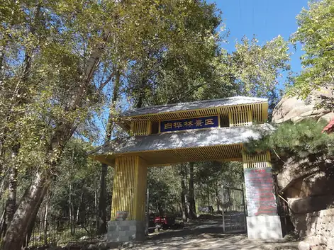 Ergun White Birch Forest Scenic Area · 白桦林景区
Ergun White Birch Forest Scenic Area白桦林景区
Ergun's White Birch Forest Scenic Area is a developed woodland attraction with wooden boardwalks, an elevated forest walk and fairy-tale-themed spaces among the birches.
Read the place guide →Plan your visit
Getting there
Ergun is about 120 km in a straight line from central Hulunbuir. Search for 额尔古纳市 in a map app to find stations and your accommodation.
Where to stay →Build your route
Mordaoga National Forest Park and Ergun wetlands are about 135 km apart in a straight line. The linked place guides have entrance and visit details.
Continue with Hulunbuir →More in Hulunbuir
Sources & geographic information
Administrative names and parent areas: Official geographic directory · Reference date 2026-09-06.
Photo: Mordaoga National Forest Park · Liuxingy · Liuxingy — 额尔古纳 莫尔道嘎国家森林公园大门.jpg — CC BY-SA 4.0 · CC BY-SA 4.0. The exact downloaded source bytes are separately retained and hashed. Prepared JPEG is proportionally reduced to a maximum 720-pixel long edge; full frame retained, no subject alteration. Final website rendition: full frame retained, proportionally resized to at most 720 pixels and converted to WebP. No additional retouching or subject alteration. Card displays may crop the view.

Photo: Ergun wetlands · 中国郑开亮 · CC BY-SA 3.0. The exact downloaded source bytes are separately retained and hashed. Prepared JPEG is proportionally reduced to a maximum 720-pixel long edge; full frame retained, no subject alteration. Final website rendition: full frame retained, proportionally resized to at most 720 pixels and converted to WebP. No additional retouching or subject alteration. Card displays may crop the view.

Photo: Shiwei · 西安兵马俑 · CC BY-SA 3.0. Proportionally resized and converted to WebP without cropping, retouching or changing the photographed subject.

Photo: Enhe Russian Ethnic Township · Liuxingy · CC BY-SA 4.0. Full frame retained; proportionally resized and converted to WebP. No retouching or changes to the photographed subject. Card displays may crop the view.

Photo: Ergun White Birch Forest Scenic Area · rheins · CC BY 3.0. EXIF orientation normalized; resized without changing aspect ratio; converted to WebP. No subject edits.

Map data © OpenStreetMap contributors. Pins mark approximate centres, not entrances or boundaries.