


Get to know Hongyuan County
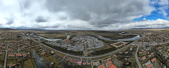
Photo adjustments
Full frame retained; proportionally resized and converted to WebP. No retouching or changes to the photographed subject. Card displays may crop the view.
- Administrative area
- County · 县
- Part of
- Ngawa Tibetan and Qiang Autonomous Prefecture
- Chinese name
- 红原县
- Local areas
- County guide
Area & population
- Area in the source
- 8,398.00 km²
- Population · 2020
- 46,644
- Administrative seat
- Kyungqu
Source: cited geographic source, as of the dates shown.
Flower meadows and wetlands
Emotang Flower Meadow (俄么塘花海) is one of the county’s principal grassland sights. Wildflowers spread across the grassland during the warmer part of the year; the Ngawa (阿坝州) prefecture government’s 2016 account describes a flowering season running from June into October. Hongyuan’s other named landscapes include Moon Bay (月亮湾) and the Riganqiao Wetland (日干乔湿地).
The plateau around Wache
Wache Town (瓦切镇), in the northwest of Hongyuan County, lies 42 kilometres from the county seat. Its terrain consists mainly of rolling plateau, with an average elevation above 3,500 metres and extensive natural pasture. Riganqiao’s marshes, the Wache Stupa Forest (瓦切塔林) and an Amdo pastoral-culture village are among the town’s sights. Livestock husbandry remains part of its local economy.
Sources for this guide
2016红原夏季旅游暨俄么塘花海景区推介会在蓉召开_阿坝藏族羌族自治州人民政府 · Ngawa Tibetan and Qiang Autonomous Prefecture Government
瓦切镇_红原县人民政府 · Hongyuan County Government
Original English written from the listed sources and checked sentence by sentence against quoted extracts by a separate reviewer. Updated 2026-09-26.
Explore Hongyuan County
Core places to explore, with English and Chinese names.
Places to explore around Hongyuan County
 AI illustration · AI 示意图(仅供参考,非该地点实拍)
Emetang Flower Sea俄么塘花海
Emetang Flower Sea is the flower-covered grassland of Ewotang, in Rangkou township, Hongyuan County, Aba prefecture, Sichuan, known to local Tibetan people as 'the garden of the sky god'.
Read the place guide →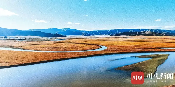 Hongyuan Moon Bay · 红原月亮湾
Hongyuan Moon Bay红原月亮湾
Hongyuan Yueliang Wan is an S-shaped bend of the Bai River, a tributary of the Yellow River, on the grassland 3 km from the county town of Hongyuan, Aba prefecture, Sichuan, named for its resemblance to a crescent moon.
Read the place guide →Plan your visit
Getting there
Hongyuan County is about 115 km in a straight line from central Ngawa Tibetan and Qiang Autonomous Prefecture. Search for 红原县 in a map app to find stations and your accommodation.
Where to stay →Build your route
Emetang Flower Sea and Hongyuan Moon Bay are both listed here. The linked place guides have entrance and visit details.
Continue with Ngawa Tibetan and Qiang Autonomous Prefecture →More in Ngawa Tibetan and Qiang Autonomous Prefecture
Sources & geographic information
Administrative names and parent areas: Official geographic directory · Reference date 2026-09-06.
Photo: Hongyuan Moon Bay · Source photographer · License not provided. EXIF orientation normalized; resized without changing aspect ratio; converted to WebP. No subject edits.
Map data © OpenStreetMap contributors. Pins mark approximate centres, not entrances or boundaries.