


Get to know Cangxi County
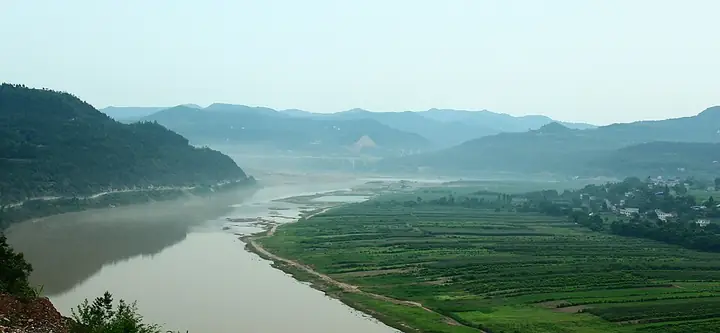
Photo adjustments
Full-frame source proportionally resized and converted to WebP for display. No subject alteration. Source-supplied marks and edits remain; cards may crop the view.
- Administrative area
- County · 县
- Part of
- Guangyuan
- Chinese name
- 苍溪县
- Local areas
- County guide
Area & population
- Area in the source
- 2,334.00 km²
- Population · 2020 census
- 512,617
- Administrative seat
- Lingjiang (陵江镇)
Source: cited geographic source, as of the dates shown.
Pear orchards in March
Pear blossom spreads from lower to higher elevations each March, including orchards around Yunfeng (云峰), Lingjiang (陵江), Yunshan (运山) and Longshan (龙山) towns. Cangxi Pear Culture Expo Garden (苍溪梨文化博览园), near the county seat, contains pear-culture displays and a rural farming-culture experience area. The Ministry of Culture and Tourism lists 42 pear varieties from around the world and 21 varieties of local fruit trees there.
Pears beyond the orchard
Cangxi snow pears (苍溪雪梨) are also processed into pear paste, canned fruit and juice. Local producers have developed pear wine and pear drink mixes. Other foods named by Cangxi County’s publicity department include pickled-vegetable, tofu and rice porridge (苍溪酸菜豆花稀饭), alongside banquets featuring food from the Jialing River.
Sources for this guide
县情概况-苍溪县人民政府 · Cangxi County Government
四川苍溪:“颜值”变产值 花经济助力文旅产业蓬勃发展-新华网 · Xinhua / Cangxi County Publicity Department
四川·广元“春约蜀道赏花”之旅 · Ministry of Culture and Tourism
Original English written from the listed sources and checked sentence by sentence against quoted extracts by a separate reviewer. Updated 2026-09-27.
Explore Cangxi County
Core places to explore, with English and Chinese names.
Cangxi County 苍溪县
Plan your visit
Getting there
Cangxi County is about 60 km in a straight line from central Guangyuan. Search for 苍溪县 in a map app to find stations and your accommodation.
Where to stay →More in Guangyuan
Sources & geographic information
Administrative names and parent areas: Official geographic directory · Reference date 2026-09-06.
Map data © OpenStreetMap contributors. Pins mark approximate centres, not entrances or boundaries.