


Get to know Wangcang County
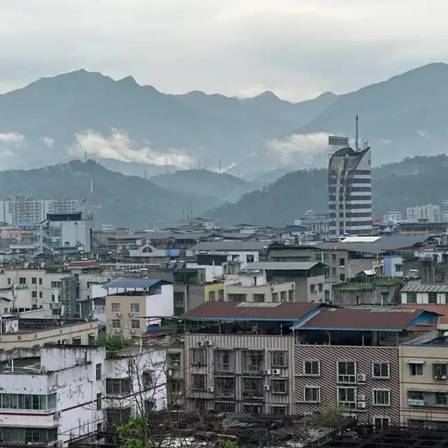
Photo adjustments
EXIF orientation normalized; resized without changing aspect ratio; converted to WebP. No subject edits.
- Administrative area
- County · 县
- Part of
- Guangyuan
- Chinese name
- 旺苍县
- Local areas
- County guide
Area & population
- Area in the source
- 2,976.00 km²
- Population · 2020 census
- 330,108
Source: cited geographic source, as of the dates shown.
Pools, waterfall and a narrow cleft
At Micang Mountain Grand Canyon, flowing water has hollowed the Qianlong Eighteen Pools (潜龙十八潭) into the rocky riverbed. Longtan Waterfall (龙潭飞瀑) has a drop of 125 metres. A passage called Yixiantian (一线天), or “a thread of sky”, runs between cliffs 300–500 metres high; its narrowest floor measures just half a metre across.
Rhododendrons above the gorge
In Yanjing River Grand Canyon, rhododendrons grow mainly in the forests of Guangtou Mountain (光头山) above 2,000 metres. The trees reach six or seven metres, with red, pink and white flowers. The Ministry of Culture and Tourism identifies mid-April to early May as the flowering period viewed from the boardwalk.
Sources for this guide
多图|旺苍4A级景区米仓山大峡谷今日开山迎客_四川在线 · Sichuan Online
四川·广元“春约蜀道赏花”之旅 · Ministry of Culture and Tourism
Original English written from the listed sources and checked sentence by sentence against quoted extracts by a separate reviewer. Updated 2026-09-27.
Explore Wangcang County
Core places to explore, with English and Chinese names.
Places to explore around Wangcang County
 AI illustration · AI
 Plan your visit
Getting there
Wangcang County is about 50 km in a straight line from central Guangyuan. Search for 旺苍县 in a map app to find stations and your accommodation.
Where to stay →Build your route
Start with Micangshan Grand Canyon. The linked place guides have entrance and visit details.
Continue with Guangyuan →More in Guangyuan
Sources & geographic information
Administrative names and parent areas: Official geographic directory · Reference date 2026-09-06.
Map data © OpenStreetMap contributors. Pins mark approximate centres, not entrances or boundaries.