


Get to know Chaotian District
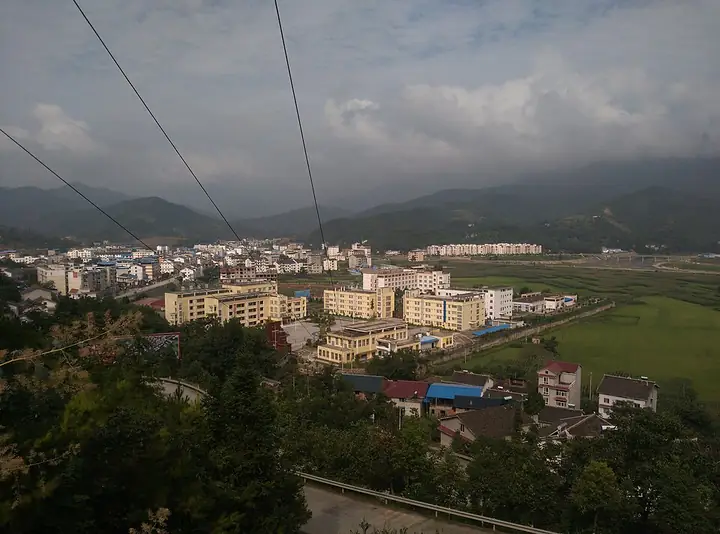
Photo adjustments
Full-frame source proportionally resized and converted to WebP for display. No subject alteration. Source-supplied marks and edits remain; cards may crop the view.
- Administrative area
- District · 市辖区
- Part of
- Guangyuan
- Chinese name
- 朝天区
- Local areas
- District guide
Area & population
- Area in the source
- 1,618.00 km²
- Population · 2022
- 210,000
- Administrative seat
- Chaotian Town (朝天镇)
Source: cited geographic source, as of the dates shown.
Routes through Mingyue Gorge
The gorge brings together six transport routes: an ancient plank road, the Jinniu post road (金牛驿道), the river waterway, a towpath, the Baoji–Chengdu railway (宝成铁路) and National Highway 108 (108国道). A restored section of plank road extends for two kilometres. The ancient plank-road remains received national key cultural-relic protection in 2006.
Caves and cherry trees
North of Chaotian’s urban area, Longmenge (龙门阁) includes Xuexi Cave (雪溪洞), stone-forest scenery and plank paths. The cave’s name comes from a poem by Lu You (陆游). Chaotian Cherry Valley (朝天樱花谷) contains five named gardens and combines fruiting cherry trees with ornamental flowering cherries. The Ministry of Culture and Tourism describes flower viewing and cherry picking there between late February and May.
Sources for this guide
走进四川广元朝天明月峡雪溪洞景区--专题集 · Chongqing Network Radio and Television / Xuexi Qiangguo Sichuan
四川·广元“春约蜀道赏花”之旅 · Ministry of Culture and Tourism
Original English written from the listed sources and checked sentence by sentence against quoted extracts by a separate reviewer. Updated 2026-09-27.
Explore Chaotian District
Core places to explore, with English and Chinese names.
Chaotian District 朝天区
Plan your visit
Getting there
Chaotian District is about 25 km in a straight line from central Guangyuan. Search for 朝天区 in a map app to find stations and your accommodation.
Where to stay →More in Guangyuan
Sources & geographic information
Administrative names and parent areas: Official geographic directory · Reference date 2026-09-06.
Map data © OpenStreetMap contributors. Pins mark approximate centres, not entrances or boundaries.