


Get to know Jiangjun District
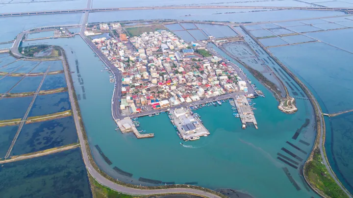
Photo adjustments
Full frame retained; proportionally resized and converted to WebP. No retouching or changes to the photographed subject. Card displays may crop the view.
- Administrative area
- District · 區
- Part of
- Tainan City
- Chinese name
- 將軍區
- Local areas
- District guide
Area & population
- Area in the source
- 42.00 km²
Source: cited geographic source, as of the dates shown.
A fan of channels and salt pans
Taiyen (台鹽) created the fields in 1977 by reclaiming land at the Qingkunshen sandbar and inland sea. Supply channels, drainage channels, brine channels and roads form the fan’s ribs, with salt pans between them. Crystallisation ponds were placed closest to the accommodation for convenient harvesting. Salt production ended in 2002, and the site now includes a large white Tree of Life (生命之樹) artwork.
Jiangjun Fishing Harbour
At Jiangjun Fishing Harbour (將軍漁港), boats unload catches beside a fish market. Visitors can buy seafood to take away or have it prepared by nearby restaurants that cook customers’ purchases. The harbour also provides the setting for the Jiangjun Hou (將軍吼) summer music festival.
Sources for this guide
青鯤鯓扇形鹽田(生命之樹)-台南旅遊網 · Tourism Bureau of Tainan City Government
將軍漁港-台南旅遊網 · Tourism Bureau of Tainan City Government
Original English written from the listed sources and checked sentence by sentence against quoted extracts by a separate reviewer. Updated 2026-09-27.
Explore Jiangjun District
Core places to explore, with English and Chinese names.
Jiangjun District 將軍區
Plan your visit
Getting there
Jiangjun District is about 25 km in a straight line from central Tainan City. Search for 將軍區 in a map app to find stations and your accommodation.
Where to stay →More in Tainan City
Sources & geographic information
Administrative names and parent areas: Official geographic directory · Reference date 2026-09-06.
Map data © OpenStreetMap contributors. Pins mark approximate centres, not entrances or boundaries.