


Get to know Longci District
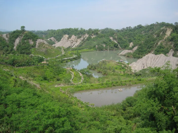
Photo adjustments
Full frame retained; proportionally resized and converted to WebP. No retouching or changes to the photographed subject. Card displays may crop the view.
- Administrative area
- District · 區
- Part of
- Tainan City
- Chinese name
- 龍崎區
- Local areas
- District guide
Area & population
- Area in the source
- 64.00 km²
Source: cited geographic source, as of the dates shown.
Niupu’s changing slopes
Niupu Pond (牛埔農塘) lies in the upper Erren River (二仁溪) catchment. Easily eroded ground has produced bare slopes among hills and valleys. Soil-conservation work introduced vegetation on exposed land, alongside trails and pavilions. A thatched cultural display building explains how the conservation park developed, while the planted site provides habitat for wildlife.
Bamboo and charcoal
The Bamboo Charcoal Story House (竹炭故事館) occupies the district’s former office building from the Japanese period. It introduces bamboo charcoal and related products, reflecting a shift from older bamboo weaving to new uses for the material. Nearby Huxingshan Park (虎形山公園) has wooded paths, deep-valley views and three suspension bridges.
Sources for this guide
龍崎竹炭生態之旅一日遊-台南旅遊網 · Tourism Bureau of Tainan City Government
Original English written from the listed sources and checked sentence by sentence against quoted extracts by a separate reviewer. Updated 2026-09-27.
Explore Longci District
Core places to explore, with English and Chinese names.
Longci District 龍崎區
Plan your visit
Getting there
Longci District is about 20 km in a straight line from central Tainan City. Search for 龍崎區 in a map app to find stations and your accommodation.
Where to stay →More in Tainan City
Sources & geographic information
Administrative names and parent areas: Official geographic directory · Reference date 2026-09-06.
Map data © OpenStreetMap contributors. Pins mark approximate centres, not entrances or boundaries.