


Get to know South District
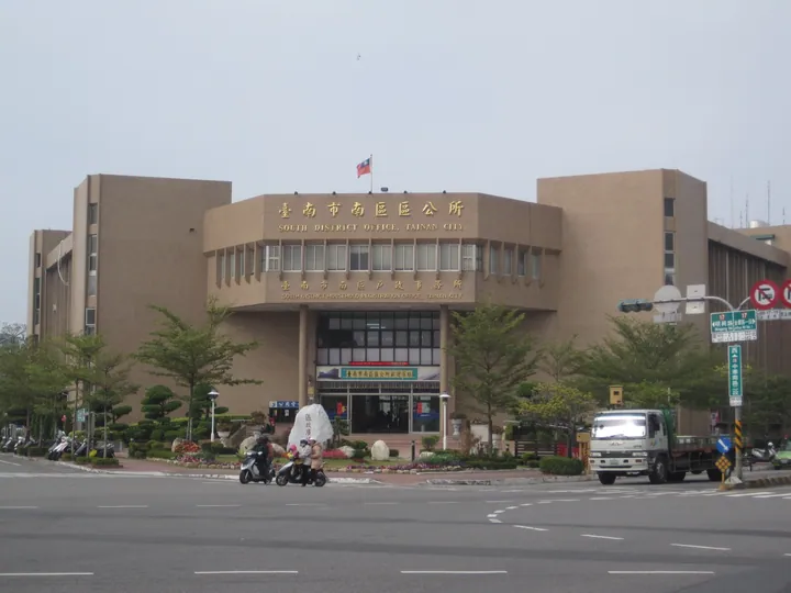
Photo adjustments
Full frame retained; proportionally resized and converted to WebP. No retouching or changes to the photographed subject. Card displays may crop the view.
- Administrative area
- District · 區
- Part of
- Tainan City
- Chinese name
- 南區
- Local areas
- District guide
Area & population
- Area in the source
- 27.27 km²
Source: cited geographic source, as of the dates shown.
Blueprint streets
The Blueprint park occupies former judicial dormitories. Its three-dimensional blueprint installation places white lines against blue walls, while murals and other artworks fill shared outdoor spaces. Small creative shops occupy the park’s buildings, giving the old residential area a new role.
Coast and community crafts
Kunxiwan includes Golden Coast (黃金海岸), Xishu Art Village (喜樹藝術聚落) and the Wanli shopping area (灣裡商圈). Near Kunshen’s (鯤鯓) sea-view footbridge, a timber boardwalk follows the seawall for walking and cycling. Beaches provide space for kite flying and seaside strolls. In Xishu, community grandmothers make lifelike fish-shaped pencil cases and bags modelled on vegetables.
Sources for this guide
藍晒圖文創園區-台南旅遊網 · Tourism Bureau of Tainan City Government
鯤喜灣文化園區-台南旅遊網 · Tourism Bureau of Tainan City Government
Original English written from the listed sources and checked sentence by sentence against quoted extracts by a separate reviewer. Updated 2026-09-27.
Explore South District
Core places to explore, with English and Chinese names.
South District 南區
Plan your visit
Getting there
South District is about 3 km in a straight line from central Tainan City. Search for 南區 in a map app to find stations and your accommodation.
Where to stay →More in Tainan City
Sources & geographic information
Administrative names and parent areas: Official geographic directory · Reference date 2026-09-06.
Map data © OpenStreetMap contributors. Pins mark approximate centres, not entrances or boundaries.