


Get to know Jeminay County
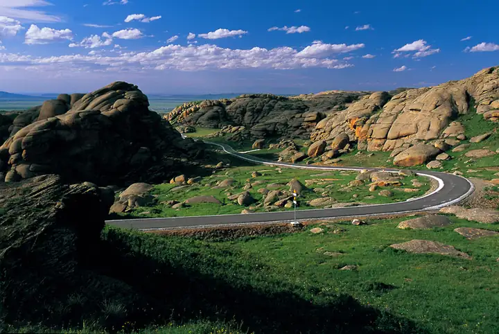
Photo adjustments
EXIF orientation normalized; resized without changing aspect ratio; converted to WebP. No subject edits.
- Administrative area
- County · 县
- Part of
- Altay Prefecture
- Chinese name
- 吉木乃县
- Local areas
- County guide
Area & population
- Area in the source
- 7,145.80 km²
- Population · 2020
- 34,336
- Administrative seat
- Topterek
Source: cited geographic source, as of the dates shown.
Granite in the grassland
Grassland Stone City covers about 270 square kilometres, including a fourteen-square-kilometre core. Rolling hills are scattered with unusually shaped granite outcrops. The county government attributes their forms to dissolution and wind erosion. Flowers spread across the grassland in June and July.
Mounds and channels
The Grand Canyon lies in the Kaerjiao (喀尔交) area, southeast of the county town. Its landscape consists of elongated earthen mounds alternating with hollows and channels. The county’s description notes changes in their colour through the day: golden in the morning, yellow at midday and red in the evening.
Sources for this guide
草原石城_吉木乃县人民政府门户网站 · Jeminay County Government
吉木乃大峡谷_吉木乃县人民政府门户网站 · Jeminay County Government
Original English written from the listed sources and checked sentence by sentence against quoted extracts by a separate reviewer. Updated 2026-09-27.
Explore Jeminay County
Core places to explore, with English and Chinese names.
Places to explore around Jeminay County
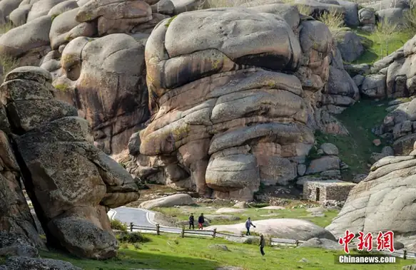 Grassland Stone City ·
 Plan your visit
Getting there
Jeminay County is about 175 km in a straight line from central Altay Prefecture. Search for 吉木乃县 in a map app to find stations and your accommodation.
Where to stay →Build your route
Start with Grassland Stone City. The linked place guides have entrance and visit details.
Continue with Altay Prefecture →More in Altay Prefecture
Sources & geographic information
Administrative names and parent areas: Official geographic directory · Reference date 2026-09-06.
Photo: Grassland Stone City · Source photographer · License not provided. EXIF orientation normalized; resized without changing aspect ratio; converted to WebP. No subject edits.
Map data © OpenStreetMap contributors. Pins mark approximate centres, not entrances or boundaries.