


Get to know Payzawat County
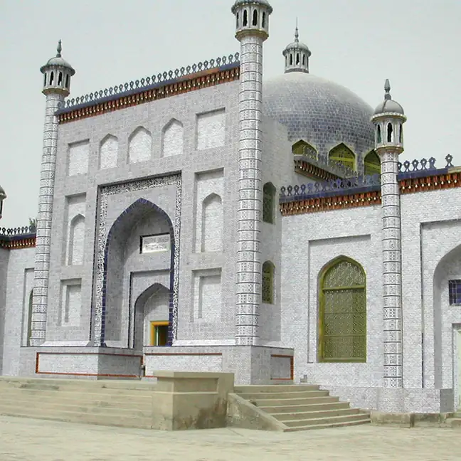
Photo adjustments
EXIF orientation normalized; resized without changing aspect ratio; converted to WebP. No subject edits.
- Administrative area
- County · 县
- Part of
- Kashgar Prefecture
- Chinese name
- 伽师县
- Local areas
- County guide
Area & population
- Area in the source
- 6,600.68 km²
- Population · 2020
- 424,821
- Administrative seat
- Barin
Source: cited geographic source, as of the dates shown.
Orchards and water landscapes
Xinmei Town (新梅小镇) in Yingmaili (英买里) centres on local prunes, with picking gardens, wooden walkways and a street displaying local cultural traditions. In Baren Town (巴仁镇), the Jiashi Forest Tourism Ecological Park (伽师森林旅游生态园) has fishing ponds, a lotus pond and a horse-racing ground among ornamental trees and fruit trees. Mulberries, grapes, figs, apricots, pears, apples and peaches are among its plantings.
Poplars and bread ovens
Chengzhong Poplar Ecological Park (城中胡杨林生态园) lies northwest of the county seat. A kilometre-long wooden walkway and an artificial lake accompany poplars, tamarisks and water channels. Jiashi Nang Culture Industrial Park (伽师馕文化产业园) combines cultural displays, production and sales, with bread-making activities for visitors.
Sources for this guide
文化旅游-伽师县人民政府 · Ministry of Agriculture and Rural Affairs, via Payzawat County Government
探秘魅力南疆,多彩伽师欢迎你! 佛山市人民政府门户网站 · Foshan News Network, via Foshan Government
Original English written from the listed sources and checked sentence by sentence against quoted extracts by a separate reviewer. Updated 2026-09-27.
Explore Payzawat County
Core places to explore, with English and Chinese names.
Payzawat County 伽师县
Plan your visit
Getting there
Payzawat County is about 60 km in a straight line from central Kashgar Prefecture. Search for 伽师县 in a map app to find stations and your accommodation.
Where to stay →More in Kashgar Prefecture
Sources & geographic information
Administrative names and parent areas: Official geographic directory · Reference date 2026-09-06.
Map data © OpenStreetMap contributors. Pins mark approximate centres, not entrances or boundaries.