


Get to know Shufu County
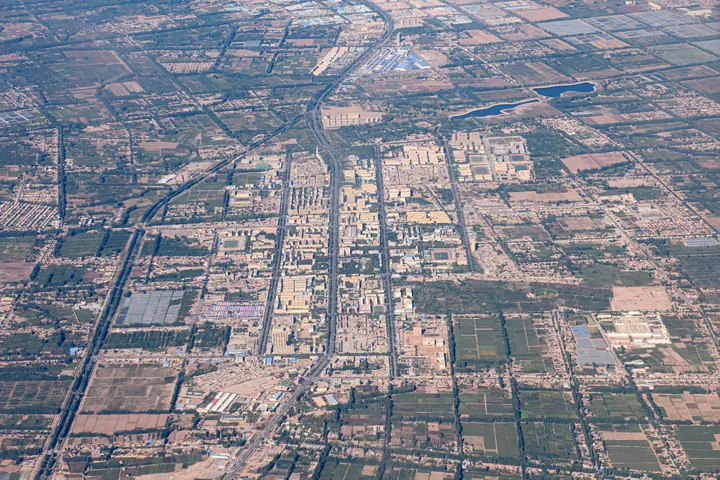
Photo adjustments
Full frame retained; proportionally resized and converted to WebP. No retouching or changes to the photographed subject. Card displays may crop the view.
- Administrative area
- County · 县
- Part of
- Kashgar Prefecture
- Chinese name
- 疏附县
- Local areas
- County guide
Area & population
- Population · 2020
- 263,014
- Administrative seat
- Tokkuzak
Source: cited geographic source, as of the dates shown.
Household workshops and music
Towank Wusake Village (托万克吾库萨克村), in Wusake Town (吾库萨克镇), lies seven kilometres from Kashgar’s urban area (喀什市区). Household workshops produce traditional instruments including the rawap (热瓦普), dutar (都塔尔) and ghijek (艾捷克). The village combines demonstrations of hand manufacture with opportunities to try instruments and hear traditional music performed by local artists. It also serves as a training base for instrument makers.
Springs beneath old willows
Maerjiangbulake is in Wupar Town (乌帕尔镇). Old willows surround bubbling springs, with reeds occupying the wetland. In July 2026, Shufu’s local news service documented boating, camping canopies and children’s recreation areas there. Its photographs also showed horse riding, while visitors described combining boat trips with barbecues.
Sources for this guide
中国新疆民族乐器村景区介绍 - 旅游 - 疏附县人民政府 · Shufu County Culture, Sports, Broadcasting and Tourism Bureau
藏在疏附的清凉秘境!麻尔江布拉克景区成夏日避暑首选 - 乡镇动态 - 疏附县人民政府 · Shufu Zero Distance, via Shufu County Government
Original English written from the listed sources and checked sentence by sentence against quoted extracts by a separate reviewer. Updated 2026-09-27.
Explore Shufu County
Core places to explore, with English and Chinese names.
Shufu County 疏附县
Plan your visit
Getting there
Shufu County is about 20 km in a straight line from central Kashgar Prefecture. Search for 疏附县 in a map app to find stations and your accommodation.
Where to stay →More in Kashgar Prefecture
Sources & geographic information
Administrative names and parent areas: Official geographic directory · Reference date 2026-09-06.
Map data © OpenStreetMap contributors. Pins mark approximate centres, not entrances or boundaries.