


Get to know Yopurga County
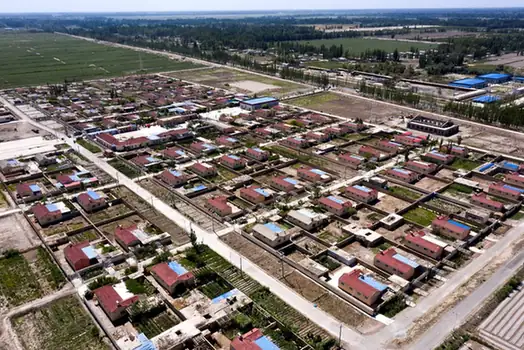
Photo adjustments
EXIF orientation normalized; resized without changing aspect ratio; converted to WebP. No subject edits.
- Administrative area
- County · 县
- Part of
- Kashgar Prefecture
- Chinese name
- 岳普湖县
- Local areas
- County guide
Area & population
- Area in the source
- 3,128.09 km²
- Population · 2020
- 162,675
- Administrative seat
- Yopurga
Source: cited geographic source, as of the dates shown.
A broad canopy and exposed roots
The Willow King (柳树王) has interlacing branches and exposed, twisting roots. The county government gives its height as twenty metres, with a canopy stretching thirty-five metres east to west and thirty metres north to south. It associates the tree’s growth with water from snowy mountains.
Separate plots for fruit growing
The Yopurga Rural Complex (岳普湖县田园综合体) is in Village Three (3村) of Yopurga Town (岳普湖镇), where urban and rural land meet. Its fruit-growing plots support production, agricultural sightseeing and picking activities. Planted crops include figs, grapes, prunes, pomegranates and apples. The project also combines farming-culture experiences, local customs and cultural displays, with its influence extending into several surrounding villages.
Sources for this guide
柳树王景区简介 - 岳普湖旅游 - 岳普湖县人民政府 · Yopurga County Government
岳普湖县田园综合体 - 岳普湖旅游 - 岳普湖县人民政府 · Yopurga County Government
Original English written from the listed sources and checked sentence by sentence against quoted extracts by a separate reviewer. Updated 2026-09-27.
Explore Yopurga County
Core places to explore, with English and Chinese names.
Yopurga County 岳普湖县
Plan your visit
Getting there
Yopurga County is about 70 km in a straight line from central Kashgar Prefecture. Search for 岳普湖县 in a map app to find stations and your accommodation.
Where to stay →More in Kashgar Prefecture
Sources & geographic information
Administrative names and parent areas: Official geographic directory · Reference date 2026-09-06.
Map data © OpenStreetMap contributors. Pins mark approximate centres, not entrances or boundaries.