


Get to know Yanshan County
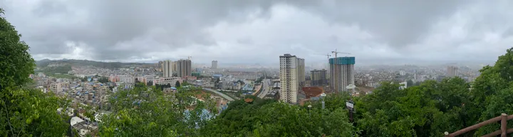
Photo adjustments
Full frame retained; proportionally resized and converted to WebP. No retouching or changes to the photographed subject. Card displays may crop the view.
- Administrative area
- County · 县
- Part of
- Wenshan Zhuang and Miao Autonomous Prefecture
- Chinese name
- 砚山县
- Local areas
- County guide
Area & population
- Area in the source
- 3,888.00 km²
- Population · 2020 census
- 476,587
Source: cited geographic source, as of the dates shown.
Towns and neighbours
The county adjoins Wenshan City (文山市) and Xichou (西畴) to the south, Qiubei (丘北) to the north, and Kaiyuan (开远) and Mengzi (蒙自) to the west. Jiangna (江那), Pingyuan (平远), Jiayi (稼依) and Ameng (阿猛) are its four towns. Its agriculture includes grain and beans, sugarcane, tobacco, fruit and oil-tea seeds. The county covers 3,822 square kilometres.
Traces of painting and pottery
The former Kaiwen Reclamation Bureau site (开文垦殖局旧址), Dashan Village rock art in Pingyuan (平远大山村岩画), Yanshan Yaoshang Dragon Kiln site (砚山窑上龙窑址) and Kazi rock art (卡子岩画) entered the prefectural list of protected cultural sites in 2021.
Sources for this guide
云南省人民政府驻上海办事处 · Yunnan Provincial Government Shanghai Office
魅力砚山 - 砚山县人民政府 · Yanshan County Government
Original English written from the listed sources and checked sentence by sentence against quoted extracts by a separate reviewer. Updated 2026-09-30.
Explore Yanshan County
Core places to explore, with English and Chinese names.
Yanshan County 砚山县
Plan your visit
Getting there
Yanshan County is about 25 km in a straight line from central Wenshan Zhuang and Miao Autonomous Prefecture. Search for 砚山县 in a map app to find stations and your accommodation.
Where to stay →More in Wenshan Zhuang and Miao Autonomous Prefecture
Sources & geographic information
Administrative names and parent areas: Official geographic directory · Reference date 2026-09-06.
Map data © OpenStreetMap contributors. Pins mark approximate centres, not entrances or boundaries.