


Get to know Wenshan Zhuang and Miao Autonomous Prefecture
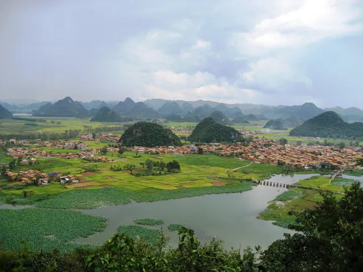
Photo adjustments
Full frame retained; proportionally resized and converted to WebP. No retouching or changes to the photographed subject. Card displays may crop the view.
- Administrative area
- Autonomous prefecture · 自治州
- Part of
- Yunnan
- Chinese name
- 文山壮族苗族自治州
- Local areas
- 8 local areas
Area & population
- Area in the source
- 31,409.12 km²
- Population · 2010
- 3,517,946
- Administrative seat
- Wenshan
Source: cited geographic source, as of the dates shown.
Explore Wenshan Zhuang and Miao Autonomous Prefecture
Core places to explore, with English and Chinese names.
Places to explore around Wenshan Zhuang and Miao Autonomous Prefecture
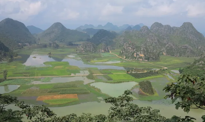 Karst peaks and wetland fields at Puzhehei, Qiubei County, Wenshan · 云南文山州丘北县普者黑的喀斯特峰林与湿地田园 Source-recorded photograph date: Taken on 5 August 2014.
Puzhehei普者黑
Puzhehei is a landscape of connected lakes, limestone hills and villages in Qiubei. Qinglong Hill provides an elevated perspective over the water and surrounding peaks, while the lakeside settlements of Puzhehei and Xianrendong…
Read the place guide → Bamei village in its karst valley, Guangnan County · 广南县坝美村,喀斯特山谷中的村落 Source-recorded photograph date: Taken on 10 March 2014.
Bamei Village坝美
Zhuang village in Guangnan, Yunnan, set in a karst basin reached by boat through two water caves and likened to the Peach Blossom Spring.
Read the place guide → AI illustration · AI 示意图(仅供参考,非该地点实拍)
Babao Scenic Area八宝
Babao (八宝) is a karst river-and-farmland landscape centred on Babao town, Guangnan County, Yunnan, partly protected as a provincial nature reserve.
Read the place guide →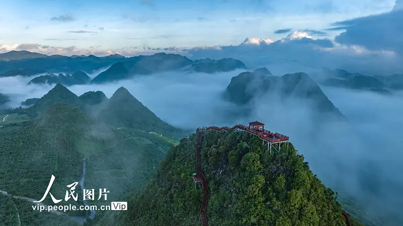 Xichou National Stone Desert Park · 西畴国家石漠公园
Xichou National Stone Desert Park西畴国家石漠公园
Xichou National Stone Desert Park (西畴国家石漠公园) is a national-level park in Xingjie township, Xichou County, Yunnan, approved in 2019 as part of a national programme addressing rocky desertification.
Read the place guide → AI illustration · AI 示意图(仅供参考,非该地点实拍)
Laoshan Patriotic Education Base老山爱国主义教育基地
The Laoshan Patriotic Education Base combines Malipo Martyrs Cemetery near the Malipo county seat and Laoshan mountain itself on the China-Vietnam border, in Malipo County, Yunnan.
Read the place guide →Local life & food
Wenshan Zhuang and Miao Autonomous Prefecture local specialties
文山壮族苗族自治州特色美食 · 10 specialties to discover
 Wenshan Rice Noodles 文山米线Reference photo of a similar dish · 同类菜品参考照片
Wenshan Rice Noodles (文山米线) are made from locally grown rice in Wenshan Zhuang and Miao Autonomous Prefecture (文山壮族苗族自治州), Yunnan.
Read the dish guide →
Photo adjustments
Full frame retained; EXIF orientation normalized, proportionally resized to at most 800 pixels and converted to WebP. No generated pixels or subject changes. Cards may crop the display.
 Notoginseng Steam-Pot Chicken 三七汽锅鸡
Notoginseng Steam-Pot Chicken (三七汽锅鸡) is Yunnan's steam-pot chicken (汽锅鸡) cooked with the roots of notoginseng (三七), the medicinal plant for which Wenshan Zhuang and Miao Autonomous Prefecture (文山壮族苗族自治州) is known.
Read the dish guide →Photo adjustments
EXIF orientation normalized; resized without changing aspect ratio; converted to WebP. No subject edits.
 Qiubei Stir-Fried Pork with Chili 丘北辣椒炒肉AI illustration · AI 示意图(仅供参考,非实拍)
Qiubei Stir-Fried Pork with Chili (丘北辣椒炒肉) is listed among the local specialties of Wenshan Zhuang and Miao Autonomous Prefecture, Yunnan. 炒 describes stir-frying.
Read the dish guide → Guangnan Bahang Sour Soup Chicken 广南岜夯鸡AI illustration · AI 示意图(仅供参考,非实拍)
Guangnan Bahang Sour Soup Chicken (广南岜夯鸡) is a traditional dish of the Zhuang communities of Guangnan (广南). Its name refers to bahang (岜夯), the Zhuang term for sour soup.
Read the dish guide → Yanshan Pepper-Salt Flatbread 砚山椒盐饼AI illustration · AI 示意图(仅供参考,非实拍)
Yanshan Pepper-Salt Flatbread (砚山椒盐饼) is listed among the local specialties of Wenshan Zhuang and Miao Autonomous Prefecture, Yunnan. The term 饼 points to cakes or flatbreads. 椒盐 describes pepper-and-salt seasoning.
Read the dish guide →Funing Star Anise Chicken 富宁八角鸡AI illustration · AI 示意图(仅供参考,非实拍)
Funing Star Anise Chicken (富宁八角鸡) is listed among the local specialties of Wenshan Zhuang and Miao Autonomous Prefecture, Yunnan. The name includes 鸡 (chicken).
Read the dish guide → Malipo Zhuang Multicolored Rice 麻栗坡壮族花米饭AI illustration · AI 示意图(仅供参考,非实拍)
Malipo Zhuang Multicolored Rice (麻栗坡壮族花米饭) is listed among the local specialties of Wenshan Zhuang and Miao Autonomous Prefecture, Yunnan. It is grouped here with rice & congee; retain the complete Chinese name when comparing local menus.
Read the dish guide →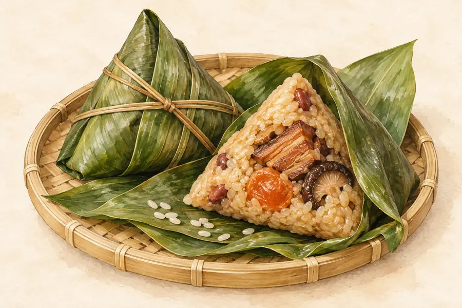 Xichou Zhuang Leaf-Wrapped Rice Parcels 西畴壮家粽粑AI illustration · AI 示意图(仅供参考,非实拍)
Xichou Zhuang Leaf-Wrapped Rice Parcels (西畴壮家粽粑) is listed among the local specialties of Wenshan Zhuang and Miao Autonomous Prefecture, Yunnan. The term 粽 points to leaf-wrapped rice parcels.
Read the dish guide →All dish names · 全部菜名 (10)
- Wenshan Rice Noodles · 文山米线
- Notoginseng Steam-Pot Chicken · 三七汽锅鸡
- Qiubei Stir-Fried Pork with Chili · 丘北辣椒炒肉
- Guangnan Bahang Sour Soup Chicken · 广南岜夯鸡
- Yanshan Pepper-Salt Flatbread · 砚山椒盐饼
- Funing Star Anise Chicken · 富宁八角鸡
- Malipo Zhuang Multicolored Rice · 麻栗坡壮族花米饭
- Xichou Zhuang Leaf-Wrapped Rice Parcels · 西畴壮家粽粑
- Maguan Multicolored Rice · 马关花米饭
- Notoginseng Stewed Chicken · 三七炖鸡
More dishes from across Yunnan are in the Yunnan food guide.
Counties & districts in Wenshan Zhuang and Miao Autonomous Prefecture
8 areas belong directly to Wenshan Zhuang and Miao Autonomous Prefecture.
8 areas
Wenshan 文山市
Wenshan, old name Kaihua, is a city in and the seat of Wenshan Zhuang and Miao Autonomous Prefecture, in the southeast of Yunnan province, People's Republic of China.
Explore the area →CountyYanshan County 砚山县
Yanshan County (simplified Chinese: 砚山县; traditional Chinese: 硯山縣; pinyin: Yànshān Xiàn; Zhuang: Yensanh Yen) is under the administration of the Wenshan Zhuang and Miao Autonomous Prefecture, in the southeast…
Explore the area →CountyXichou County 西畴县
Xichou County (simplified Chinese: 西畴县; traditional Chinese: 西疇縣; pinyin: Xīchóu Xiàn) is under the administration of the Wenshan Zhuang and Miao Autonomous Prefecture, in the southeast of Yunnan province…
Explore the area →CountyMalipo County 麻栗坡县
Malipo County is under the administration of the Wenshan Zhuang and Miao Autonomous Prefecture, in the southeast of Yunnan province, China, bordering Tuyên Quang province to the southeast.
Explore the area →Show fewer areas
Maguan County 马关县
Maguan County (simplified Chinese: 马关县; traditional Chinese: 馬關縣; pinyin: Mǎguān Xiàn; lit. 'horse pass', Vietnamese: Mã Quan) is located in Wenshan Zhuang and Miao Autonomous Prefecture, Yunnan province…
Explore the area →CountyQiubei County 丘北县
Qiubei County is under the administration of the Wenshan Zhuang and Miao Autonomous Prefecture, in southeast Yunnan province, China.
Explore the area →CountyGuangnan County 广南县
Guangnan County (simplified Chinese: 广南县; traditional Chinese: 廣南縣; pinyin: Guǎngnán Xiàn; Zhuang: Gvangjnanz Yen) is located in Wenshan Zhuang and Miao Autonomous Prefecture, Yunnan province, China.
Explore the area →CountyFuning County 富宁县
Funing County (simplified Chinese: 富宁县; traditional Chinese: 富寧縣; pinyin: Fùníng Xiàn; Zhuang language: Funingz Yen) is located in Wenshan Zhuang and Miao Autonomous Prefecture, in the southeast of Yunnan…
Explore the area →No areas match this name.
Plan your visit
Getting there
Search for 文山壮族苗族自治州 in a map app to find stations and your accommodation.
Where to stay →Build your route
Puzhehei and Bamei Village are both listed here. The linked place guides have entrance and visit details.
Continue with Yunnan →More in Yunnan
Sources & geographic information
Administrative names and parent areas: Official geographic directory · Reference date 2026-09-06.
Background text adapted from Wenshan Zhuang and Miao Autonomous Prefecture — Wikipedia contributors, under CC BY-SA 4.0. Text has been shortened and reorganized; source revision 1355985809.
Photo: Puzhehei · Nyx Ning · CC BY-SA 3.0. Full frame retained; proportionally resized and converted to WebP. No retouching or changes to the photographed subject. Card displays may crop the view.

Photo: Bamei Village · Anders Johnson · CC BY 3.0. Full frame retained; proportionally resized and converted to WebP. No retouching or changes to the photographed subject. Card displays may crop the view.
.jpg)
Photo: Xichou National Stone Desert Park · Source photographer · License not provided. EXIF orientation normalized; resized without changing aspect ratio; converted to WebP. No subject edits.
Map data © OpenStreetMap contributors. Pins mark approximate centres, not entrances or boundaries.