


Get to know Baishan
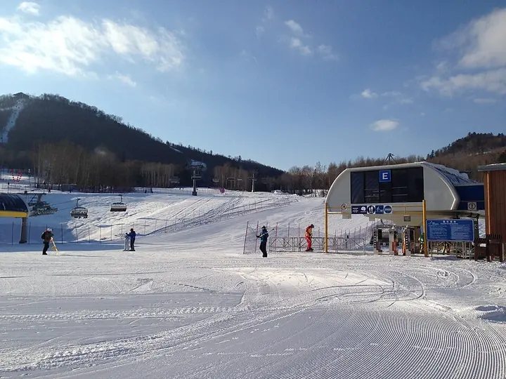
Photo adjustments
Full frame retained; proportionally resized and converted to WebP. No retouching or changes to the photographed subject. Card displays may crop the view.
- Administrative area
- Prefecture-level city · 地级市
- Part of
- Jilin
- Chinese name
- 白山市
- Local areas
- 6 local areas
Area & population
- Area in the source
- 17,485.00 km²
- Population · 2010
- 1,296,575
- Administrative seat
- Hunjiang District
Source: cited geographic source, as of the dates shown.
Baishan is to be granted the title of China International Mineral Water City. In Baishan is the Baishan Dam.
Explore Baishan
Core places to explore, with English and Chinese names.
Changbai Mountain West Slope 长白山西坡
Laotudingzi Peak 老秃顶子
Jinjiang Log-House Village 锦江木屋村
Changbaishan Wanda International Resort 长白山万达国际度假区
Wangtian’e Scenic Area 望天鹅
Changbai Port Riverfront 长白口岸江畔
Hunjiang District 浑江区
Jiangyuan District 江源区
Fusong County 抚松县
Jingyu County 靖宇县
Changbai Korean Autonomous County 长白朝鲜族自治县
Linjiang 临江市
Places to explore around Baishan
 Tianchi (Heaven Lake) crater lake seen from the west slope of Changbai Mountain · 长白山西坡远眺天池 Source-recorded photograph date: 2017-08-24 12:38:29.
Changbai Mountain West Slope长白山西坡
Changbai Mountain's western route offers a broad view into Tianchi together with forest and volcanic landforms lower down. The ascent from the upper transport stop involves a substantial staircase, making mobility an important…
Read the place guide → Laotudingzi Peak · 老秃顶子
Laotudingzi Peak老秃顶子
Laotudingzi in Linjiang is a 1,438-metre peak with a grassy summit and scattered rock formations within Huashan National Forest Park.
Read the place guide →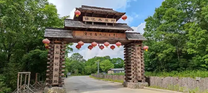 Jinjiang Log-House Village · 锦江木屋村
Jinjiang Log-House Village锦江木屋村
Jinjiang Log-House Village is a settlement in Manjiang Town, Fusong County, associated with traditional Manchu timber houses.
Read the place guide → AI illustration · AI 示意图(仅供参考,非该地点实拍)
Changbaishan Wanda International Resort长白山万达国际度假区
Changbaishan Wanda International Resort is a mountain holiday complex in the Songjianghe area of Fusong County, combining skiing, a resort village and forest recreation.
Read the place guide →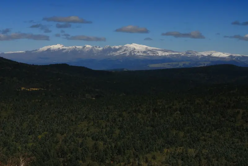 Wangtian’e Scenic Area · 望天鹅
Wangtian’e Scenic Area望天鹅
Wangtian’e is a volcanic landscape in Changbai Korean Autonomous County, known for rock formations and waterfalls along the Shisidaogou valley.
Read the place guide →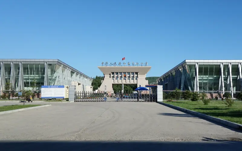 Changbai Port Riverfront · 长白口岸江畔
Changbai Port Riverfront长白口岸江畔
The waterfront by Changbai Port overlooks the Yalu River toward Hyesan, linking the border town's river views with its Korean cultural setting.
Read the place guide →Local life & food
Baishan local specialties
白山市特色美食 · 8 specialties to discover
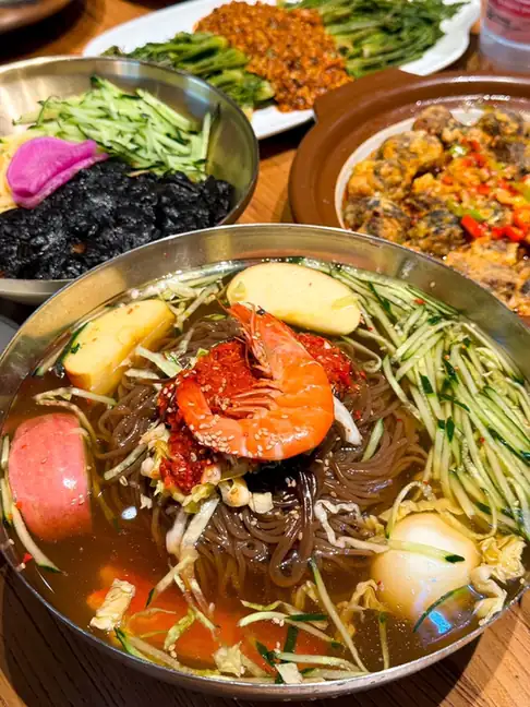 Korean-Style Cold Noodles 朝鲜族冷面
Korean-Style Cold Noodles (朝鲜族冷面) are the cold noodles of Jilin's ethnic Korean community, a cold staple eaten in broth.
Read the dish guide →Photo adjustments
EXIF orientation normalized; resized without changing aspect ratio; converted to WebP. No subject edits.
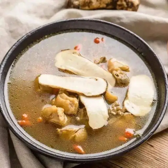 Chicken Stewed with Matsutake 松茸炖鸡
Chicken Stewed with Matsutake (松茸炖鸡) is listed among the local specialties of Baishan, Jilin. The name includes 鸡 (chicken), 松茸 (matsutake mushrooms). 炖 describes slow simmering.
Read the dish guide →Photo adjustments
EXIF orientation normalized; resized without changing aspect ratio; converted to WebP. No subject edits.
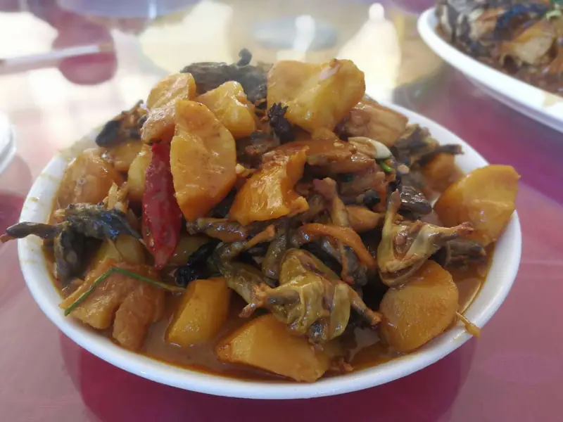 Forest Frog Stewed with Potatoes 林蛙炖土豆
Forest Frog Stewed with Potatoes (林蛙炖土豆) is a stew of forest frogs and potato chunks braised in Northeast yellow soybean paste.
Read the dish guide →Photo adjustments
EXIF orientation normalized; resized without changing aspect ratio; converted to WebP. No subject edits.
 Ginseng Chicken 人参鸡
Ginseng Chicken (人参鸡) is listed among the local specialties of Baishan, Jilin. The name includes 鸡 (chicken).
Read the dish guide →
Photo adjustments
EXIF orientation normalized; resized without changing aspect ratio; converted to WebP. No subject edits.
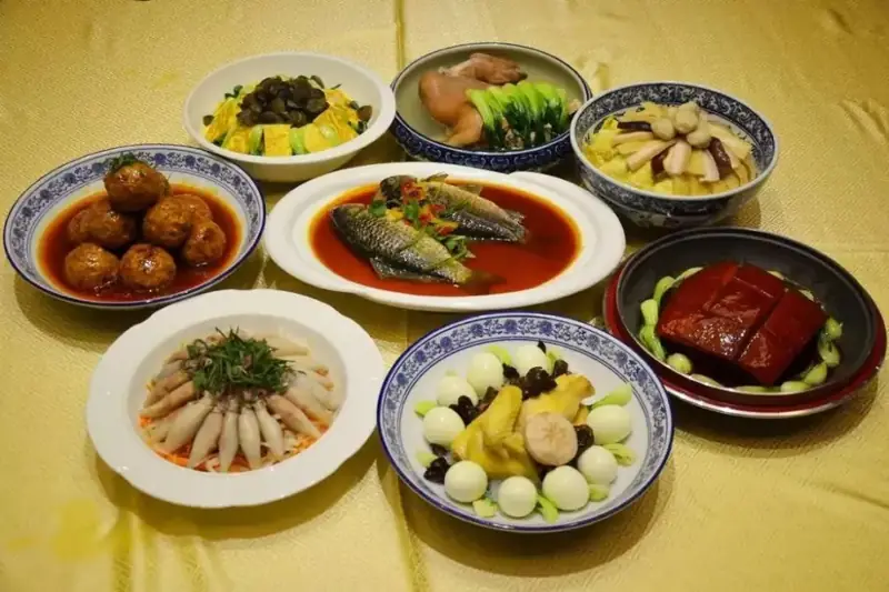 Changbai Mountain Delicacies Banquet 长白山珍宴
Changbai Mountain Delicacies Banquet (长白山珍宴) is a set banquet made from the produce of Changbai Mountain (长白山), served in Baishan (白山), Jilin.
Read the dish guide →Photo adjustments
EXIF orientation normalized; resized without changing aspect ratio; converted to WebP. No subject edits.
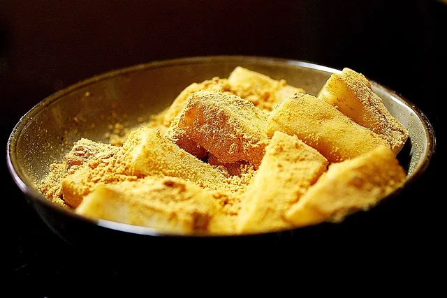 Pounded rice cake 打糕
The cake is dense, stretchy and gently grain-sweet; the coating adds a dry, nutty contrast. It firms as it cools and ages.
Source ↗Read the dish guide →_(rice_cake).jpg)
Photo adjustments
EXIF orientation applied where present; resized proportionally to at most 640 px on the long edge and encoded as WebP. No crop, retouching, recoloring or subject changes.
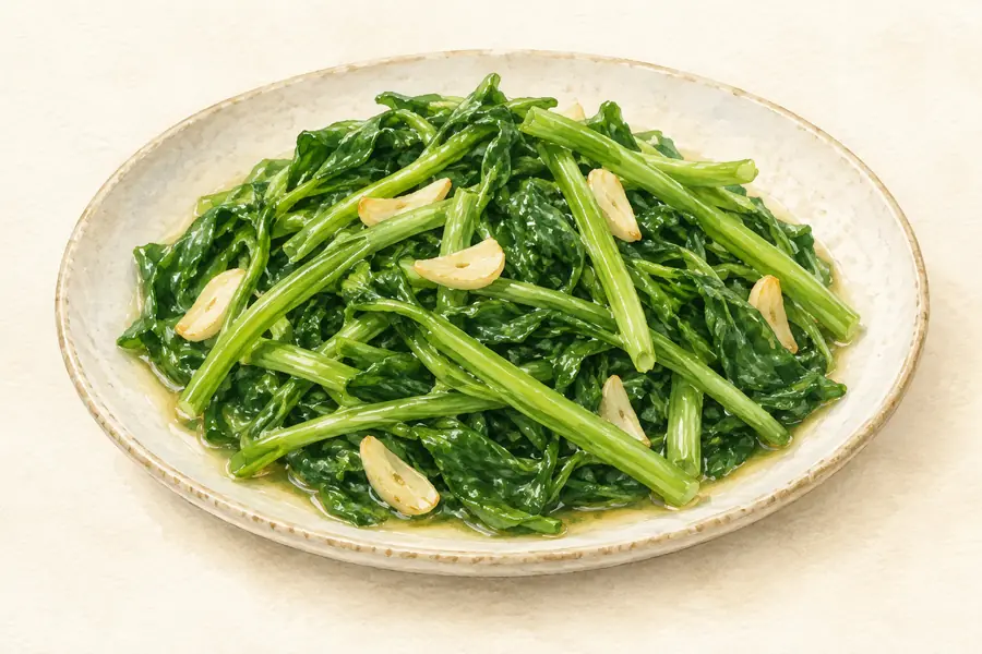 Wild Mountain Vegetables 山野菜AI illustration · AI 示意图(仅供参考,非实拍)
Wild Mountain Vegetables (山野菜) are spring foods in Baishan (白山), with mid-April a busy gathering and selling period.
Read the dish guide →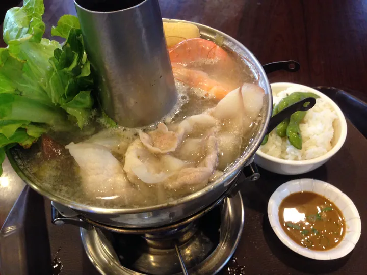 Pickled Cabbage with Pork Belly 酸菜白肉
Pickled Cabbage with Pork Belly (酸菜白肉) is a Northeastern Chinese dish of thin-sliced pork belly simmered with shredded sauerkraut and starch noodles, also called suancai cuan bairou (酸菜汆白肉).
Read the dish guide →.jpg)
Photo adjustments
Full frame retained; proportionally resized and converted to WebP. No retouching or changes to the photographed subject. Card displays may crop the view.
More dishes from across Jilin are in the Jilin food guide.
Counties & districts in Baishan
6 areas belong directly to Baishan.
6 areas
Hunjiang District 浑江区
Hunjiang District (simplified Chinese: 浑江区; traditional Chinese: 渾江區; pinyin: Húnjiāng Qū) is a district of the city of Baishan, Jilin, China.
Explore the area →DistrictJiangyuan District 江源区
Jiangyuan District (simplified Chinese: 江源区; traditional Chinese: 江源區; pinyin: Jiāngyuán Qū; lit. 'River Source') is a district of the city of Baishan, Jilin province, People's Republic of China.
Explore the area →CountyFusong County 抚松县
Fusong County (simplified Chinese: 抚松县; traditional Chinese: 撫松縣; pinyin: Fǔsōng Xiàn) is a county in southern Jilin province, China.
Explore the area →CountyJingyu County 靖宇县
Jingyu County (simplified Chinese: 靖宇县; traditional Chinese: 靖宇縣; pinyin: Jìngyǔ Xiàn), formerly Méngjiāng County (simplified Chinese: 蒙江县; traditional Chinese: 蒙江縣) until February 1946, is a county in…
Explore the area →Show fewer areas
Changbai Korean Autonomous County 长白朝鲜族自治县
Changbai Korean Autonomous County, or simply Changbai County, is a county in southern Jilin province, China, facing Hyesan, North Korea.
Explore the area →County-level cityLinjiang 临江市
Linjiang (simplified Chinese: 临江; traditional Chinese: 臨江; pinyin: Línjiāng; listed as Linkiang on old maps) is a county-level city in Baishan, Jilin, China.
Explore the area →No areas match this name.
Plan your visit
Getting there
Search for 白山市 in a map app to find stations and your accommodation.
Where to stay →Build your route
Changbai Mountain West Slope and Laotudingzi Peak are both listed here. The linked place guides have entrance and visit details.
Continue with Jilin →More in Jilin
Sources & geographic information
Administrative names and parent areas: Official geographic directory · Reference date 2026-09-06.
Background text adapted from Baishan — Wikipedia contributors, under CC BY-SA 4.0. Text has been shortened and reorganized; source revision 1365342835.
Photo: Changbai Mountain West Slope · Antigng · CC BY-SA 4.0. Full frame retained; proportionally resized and converted to WebP. No retouching or changes to the photographed subject. Card displays may crop the view.

Photo: Laotudingzi Peak · Source photographer · License not provided. EXIF orientation normalized; resized without changing aspect ratio; converted to WebP. No subject edits.
Photo: Jinjiang Log-House Village · Source photographer · License not provided. EXIF orientation normalized; resized without changing aspect ratio; converted to WebP. No subject edits.
Photo: Wangtian’e Scenic Area · 大漠1208 · CC BY 3.0. EXIF orientation normalized; resized without changing aspect ratio; converted to WebP. No subject edits.

Photo: Changbai Port Riverfront · Source photographer · License not provided. EXIF orientation normalized; resized without changing aspect ratio; converted to WebP. No subject edits.
Map data © OpenStreetMap contributors. Pins mark approximate centres, not entrances or boundaries.