


Get to know Weichang Manchu and Mongol Autonomous County
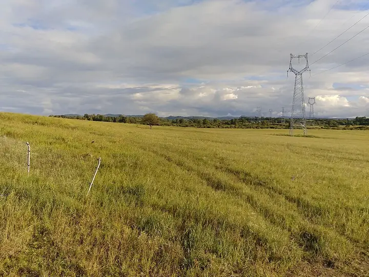
Photo adjustments
Full frame retained; resized proportionally to a maximum dimension of 960 pixels and converted to WebP quality 88. No crop, retouch, generated elements, or subject alteration. Final website rendition: full frame retained, proportionally resized to at most 720 pixels and converted to WebP. No additional retouching or subject alteration. Card displays may crop the view.
- Administrative area
- Autonomous county · 自治县
- Part of
- Chengde
- Chinese name
- 围场满族蒙古族自治县
- Local areas
- Autonomous county guide
Area & population
- Area in the source
- 9,058.00 km²
- Population · 2020 census
- 423,676
- Administrative seat
- Weichang Town
Source: cited geographic source, as of the dates shown.
History
In the early Qing the area was Mongol pasture. In the summer of 1683 the Kangxi Emperor stayed here for the first time, and the Mulan autumn hunt (木兰秋狝) grew from that visit; three Qing emperors held the hunt here, and it also served as the place where Mongol princes came to meet the emperor. Apart from the troops who guarded the hunting park, ordinary settlers were barred.
In 1862 the Qing court began opening the hunting ground to farmers. An official post to administer grain and policing was set up in 1877, and Weichang became a county in 1913.
Setting and landscape
The county sits where the Inner Mongolian Plateau meets the mountains of northern Hebei, high in the northwest and lower in the southeast. Saihanba (塞罕坝) splits it into the flat, wind-scoured Bashang (坝上) grassland at 1,200 to 2,000 metres and the ridges and valleys below. The highest peak, Daguangdingzi Mountain (大光顶子山, 1,940 m) in Chaoyangwan (朝阳湾镇), was called the Xing'an range (兴安大岭) in Qing times. Many tributaries of the Luan (滦河) and Liao (辽河) rivers rise here.
The climate is cold: the mean annual temperature is 5.7 °C, and Yudaokou (御道口) recorded Hebei's lowest temperature, −42.9 °C, on 12 January 1957.
What to see
Saihanba Mechanised Forest Farm (塞罕坝机械林场), founded in 1962 on the southern edge of the Hunshandake (浑善达克) sandy land, is a national nature reserve planted mainly with larch, Mongolian pine, spruce and white birch. The Hebei forestry administration says late-Qing land clearance, years of war and wildfires had destroyed the original forest there by 1949, and that replanting has raised forest cover from 11.4 to 82 percent; it calls the farm the largest planted forest farm in the world. The farm received the UN "Champions of the Earth" award in 2017 and the Land for Life Award in 2021.
Hebei Mulan Weichang National Forest Park (河北木兰围场国家森林公园) was set up in the north of the county in 1993. The Yudaokou pasture area (御道口牧场管理区) inside the county has been run directly by Chengde since 2017.
Food and local products
The cold climate favours potatoes and naked oats (莜麦), and Weichang is known as China's "home of the potato"; its starchy potatoes go into vermicelli and starch rather than chips. The warmer southeastern hills produce corn, millet, apricot kernels, mushrooms and daylilies (黄花菜), while the Bashang grassland is mainly used for grazing.
Highlights
- Saihanba Mechanised Forest Farm 塞罕坝机械林场: Forest farm founded in 1962 on the old Qing hunting ground; UN Champions of the Earth award, 2017.
- Mulan Weichang 木兰围场: Qing imperial hunting ground covering the whole county, used for the autumn hunt from the Kangxi reign.
- Daguangdingzi Mountain 大光顶子山: Highest peak of the county at 1,940 m, known in the Qing as the Xing'an range.
Sources for this guide
塞罕坝机械林场基本情况-绿色明珠--塞罕坝 · Hebei Saihanba Mechanised Forest Farm (Hebei Forestry and Grassland Administration)
围场满族蒙古族自治县 - 维基百科,自由的百科全书 · Wikipedia · CC BY-SA 4.0
Original English written from the listed sources and checked sentence by sentence against quoted extracts by a separate reviewer. Updated 2026-09-24.
Explore Weichang Manchu and Mongol Autonomous County
Core places to explore, with English and Chinese names.
Places to explore around Weichang Manchu and Mongol Autonomous County
 Entrance archway and forested hillside at Saihanba Forest Park, photographed on 17 July 2005.
Saihanba National Forest Park塞罕坝国家森林公园
Saihanba's forest landscape is the result of sustained planting on the uplands north of Weichang. Forest, meadow and wetland meet here, so its appeal changes between the wooded slopes and the open water of places such as Qixing…
Read the place guide →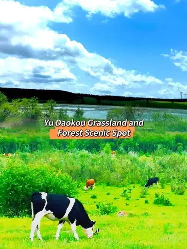 Yudaokou Grassland and Forest · 御道口草原森林
Yudaokou Grassland and Forest御道口草原森林
Yudaokou Grassland and Forest Scenic Area (御道口草原森林) is a Bashang landscape in the Mulan Weichang area, combining open meadows, sparse-tree grassland, woodland, wetlands and freshwater lakes.
Read the place guide →Plan your visit
Getting there
Weichang Manchu and Mongol Autonomous County is about 110 km in a straight line from central Chengde. Search for 围场满族蒙古族自治县 in a map app to find stations and your accommodation.
Where to stay →Build your route
Saihanba National Forest Park and Yudaokou Grassland and Forest are both listed here. The linked place guides have entrance and visit details.
Continue with Chengde →More in Chengde
Sources & geographic information
Administrative names and parent areas: Official geographic directory · Reference date 2026-09-06.
Some facts checked against 围场满族蒙古族自治县 — Wikipedia contributors, CC BY-SA 4.0.
Photo: Saihanba National Forest Park · 用心阁 · CC BY-SA 3.0. Proportionally resized and converted to WebP without cropping, retouching or changing the photographed subject.

Photo: Yudaokou Grassland and Forest · Source photographer · License not provided. EXIF orientation normalized; resized without changing aspect ratio; converted to WebP. No subject edits.
Map data © OpenStreetMap contributors. Pins mark approximate centres, not entrances or boundaries.