


Get to know Dongxihu District
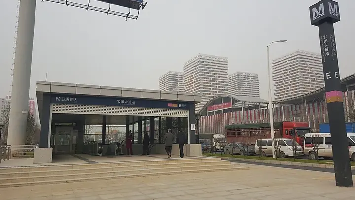
Photo adjustments
Full frame retained; proportionally resized and converted to WebP. No retouching or changes to the photographed subject. Card displays may crop the view.
- Administrative area
- District · 市辖区
- Part of
- Wuhan
- Chinese name
- 东西湖区
- Local areas
- District guide
Area & population
- Area in the source
- 439.19 km²
- Population · 2020
- 845,782
Source: cited geographic source, as of the dates shown.
Setting and landscape
The district sits on the northeastern edge of the Jianghan Plain (江汉平原) and is almost entirely flat. Its highest point, Wujiashan (吴家山), rises only 72.04 metres above sea level. To the east it is bounded by the Zhanggong Dyke (张公堤), with the urban districts of Qiaokou (硚口), Jianghan (江汉) and Jiang'an (江岸) between it and the Yangtze. To the south, west and north it faces Caidian (蔡甸), Hanchuan (汉川), Xiaogan (孝感) and Huangpi (黄陂) across the Han, the Yun (涢水) and the Lun (沦河) rivers.
History
Before 1899 the area belonged mostly to Hanyang County (汉阳县); it then passed to the new Xiakou subprefecture (夏口厅) and was known as Xiakou West Township (夏口西乡). In spring 1957 the central government approved a Hubei project to enclose and reclaim the Dongxi Lake area, led by the provincial governor Zhang Tixue (张体学). Volunteers and some 100,000 farmers from Hubei and Henan worked on the dykes, which were finished in March 1958, turning waste lakes into farmland. Dongxihu District was set up that October, run jointly with a state farm bureau; it became a state farm in 1961 and a district again in 1973. In 2013 the Wujiashan development zone was renamed Wuhan Linkonggang ('airport') Economic and Technological Development Zone, which shares offices with the district government.
What to see
Baiquan (柏泉) has three listed heritage sites. The Baiquan Ancient Well (柏泉古井) sits in the middle of Yuetang pond at Yuetangjiao village; legend says the roots of a cypress planted by Yu the Great on Tortoise Hill in Hanyang reach down into it. It became a Wuhan municipal cultural relics protection unit in 1983. Baiquan Catholic Church (柏泉天主教堂), also called the Minor Seminary of St Anthony, was built by Italian missionaries in 1840; the district government calls it the earliest Catholic church in the Wuhan area. Its two 20-metre buildings face south and are joined by a bridge. The Longwangtai site (龙王台遗址), excavated in 1993, yielded Neolithic red pottery and dates from the Neolithic to the Western Zhou.
Jinyin Lake National Urban Wetland Park (金银湖国家城市湿地公园) has ponds that fill with lotus flowers in summer; it lies about 900 metres' walk from Jinyinhu Park station (金银湖公园站) on Metro Line 6.
Highlights
- Baiquan Ancient Well 柏泉古井: Well in the middle of Yuetang pond tied to a Yu the Great legend; municipal protection unit since 1983.
- Baiquan Catholic Church 柏泉天主教堂: Built by Italian missionaries in 1840; described as the earliest Catholic church in the Wuhan area.
- Longwangtai site 龙王台遗址: Neolithic to Western Zhou site excavated in 1993.
- Jinyin Lake National Urban Wetland Park 金银湖国家城市湿地公园: Wetland park whose ponds fill with lotus flowers in summer.
Sources for this guide
东西湖概况 (地理位置) 武汉市东西湖区人民政府 · Dongxihu District People's Government, Wuhan (from the 2023 Dongxihu Yearbook)
东西湖概况 (建置沿革) 武汉市东西湖区人民政府 · Dongxihu District People's Government, Wuhan (from the 2023 Dongxihu Yearbook)
柏泉街文物保护单位简介 · Dongxihu District People's Government, Wuhan
夏日限定浪漫!金银湖湿地公园荷花开啦 · Dongxihu District People's Government, Wuhan
Original English written from the listed sources and checked sentence by sentence against quoted extracts by a separate reviewer. Updated 2026-09-24.
Explore Dongxihu District
Core places to explore, with English and Chinese names.
Dongxihu District 东西湖区
Plan your visit
Getting there
Dongxihu District is about 15 km in a straight line from central Wuhan. Search for 东西湖区 in a map app to find stations and your accommodation.
Where to stay →More in Wuhan
Sources & geographic information
Administrative names and parent areas: Official geographic directory · Reference date 2026-09-06.
Map data © OpenStreetMap contributors. Pins mark approximate centres, not entrances or boundaries.