


Get to know Qiaokou District
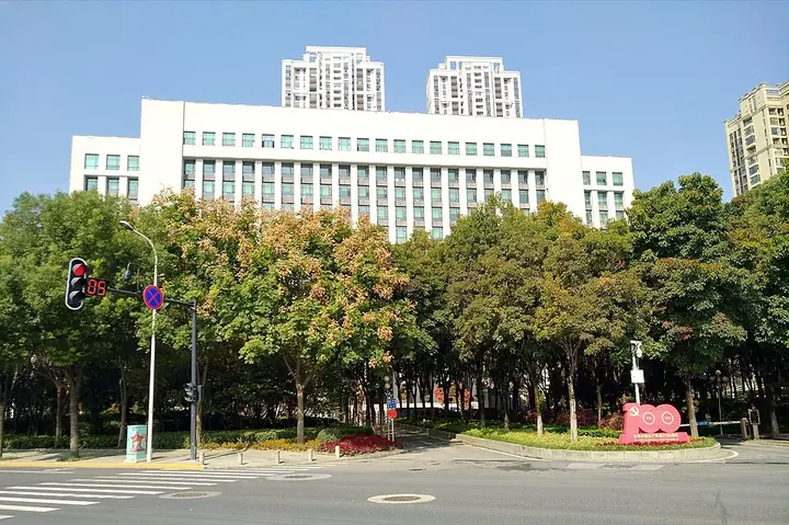
Photo adjustments
Full frame retained; proportionally resized and converted to WebP. No retouching or changes to the photographed subject. Card displays may crop the view.
- Administrative area
- District · 市辖区
- Part of
- Wuhan
- Chinese name
- 硚口区
- Local areas
- District guide
Area & population
- Area in the source
- 46.39 km²
- Population · 2020 census
- 666,661
Source: cited geographic source, as of the dates shown.
History
The district government traces Qiaokou's birth to the early Chenghua reign of the Ming dynasty (about 1465–1470), when the Han River settled into a single channel entering the Yangtze north of Tortoise Hill (龟山), creating Hankou. The name came later: in 1635 the Hanyang official Yuan Huan (袁焻) built a long dike here to protect Hanzheng Street from floods, digging for earth left the Yudai River (玉带河), and the stone bridge built where it met the Han gave the spot its name. The canal and bridge have long gone, but the name stayed. The area became Wuhan's Second District in November 1950 and was renamed Qiaokou in June 1952.
Hanzheng Street was Hankou's trading centre from the Ming and Qing onwards, lined with guild halls and firms. It was burned during the Taiping occupations of Hankou in 1852–1856, and again in the 1911 Yangxia battle, when Feng Guozhang (冯国璋), to avoid street fighting with the revolutionary army, set fires at more than ten points across the quarter. In November 1979 China's first batch of 103 licences for private small-goods traders was issued here, and the district describes the result as China's first small-commodity market run mainly by private traders; on 28 August 1982 the People's Daily ran an editorial saying the market's experience deserved attention. It grew into a wholesale market covering 1.67 square kilometres.
The district government calls Qiaokou an important birthplace of modern Chinese-owned industry. The Jiji Water and Electricity Company (既济水电公司), founded in the Hanzheng Street area in 1906 by the Ningbo merchant Song Weichen (宋炜臣), and the Shenxin No. 4 textile mill (申新纺织四厂) were among the firms that began Wuhan's modern industry, and after 1949 the Gutian (古田) area became an industrial base, home to the Wuhan Diesel Engine Factory.
What to see
Most lanes in the Hanzheng Street area took their names from trades and goods, among them Cotton Street (棉花街), Plain Cloth Street (白布街) and Lantern Lane (灯笼巷). In the Kangxi era coppersmiths from Jiangsu and Anhui opened workshops on a cross street about 70 metres long and 2 metres wide, which locals named Coppersmith Street (打铜街), a name still in use. Dakou Lane (打扣巷) later filled with the official money bureau, money shops and remittance houses and became Hankou's financial centre, though it kept its old name.
Getting oriented
Five road bridges cross the Han River from the district: the Qingchuan, Jianghan, Yuehu, Zhiyin and Gutian bridges. Wuhan Metro lines 1, 3 and 6 pass through Qiaokou.
Highlights
- Hanzheng Street 汉正街: Hankou's Qing-era main street and trading centre, where China's first private small-goods traders were licensed in 1979.
Sources for this guide
硚口区 - 维基百科,自由的百科全书 · Wikipedia (Chinese) · CC BY-SA 4.0
历史沿革-武汉市硚口区人民政府 · Qiaokou District People's Government, Wuhan
近代工商业的发祥地-武汉市硚口区人民政府 · Qiaokou District People's Government, Wuhan
《硚口区地名志》内容节选-武汉市硚口区人民政府 · Qiaokou District Civil Affairs Bureau
汉正街具有特色的街巷名-武汉市硚口区人民政府 · Qiaokou District Civil Affairs Bureau
Original English written from the listed sources and checked sentence by sentence against quoted extracts by a separate reviewer. Updated 2026-09-24.
Explore Qiaokou District
Core places to explore, with English and Chinese names.
Qiaokou District 硚口区
Plan your visit
Getting there
Qiaokou District is about 8 km in a straight line from central Wuhan. Search for 硚口区 in a map app to find stations and your accommodation.
Where to stay →More in Wuhan
Sources & geographic information
Administrative names and parent areas: Official geographic directory · Reference date 2026-09-06.
Some facts checked against 硚口区 — Wikipedia contributors, CC BY-SA 4.0.
Map data © OpenStreetMap contributors. Pins mark approximate centres, not entrances or boundaries.